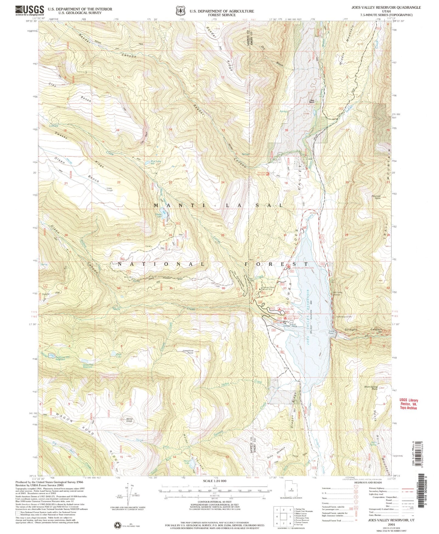
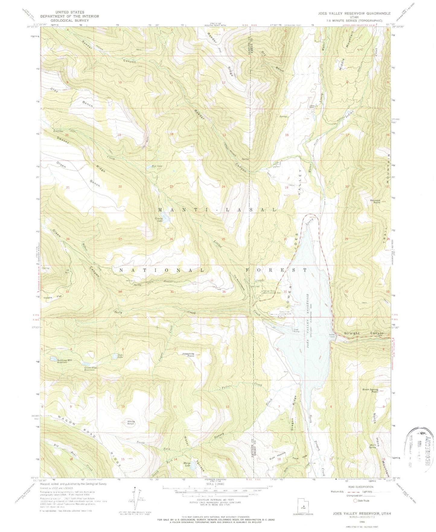
MyTopo
Classic USGS Joes Valley Reservoir Utah 7.5'x7.5' Topo Map
Couldn't load pickup availability
Historical USGS topographic quad map of Joes Valley Reservoir in the state of Utah. Map scale may vary for some years, but is generally around 1:24,000. Print size is approximately 24" x 27"
This quadrangle is in the following counties: Emery, Sanpete.
The map contains contour lines, roads, rivers, towns, and lakes. Printed on high-quality waterproof paper with UV fade-resistant inks, and shipped rolled.
Contains the following named places: Academy Mill Reservoir, Academy Mill Reservoir Dam, Birch Spring, Birch Spring Point, Blue Lake, Bubs Creek, Bubs Meadow, Clay Bank, Clay Bench, Coyote Creek, Dragon Ridge, Dry Basin, Fuller Creek, Grass Flat Reservoir, Grassy Lake, Grassy Lake Dam, Indian Creek, Joes Valley Campground, Joes Valley Dam, Joes Valley Marina, Joes Valley Overlook, Joes Valley Reservoir, Josephite Point, Kofford Creek, Little Canyon, Littles Creek, Lower Joes Valley, Lowry Water, Marys Lake, North Dragon Creek, North Fork Swasey Creek, Olsen Bench, Olsen Canyon, Olsen Ranch, Orange Olsen Administrative Site, Pauls Hole, Reeder Canyon, Reeder Trail, Reynold Point, Seely Creek, Seely Creek Campground, Slide Lake, South Fork Swasey Creek, Sportsmans Lodge, Swasey Creek, The Switchbacks, Thistle Flat, Wasatch Plateau, White Knoll