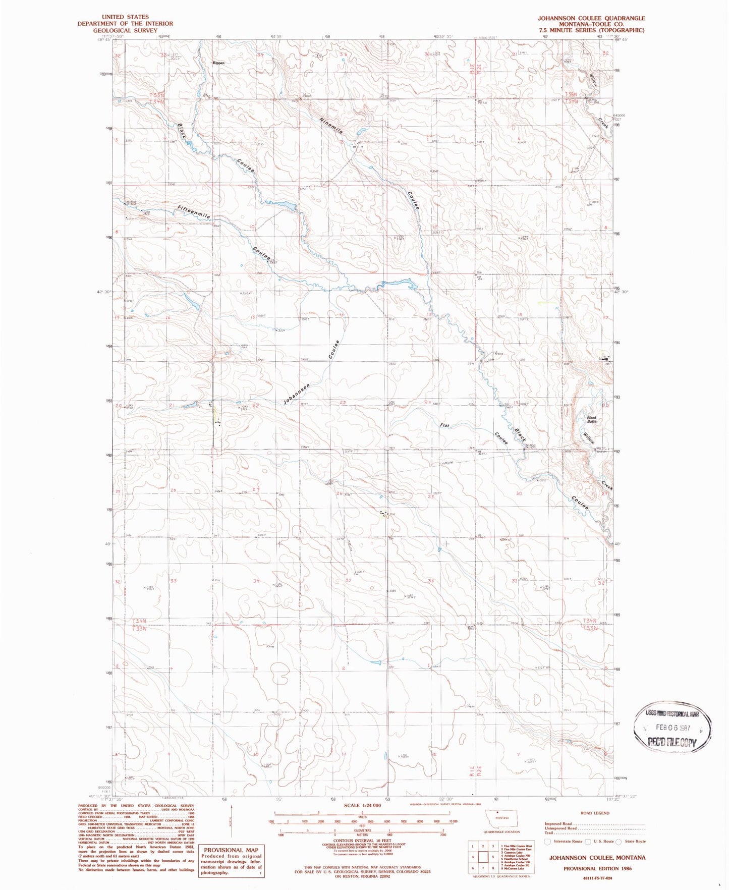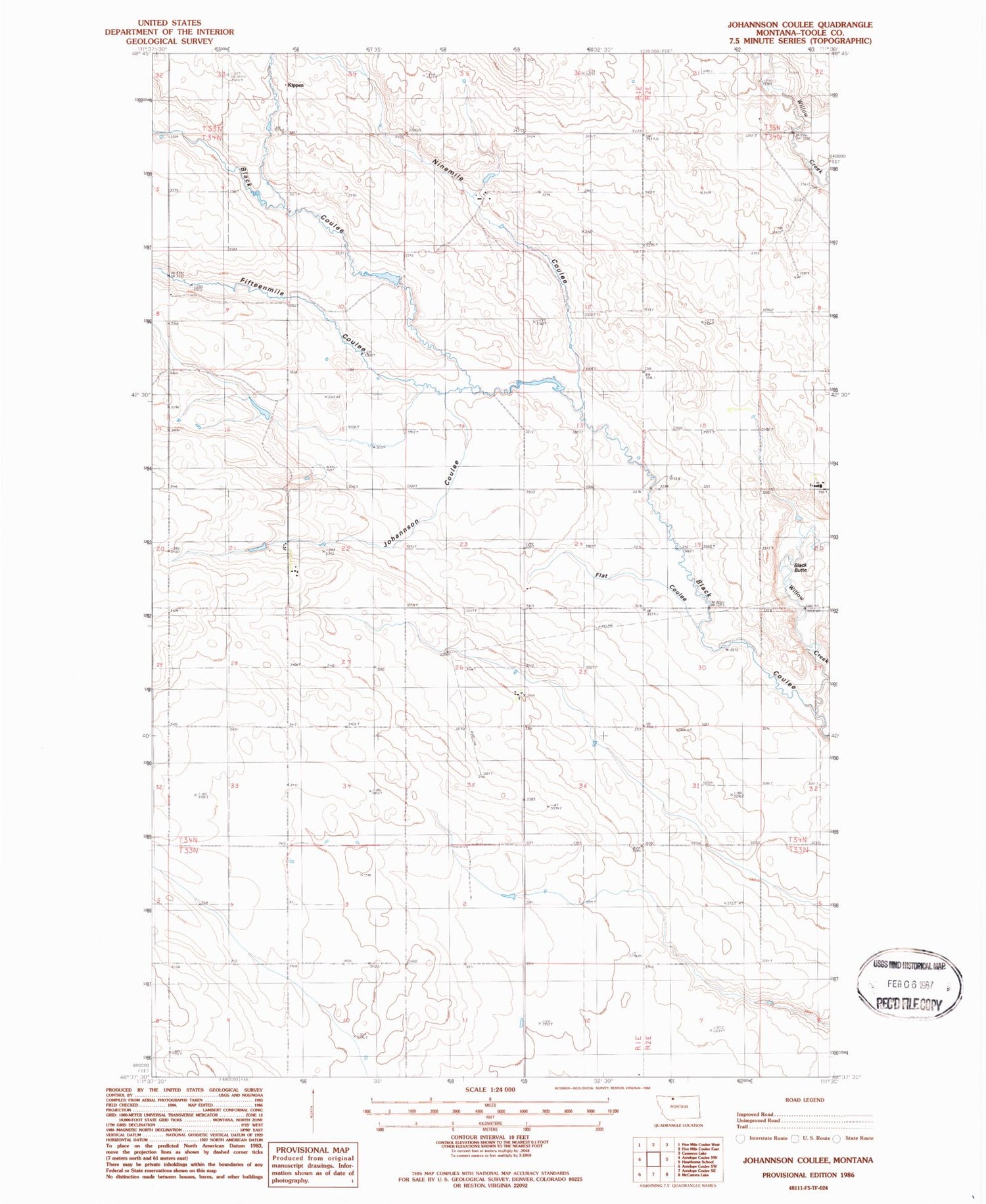
MyTopo
Classic USGS Johannson Coulee Montana 7.5'x7.5' Topo Map
Regular price
$16.95
Regular price
Sale price
$16.95
Unit price
per
Couldn't load pickup availability
Historical USGS topographic quad map of Johannson Coulee in the state of Montana. Map scale may vary for some years, but is generally around 1:24,000. Print size is approximately 24" x 27"
This quadrangle is in the following counties: Toole.
The map contains contour lines, roads, rivers, towns, and lakes. Printed on high-quality waterproof paper with UV fade-resistant inks, and shipped rolled.
Contains the following named places: 34N01E21DAAA01 Well, Black Butte, Black Coulee, Eide Trail Dam, Elkholt Ranch, Fifteenmile Coulee, Flat Coulee, Johannson Coulee, Johannson Ranch, Kippen, Miners Coulee, Ninemile Coulee, Ucaliptus Dam