MyTopo
Classic USGS John Daw Mesa Arizona 7.5'x7.5' Topo Map
Regular price
$16.95
Regular price
Sale price
$16.95
Unit price
per
Couldn't load pickup availability
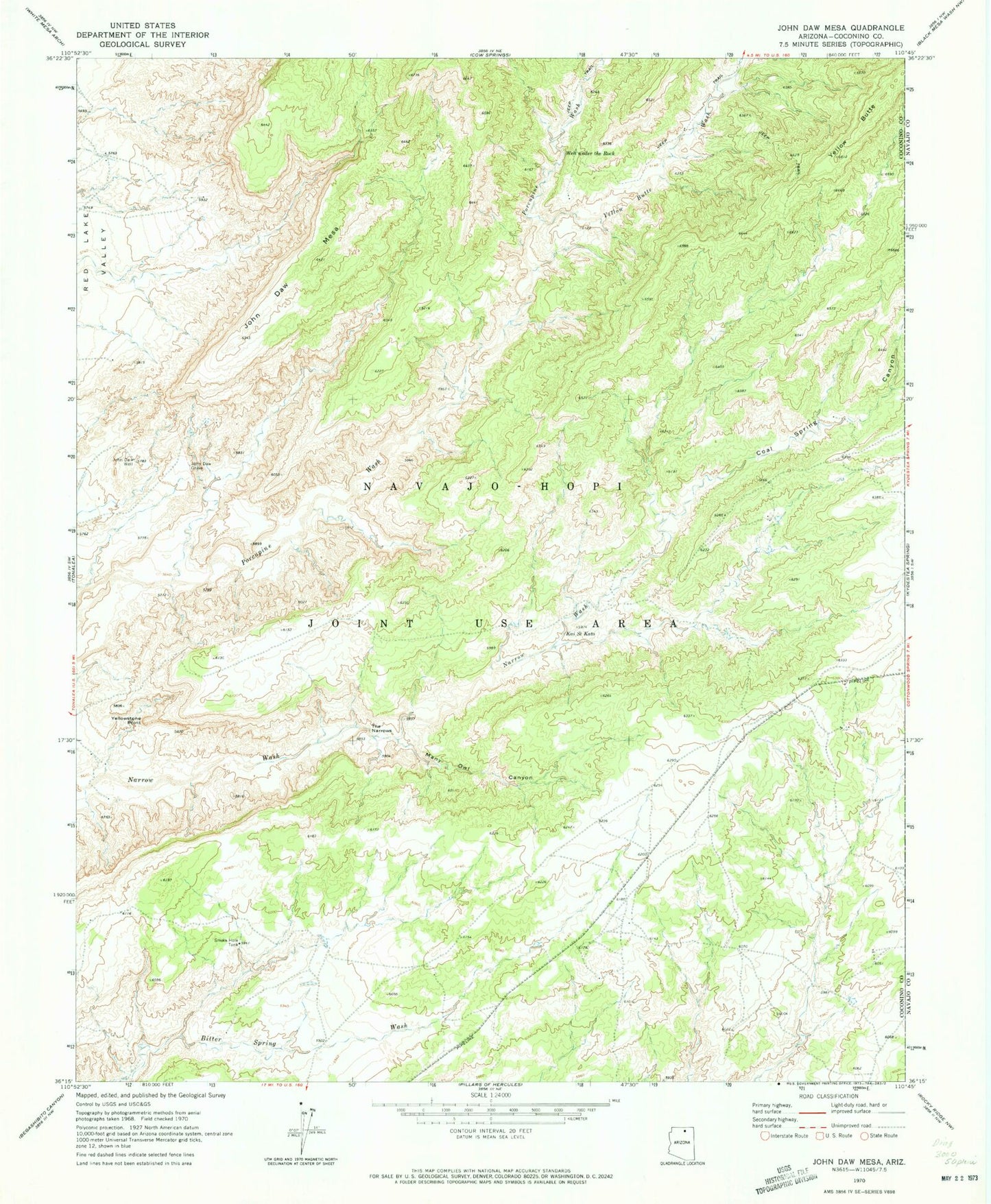
Historical USGS topographic quad map of John Daw Mesa in the state of Arizona. Map scale may vary for some years, but is generally around 1:24,000. Print size is approximately 24" x 27"
This quadrangle is in the following counties: Coconino, Navajo.
The map contains contour lines, roads, rivers, towns, and lakes. Printed on high-quality waterproof paper with UV fade-resistant inks, and shipped rolled.
Contains the following named places: Coal Spring Canyon, John Daw Grave, John Daw Mesa, John Daw Well, Kai Si Kato, Many Owl Canyon, Perea Canyon, RU252, Smoke Hole Tank, The Narrows, Well under the Rock, Yellow Butte, Yellow Butte Wash, Yellowstone Point