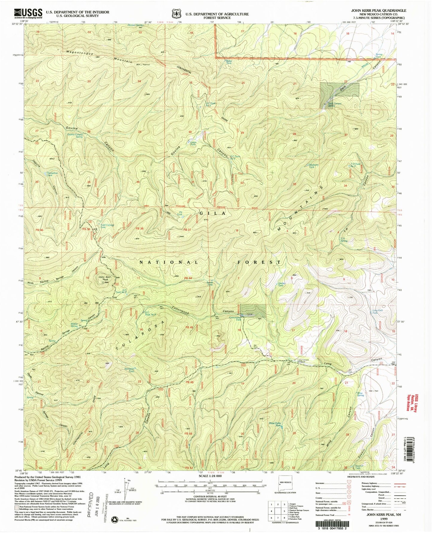
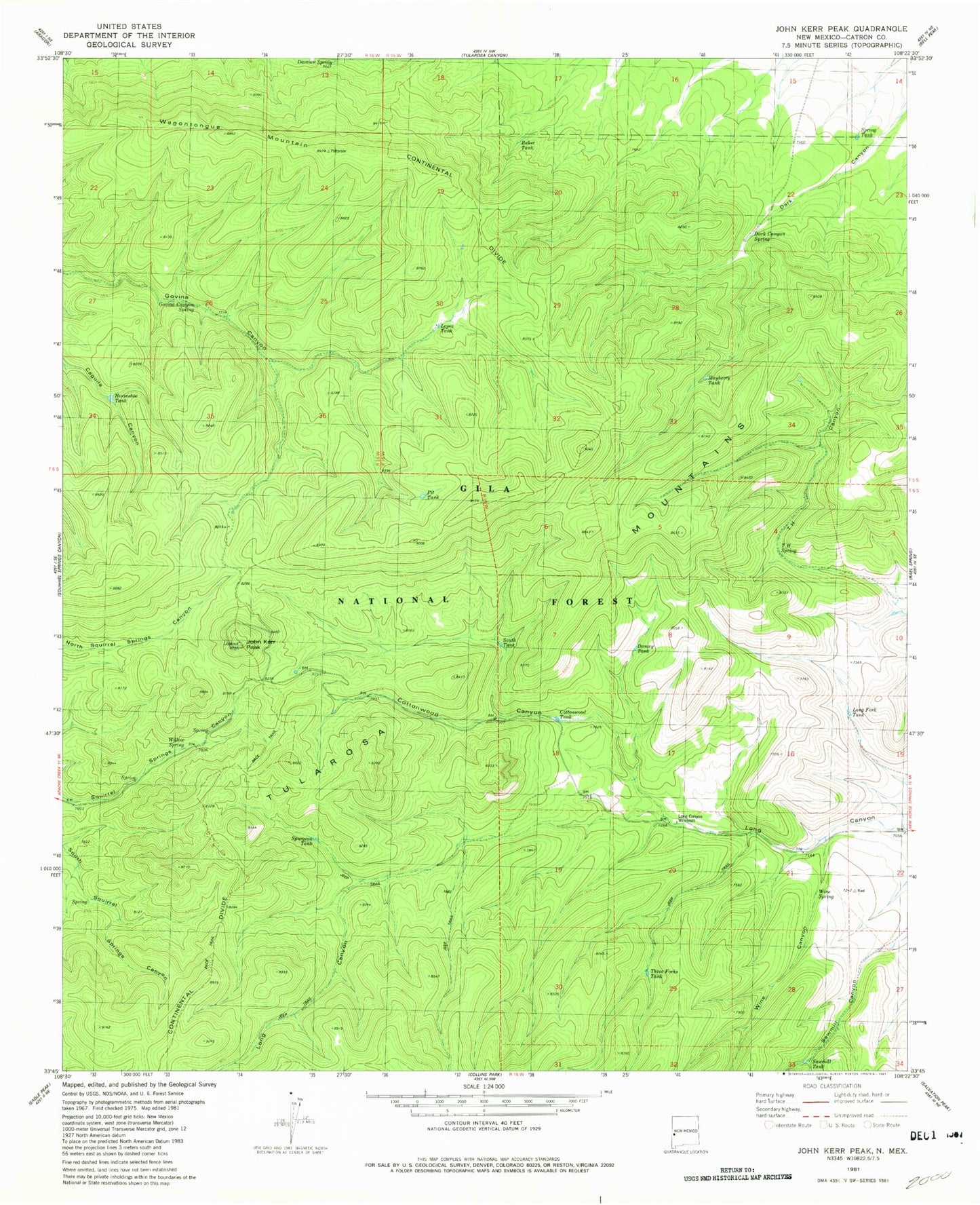
MyTopo
Classic USGS John Kerr Peak New Mexico 7.5'x7.5' Topo Map
Couldn't load pickup availability
Historical USGS topographic quad map of John Kerr Peak in the state of New Mexico. Typical map scale is 1:24,000, but may vary for certain years, if available. Print size: 24" x 27"
This quadrangle is in the following counties: Catron.
The map contains contour lines, roads, rivers, towns, and lakes. Printed on high-quality waterproof paper with UV fade-resistant inks, and shipped rolled.
Contains the following named places: Govina Canyon Spring, Todd Cienega Tank, GC Tank Number Two, GC Tank Number Three, GC Tank Number Five, GC Tank Number Four, Dark Canyon Spring, Cottonwood Canyon, John Kerr Peak, Wagontongue Mountain, Dark Canyon, Wine Canyon, Spring Tank, T H Spring, Mayberry Tank, Danley Tank, Long Fork Tank, Wine Spring, Sawmill Tank, Long Canyon Windmill, Three Forks Tank, Banker Tank, Lopez Tank, Pit Tank, South Tank, Cottonwood Tank, Spurgeon Tank, Damian Spring, Willow Spring, Horseshoe Tank, T H Tank Number Two