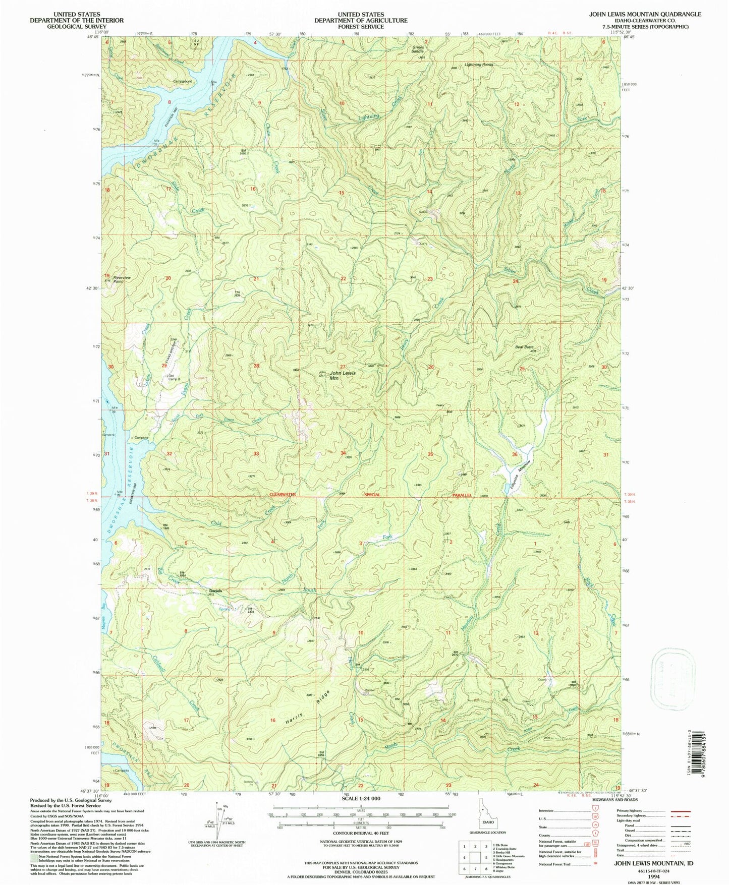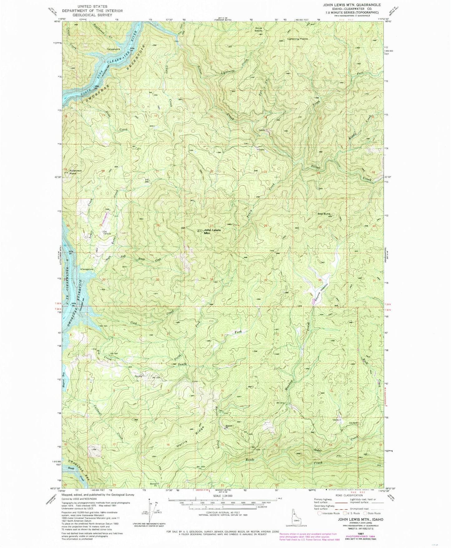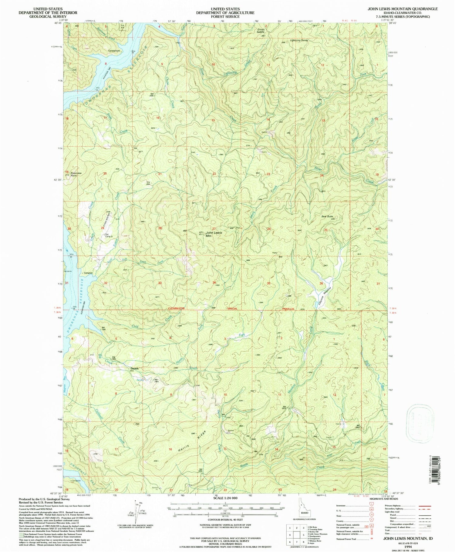

MyTopo
Classic USGS John Lewis Mountain Idaho 7.5'x7.5' Topo Map
Couldn't load pickup availability
Historical USGS topographic quad map of John Lewis Mountain in the state of Idaho. Map scale may vary for some years, but is generally around 1:24,000. Print size is approximately 24" x 27"
This quadrangle is in the following counties: Clearwater.
The map contains contour lines, roads, rivers, towns, and lakes. Printed on high-quality waterproof paper with UV fade-resistant inks, and shipped rolled.
Contains the following named places: Alder Creek, Bear Butte, Big Creek, Big Island Airport, Boathouse Creek, Canoe Creek, Chute Creek, Cold Creek, Daniels, Evans Creek, Feary Creek, Griner Saddle, John Lewis Mountain, Lewis Creek, Lightning Creek, Lightning Points, Little Silver Creek, Meadow Creek, North Fork Big Creek, North Fork Silver Creek, Riverview Point, Slide Creek, South Fork Big Creek, South Fork Evans Creek