MyTopo
Classic USGS Johnnie Little Hill Texas 7.5'x7.5' Topo Map
Regular price
$16.95
Regular price
Sale price
$16.95
Unit price
per
Couldn't load pickup availability
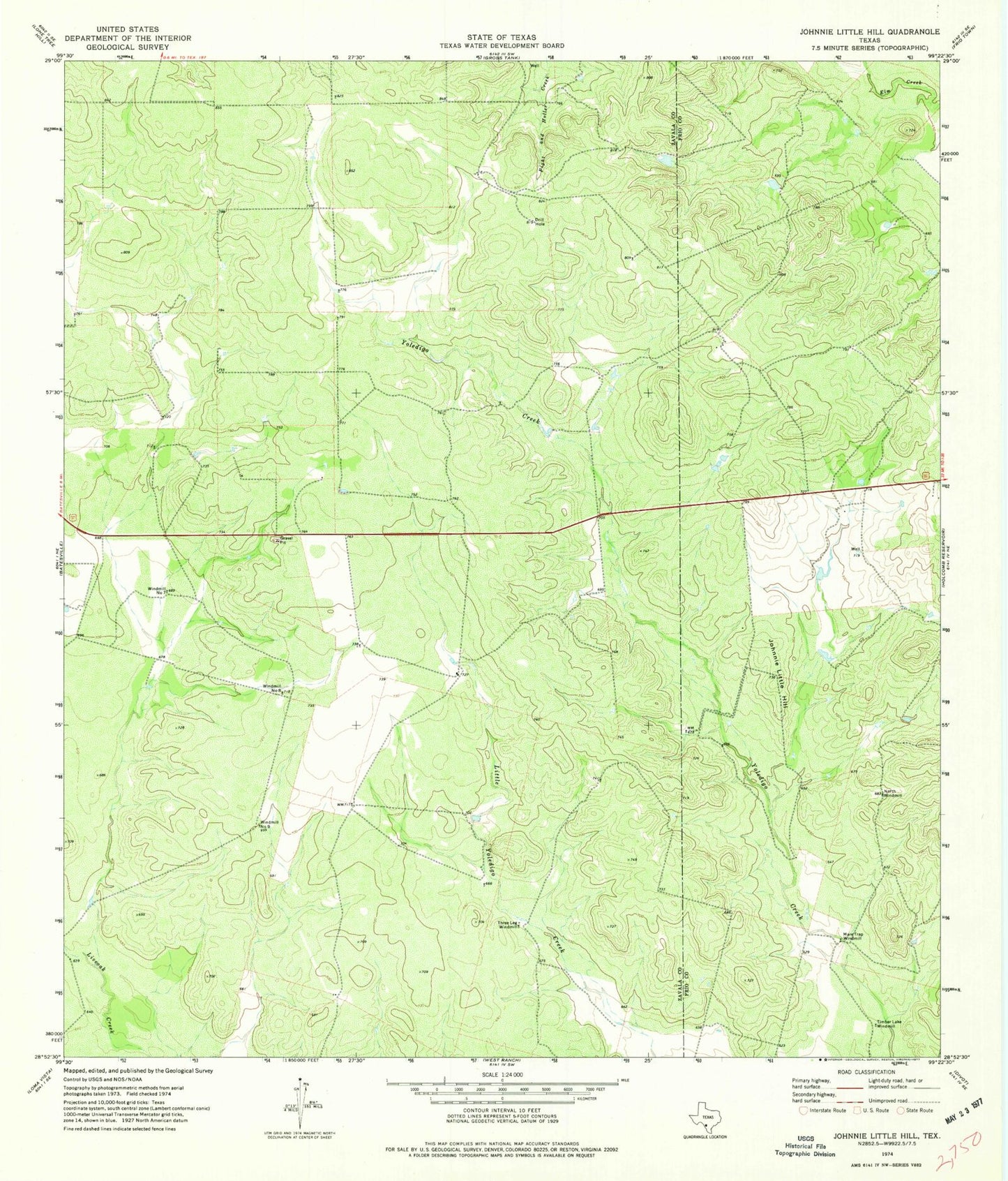
Historical USGS topographic quad map of Johnnie Little Hill in the state of Texas. Map scale may vary for some years, but is generally around 1:24,000. Print size is approximately 24" x 27"
This quadrangle is in the following counties: Frio, Zavala.
The map contains contour lines, roads, rivers, towns, and lakes. Printed on high-quality waterproof paper with UV fade-resistant inks, and shipped rolled.
Contains the following named places: Johnnie Little Hill, Mare Trap Windmill, Nash Ranch Airport, North Windmill, Three Leg Windmill, Timber Lake Windmill, Windmill Number Eight, Windmill Number Nine, Windmill Number Seven