MyTopo
Classic USGS Johnny Creek SW Oregon 7.5'x7.5' Topo Map
Couldn't load pickup availability
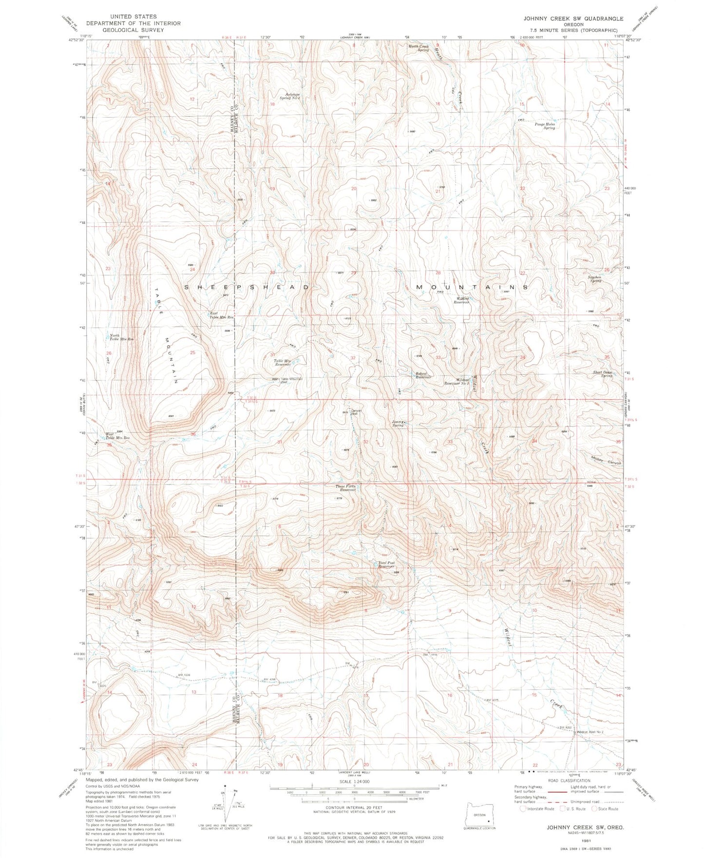
Historical USGS topographic quad map of Johnny Creek SW in the state of Oregon. Map scale may vary for some years, but is generally around 1:24,000. Print size is approximately 24" x 27"
This quadrangle is in the following counties: Harney, Malheur.
The map contains contour lines, roads, rivers, towns, and lakes. Printed on high-quality waterproof paper with UV fade-resistant inks, and shipped rolled.
Contains the following named places: Antelope Spring Number Three, Bobcat Reservoir, Canyon Well, East Table Mountain Reservoir, Heath Creek Spring, Jimmy Spring, Jimmy Spring Reservoir, North Table Mountain Reservoir, Pouge Holes Spring, Sagehen Spring, Short Draw Spring, Steel Post Reservoir, Table Mountain, Table Mountain Reservoir, Table Mountain Well, Three Forks Reservoir, West Table Mountain Reservoir, Wildcat Reservoir, Wildcat Reservoir Number Two, Wildcat Well Number Two