MyTopo
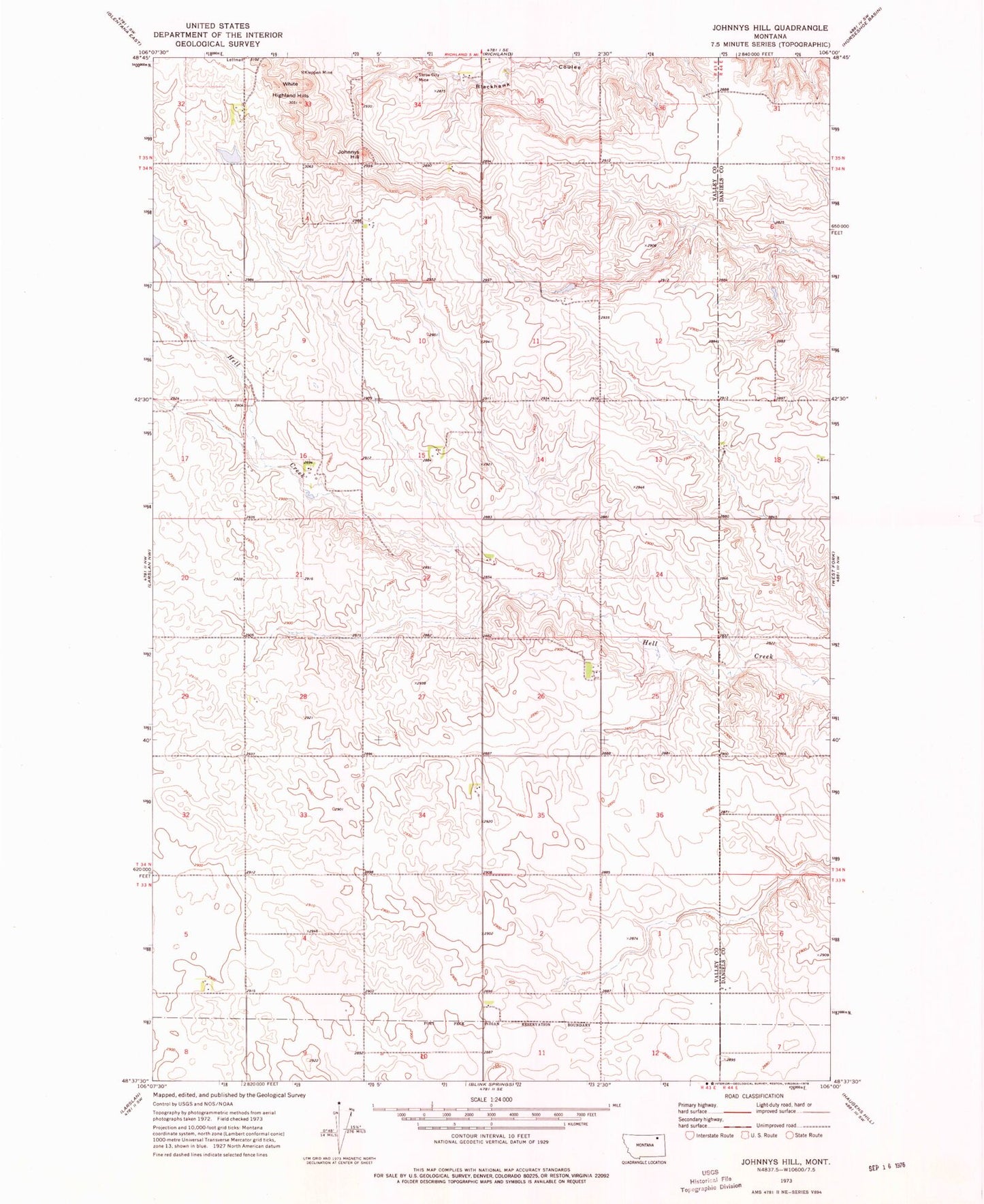
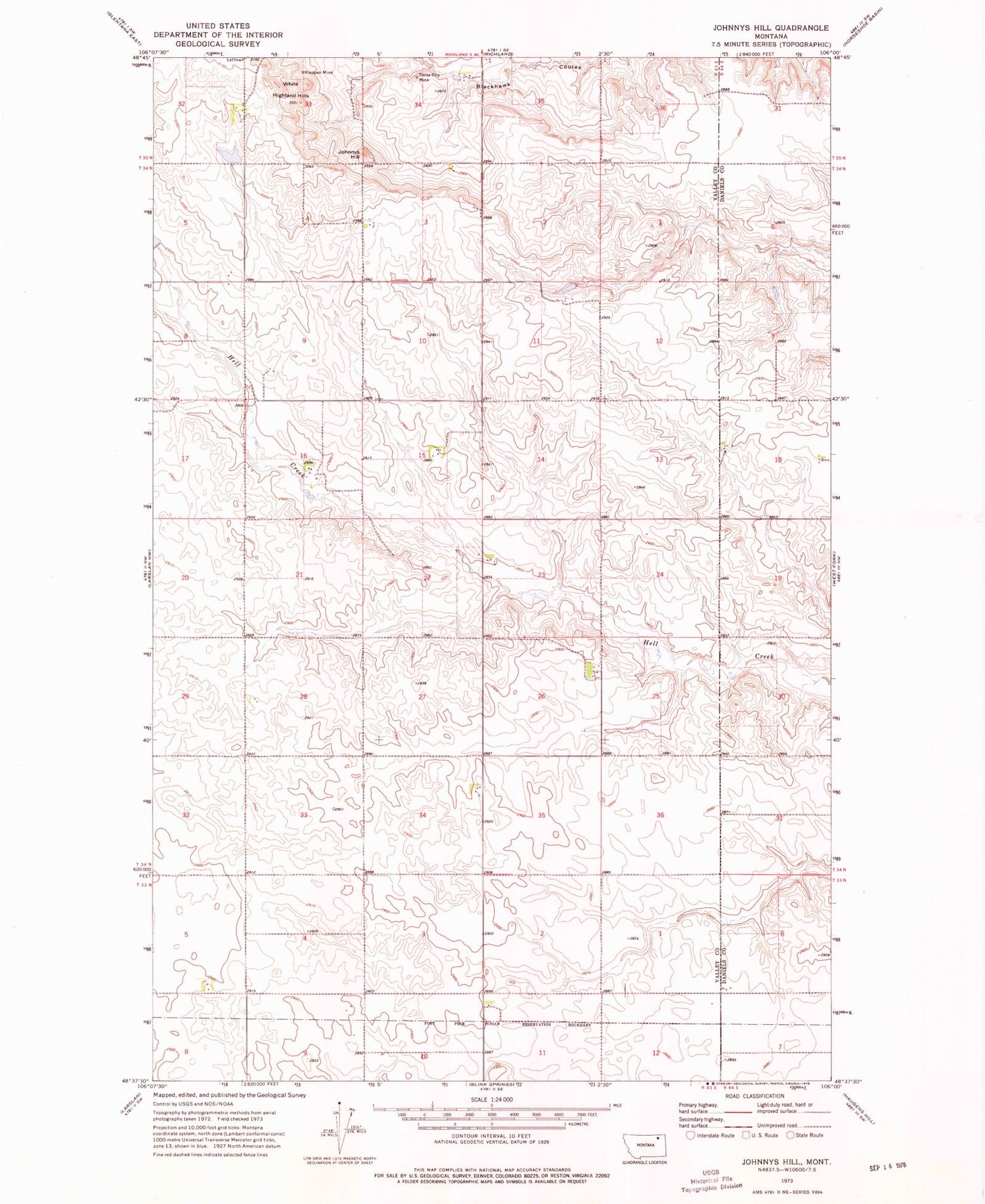
Classic USGS Johnnys Hill Montana 7.5'x7.5' Topo Map
Regular price
$16.95
Regular price
Sale price
$16.95
Unit price
per
Couldn't load pickup availability
Historical USGS topographic quad map of Johnnys Hill in the state of Montana. Map scale may vary for some years, but is generally around 1:24,000. Print size is approximately 24" x 27"
This quadrangle is in the following counties: Daniels, Valley.
The map contains contour lines, roads, rivers, towns, and lakes. Printed on high-quality waterproof paper with UV fade-resistant inks, and shipped rolled.
Contains the following named places: 33N44E06CCCC01 Well, 37N43E32CADB01 Well, Ghost Number 5 Dam, Highland School, Johnnys Hill, Kleppen Mine, Rosedale School, Sioux City Mine, White Highland Hills