
MyTopo
Classic USGS Johns North Carolina 7.5'x7.5' Topo Map
Couldn't load pickup availability
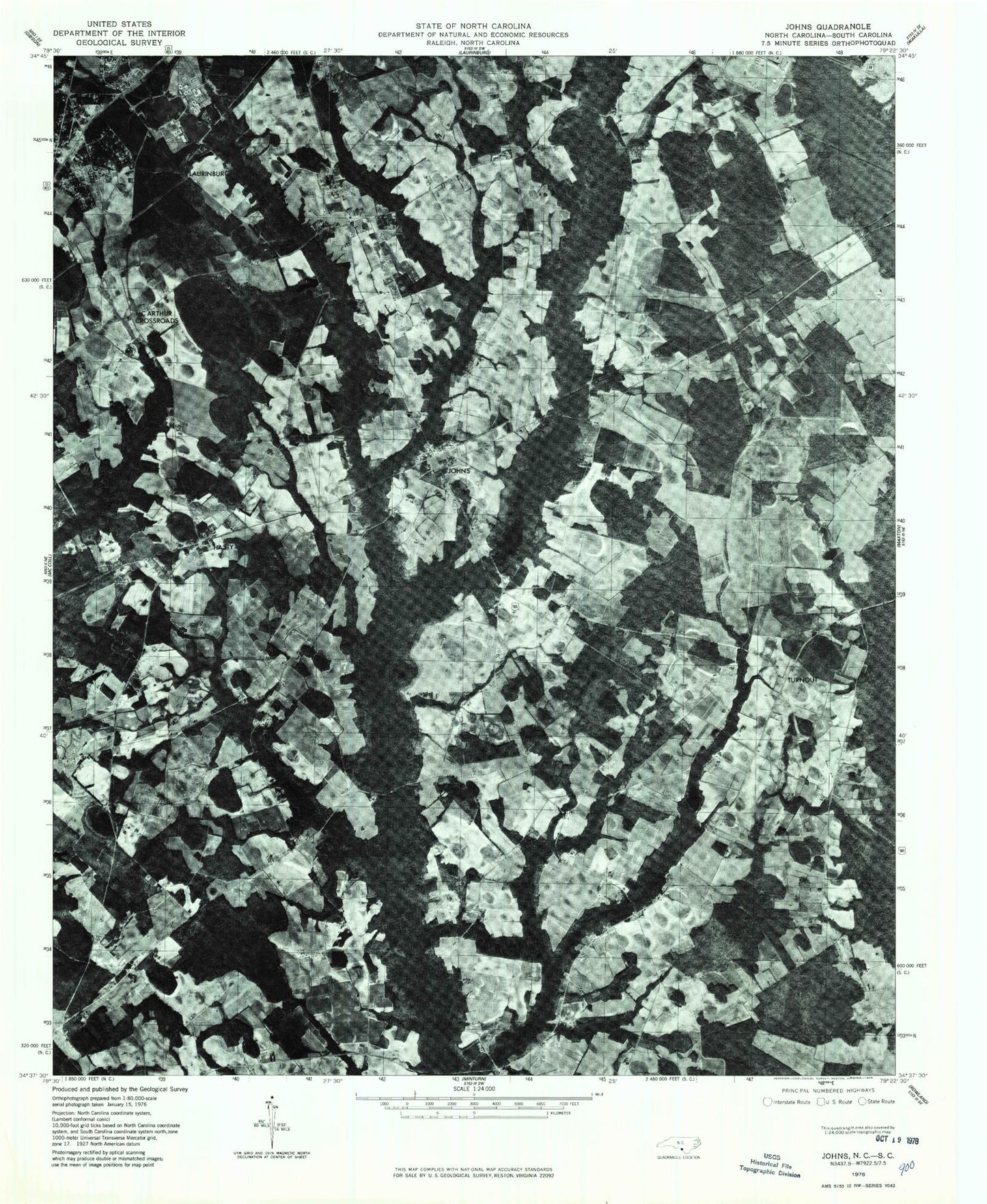
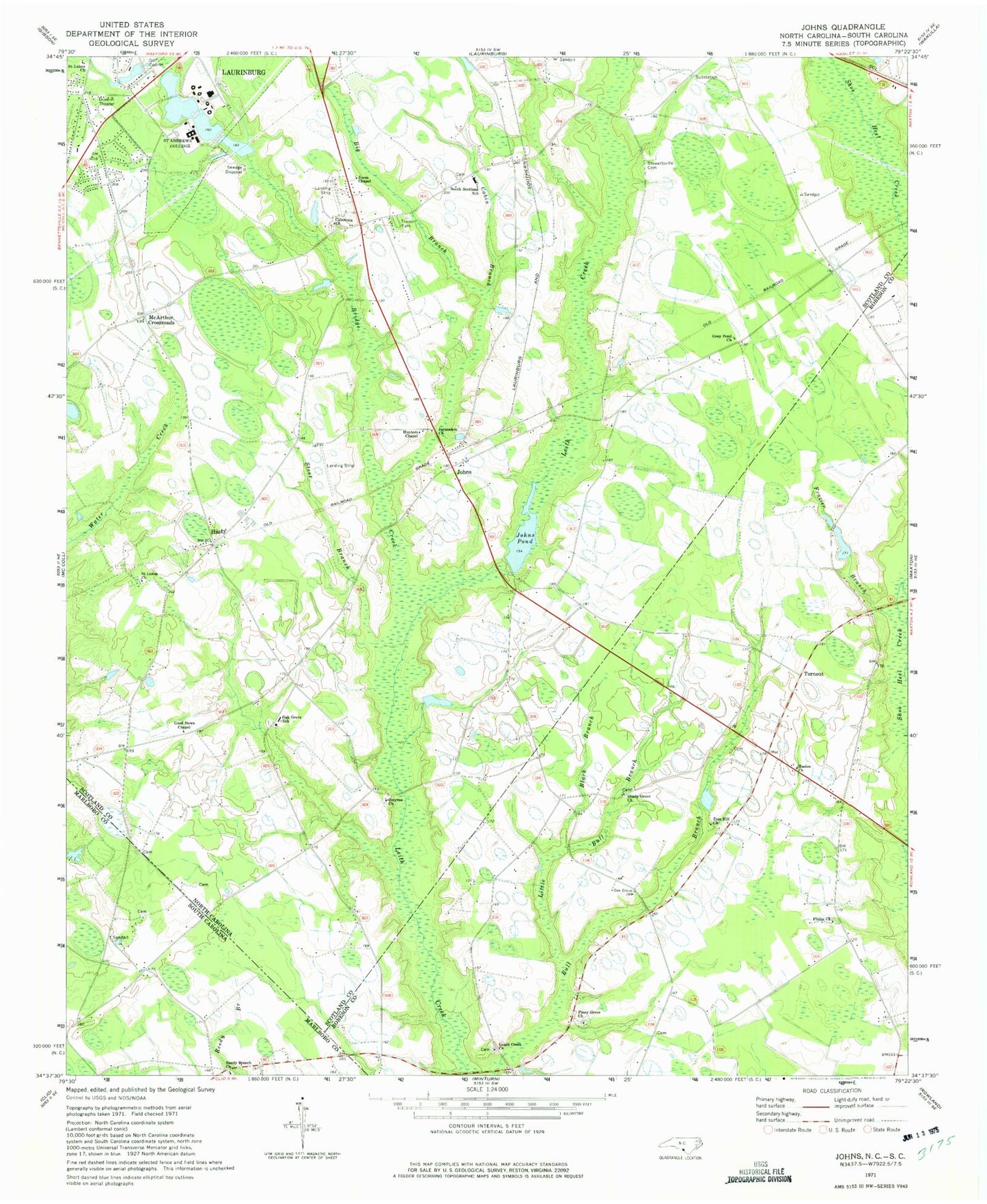
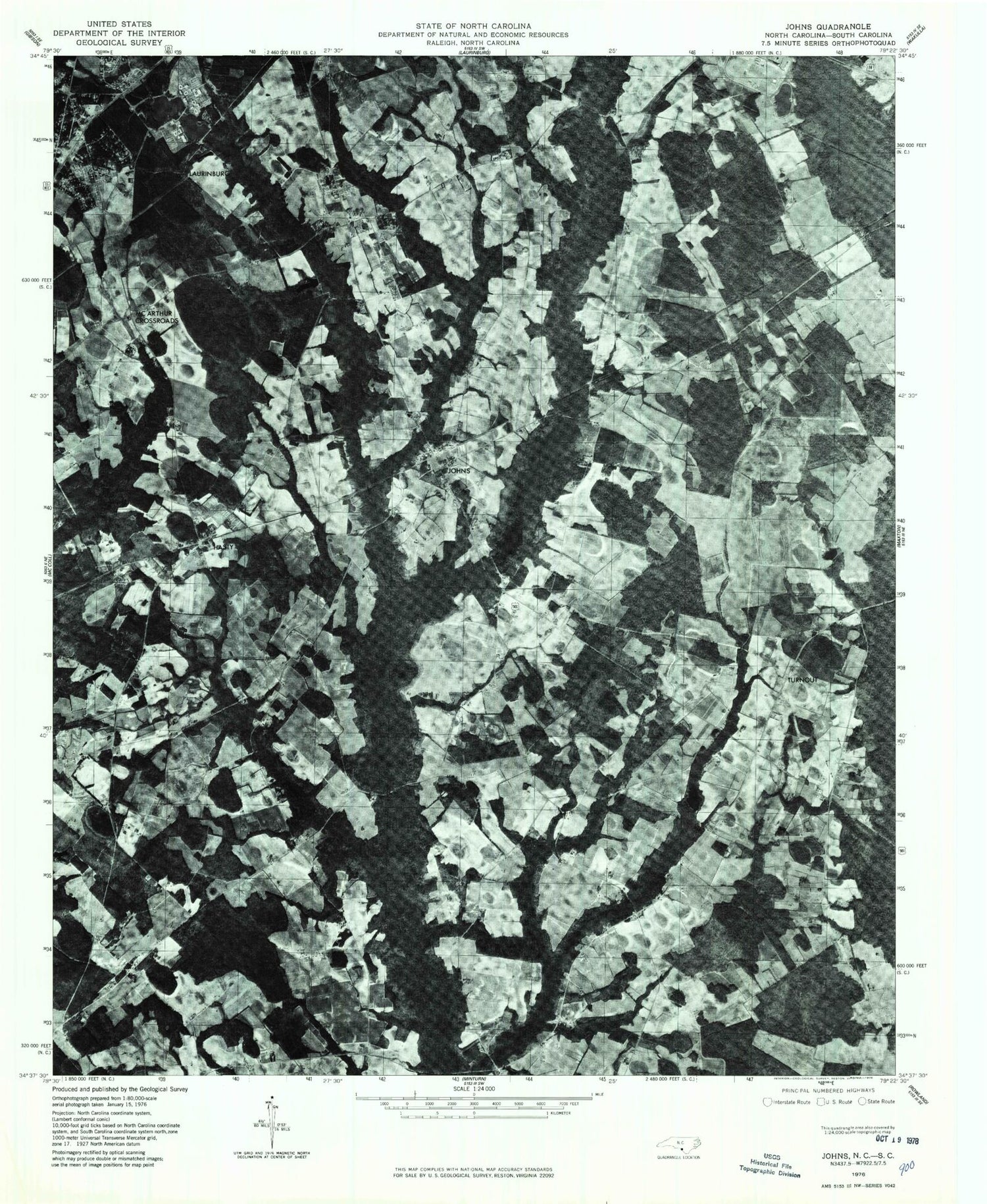
Historical USGS topographic quad map of Johns in the states of North Carolina, South Carolina. Map scale may vary for some years, but is generally around 1:24,000. Print size is approximately 24" x 27"
This quadrangle is in the following counties: Marlboro, Robeson, Scotland.
The map contains contour lines, roads, rivers, towns, and lakes. Printed on high-quality waterproof paper with UV fade-resistant inks, and shipped rolled.
Contains the following named places: Big Branch, Black Branch, Bridge Creek, Cabin Branch, Caledonia Church, Camelin Acres, Eastover Estates, Edgeland Park, Frazier Branch, Good News Chapel, Grey Pond Church, Hasion Church, Hasty, Hunters Chapel, Jerusalem Church, Johns, Johns Pond, Johns Pond Dam, Jones Chapel, Leach Creek Church, Little Bull Branch, Macland, Maxton Southeastern Rural Volunteer Fire Department, McArthur Crossroads, McKenzie Acres East, Oak Grove School, Piney Grove Church, Plains Church, Reedy Branch Church, Saint Andrews College, Saint Andrews College Lake, Saint Andrews College Lake Dam, Saint Lukes Church, Shady Grove Church, Smyrna Church, South Scotland School, Steer Branch, Stewartsville Cemetery, Stewartsville Volunteer Fire Department, Sunny Acres, Sycamore Lane Middle School, Township of Stewartsville, Turnout, Whispering Pines Number Two, Zion Hill Church