MyTopo
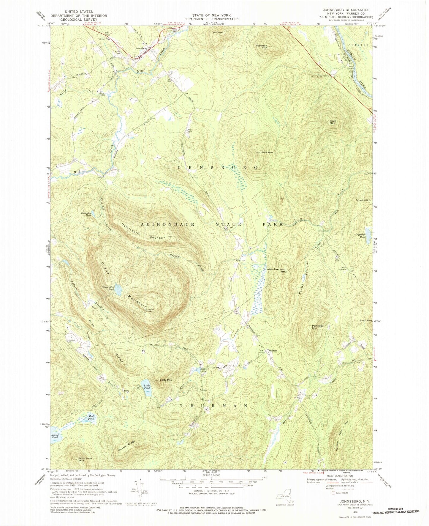
Classic USGS Johnsburg New York 7.5'x7.5' Topo Map
Couldn't load pickup availability
Historical USGS topographic quad map of Johnsburg in the state of New York. Typical map scale is 1:24,000, but may vary for certain years, if available. Print size: 24" x 27"
This quadrangle is in the following counties: Warren.
The map contains contour lines, roads, rivers, towns, and lakes. Printed on high-quality waterproof paper with UV fade-resistant inks, and shipped rolled.
Contains the following named places: Bates Cemetery, Camp Dippikill, Cherry Ridge, Crane Mountain, Crane Mountain Pond, Crystal Brook, Dippikill Pond, Gage Mountain, Huckleberry Mountain, Johnsburg, Kibby Creek, Little Mountain, Little Pond, Mill Mountain, Mud Pond, Number Nine Mountain, Number Twentysix Brook, Number Twentysix Mountain, Paintbed Brook, Partridge Mountain, Pine Mountain, Pine Ridge, Snowshoe Pond, Stockton Mountain, Wolf Pond Mountain, Thurman, Town of Thurman, Gobbler's Knob Farm, Russell Cemetery, Johnsburg Volunteer Fire Department, Johnsburg Post Office