MyTopo
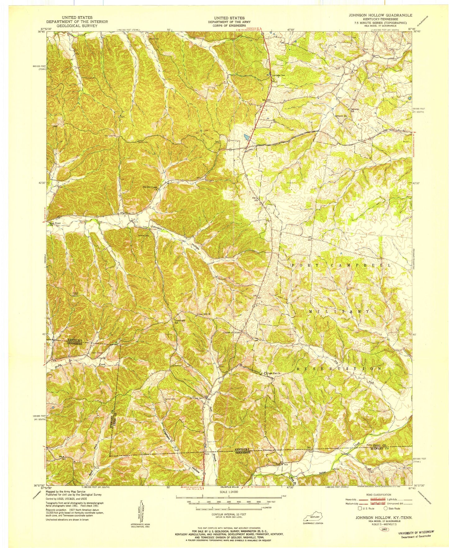
Classic USGS Johnson Hollow Kentucky 7.5'x7.5' Topo Map
Couldn't load pickup availability
Historical USGS topographic quad map of Johnson Hollow in the states of Kentucky, Tennessee. Map scale may vary for some years, but is generally around 1:24,000. Print size is approximately 24" x 27"
This quadrangle is in the following counties: Stewart, Trigg.
The map contains contour lines, roads, rivers, towns, and lakes. Printed on high-quality waterproof paper with UV fade-resistant inks, and shipped rolled.
Contains the following named places: Atkins Cemetery, Bristoe Lancaster Cemetery, Cheatam Hollow, Clark Cemetery, Delmont Baptist Church, Delmont School, Dry Fork Creek, Duck Springs Church, Duncan Branch, Ed Moore Cemetery, Hunter Cemetery, Johnson Hollow, Joiners Chapel Church of Christ, McKinney Cemetery, Old Dry Creek Primitive Baptist Church, Pugh Flat Baptist Church, Rock Front Baptist Church, Ross Branch, Samsil Cemetery, Skinner Cemetery, Summer Hollow, Union Hill Church, ZIP Code: 37028