MyTopo
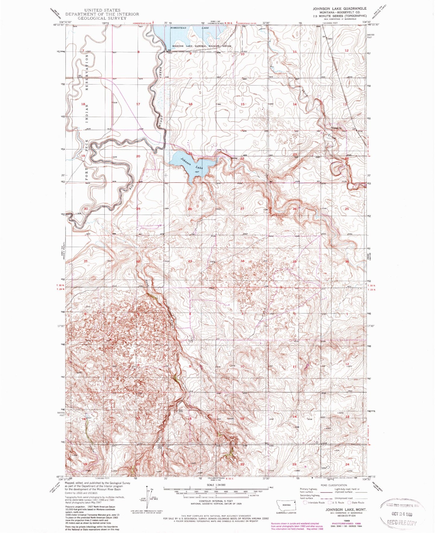
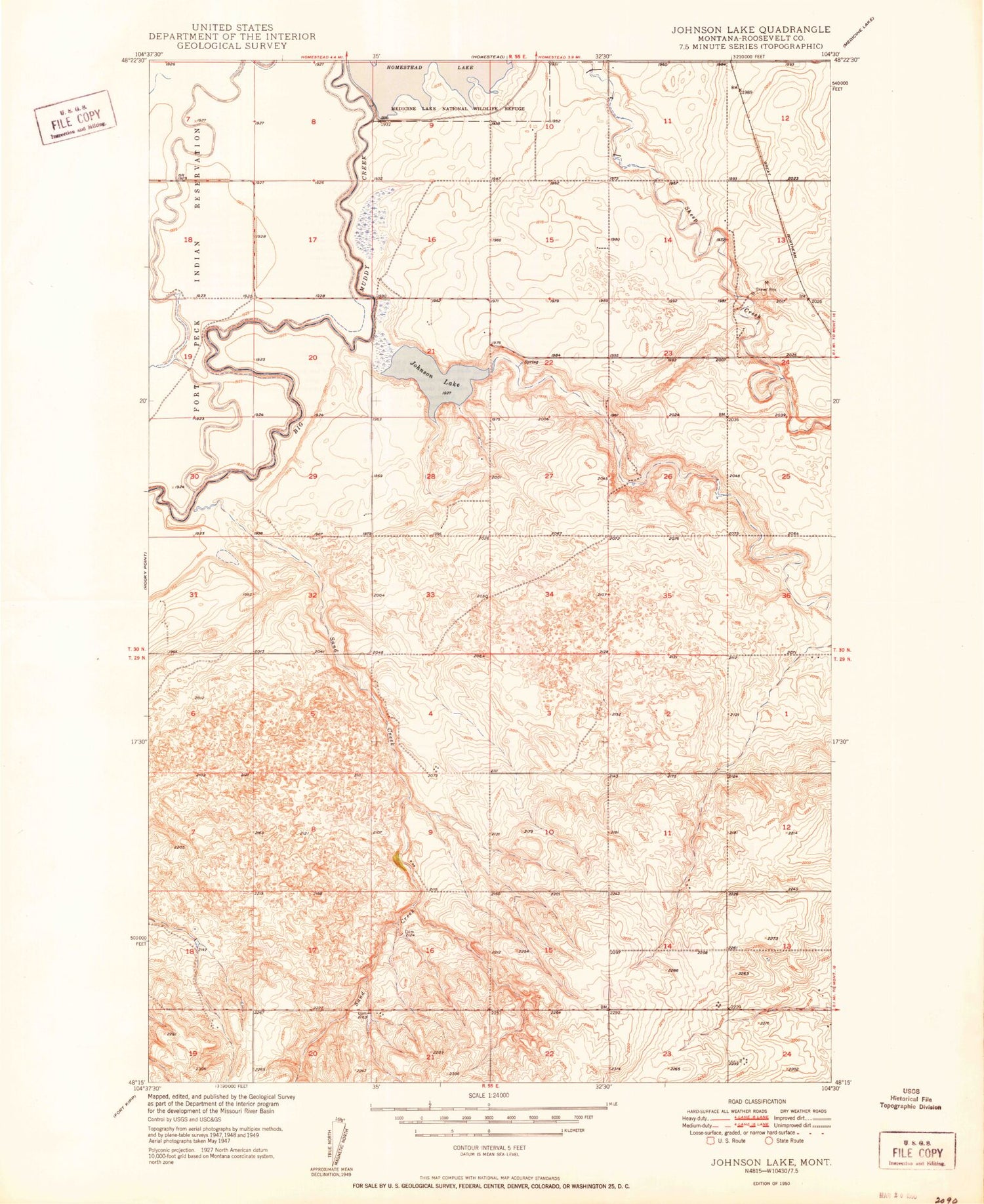
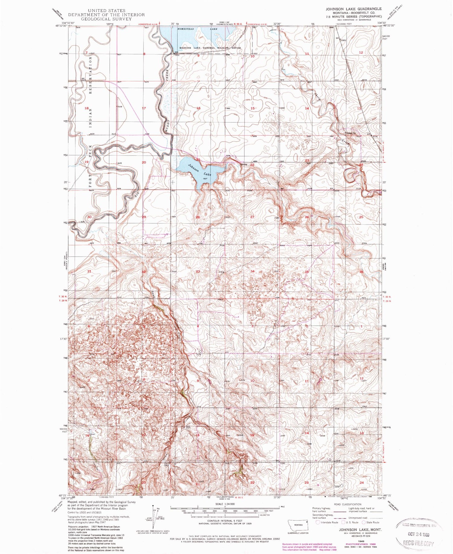
Classic USGS Johnson Lake Montana 7.5'x7.5' Topo Map
Regular price
$16.95
Regular price
Sale price
$16.95
Unit price
per
Couldn't load pickup availability
Historical USGS topographic quad map of Johnson Lake in the state of Montana. Map scale may vary for some years, but is generally around 1:24,000. Print size is approximately 24" x 27"
This quadrangle is in the following counties: Roosevelt.
The map contains contour lines, roads, rivers, towns, and lakes. Printed on high-quality waterproof paper with UV fade-resistant inks, and shipped rolled.
Contains the following named places: 29N55E18DABC01 Well, 30N55E10DDDD01 Well, 30N55E16BBBA01 Well, 30N55E23DBAB01 Well, 30N55E32ACA_01 Well, 30N55E36DADD01 Well, 59226, Johnson Lake, Roosevelt County Waterfowl Production Area, Sand Creek, Sandy Butte School, Sheep Creek, Smith School