MyTopo
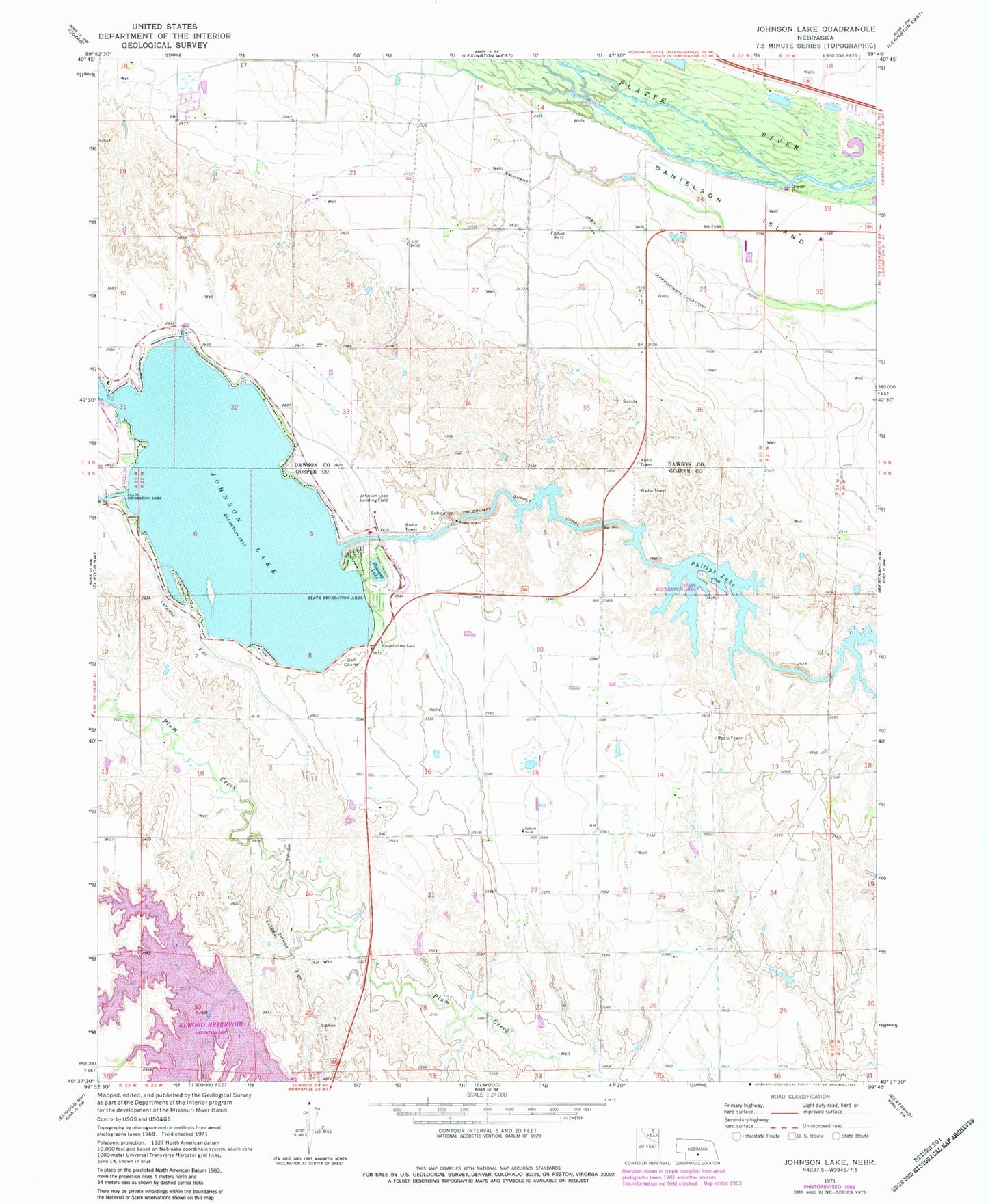
Classic USGS Johnson Lake Nebraska 7.5'x7.5' Topo Map
Couldn't load pickup availability
Historical USGS topographic quad map of Johnson Lake in the state of Nebraska. Map scale may vary for some years, but is generally around 1:24,000. Print size is approximately 24" x 27"
This quadrangle is in the following counties: Dawson, Gosper.
The map contains contour lines, roads, rivers, towns, and lakes. Printed on high-quality waterproof paper with UV fade-resistant inks, and shipped rolled.
Contains the following named places: Bass Bay, Bethel Election Precinct, Bethel Public School, Bossung Lake, Bullhead Point, Chapel of the Lake, Dry Bay, Earth Dam-Canal Mile 645 Dam, Earth Dam-Canal Mile 671 Dam, Earth Dam-Canal Mile 681 Dam, Earth Dam-Canal Mile 689 Dam, East Shore, Elwood Dam, Elwood Reservoir, Elwood Reservoir Recreation Area, George E Johnson Historical Marker, Inlet Area Campground, JJs Marina and Campgrounds, Johnson Lake, Johnson Lake Airport, Johnson Lake Emergency Ambulance Service, Johnson Lake State Recreation Area, Kilby Point, Knoeizer Dam, Knoeizer Reservoir, KRVN-FM (Lexington), Lakeside Country Club, Lauby Dam, Lauby Reservoir, Main Area Campground, Mallard Beach, Mallard Cove, Mastens Camper Haven, North Cove, North Inlet Area Campground, North Point, North Shore, Northeast Bay, Perch Bay, Philips Lake, Phillips Lake State Recreation Area, Platte Election Precinct, Reverie Campground, School Number 15, South Bay, Sunset Shore Resort and RV Park, Thompsons Resort, Township of Platte