MyTopo
Classic USGS Johnson Lake Texas 7.5'x7.5' Topo Map
Couldn't load pickup availability
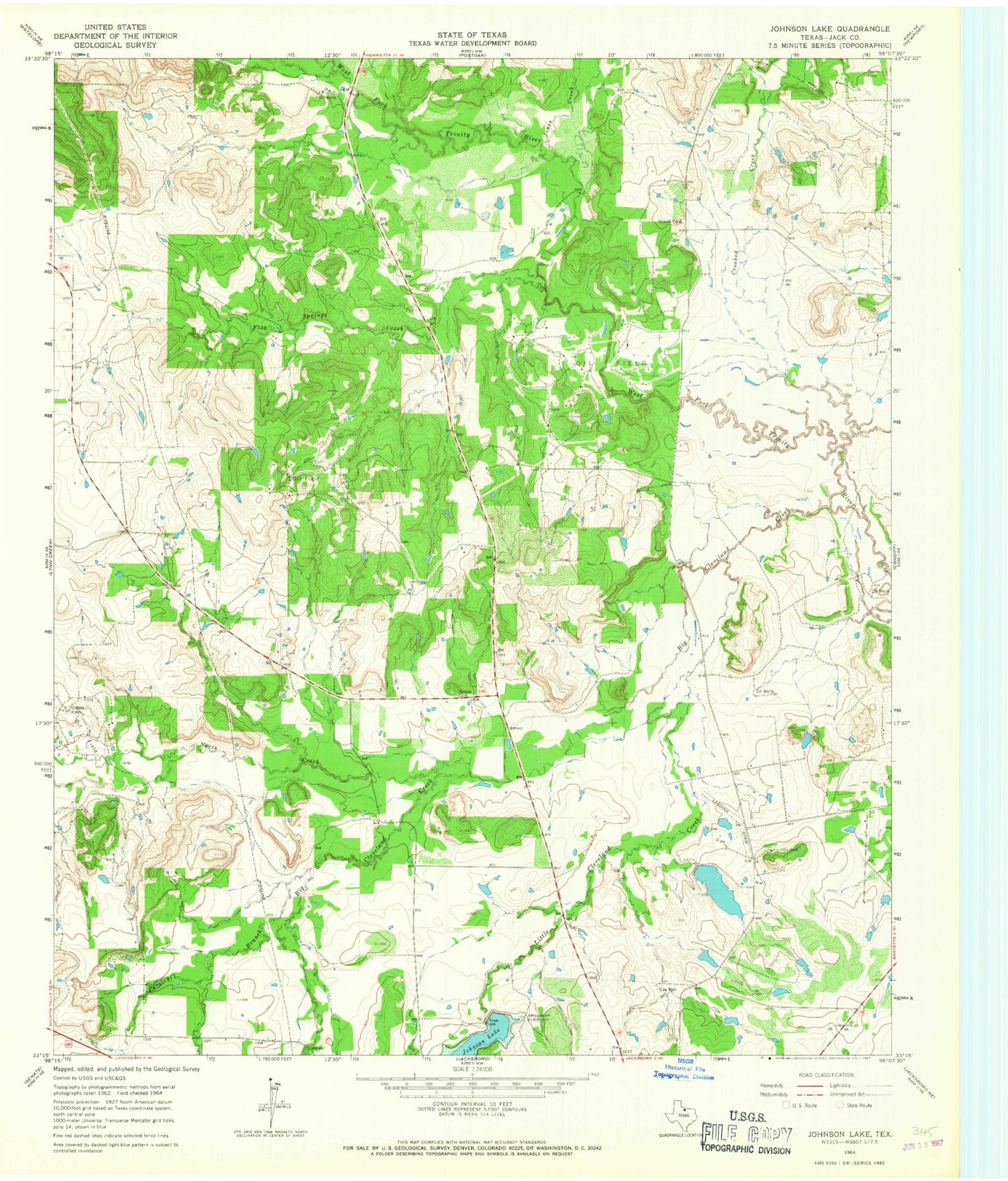
Historical USGS topographic quad map of Johnson Lake in the state of Texas. Map scale may vary for some years, but is generally around 1:24,000. Print size is approximately 24" x 27"
This quadrangle is in the following counties: Jack.
The map contains contour lines, roads, rivers, towns, and lakes. Printed on high-quality waterproof paper with UV fade-resistant inks, and shipped rolled.
Contains the following named places: Big Cleveland Creek, Brown Cemetery, Crooked Creek, Flag Springs Creek, Graves Cemetery, Jacksboro Division, Johnson Lake, Jones Creek, Little Cleveland Creek, North Creek, Patton Cemetery, Prunty Lake, Prunty Lake Dam, Pursley Branch, Soil Conservation Service Site 18 Dam, Soil Conservation Service Site 18 Reservoir, Soil Conservation Service Site 21 Dam, Soil Conservation Service Site 21 Reservoir, Worthington Lake, Worthington Lake Dam, Worthington Lake Number 2, Worthington Lake Number 2 Dam, Worthington Lake Number 3, Worthington Lake Number 3 Dam