MyTopo
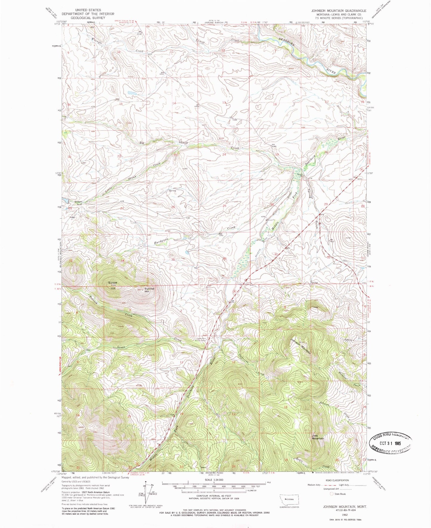
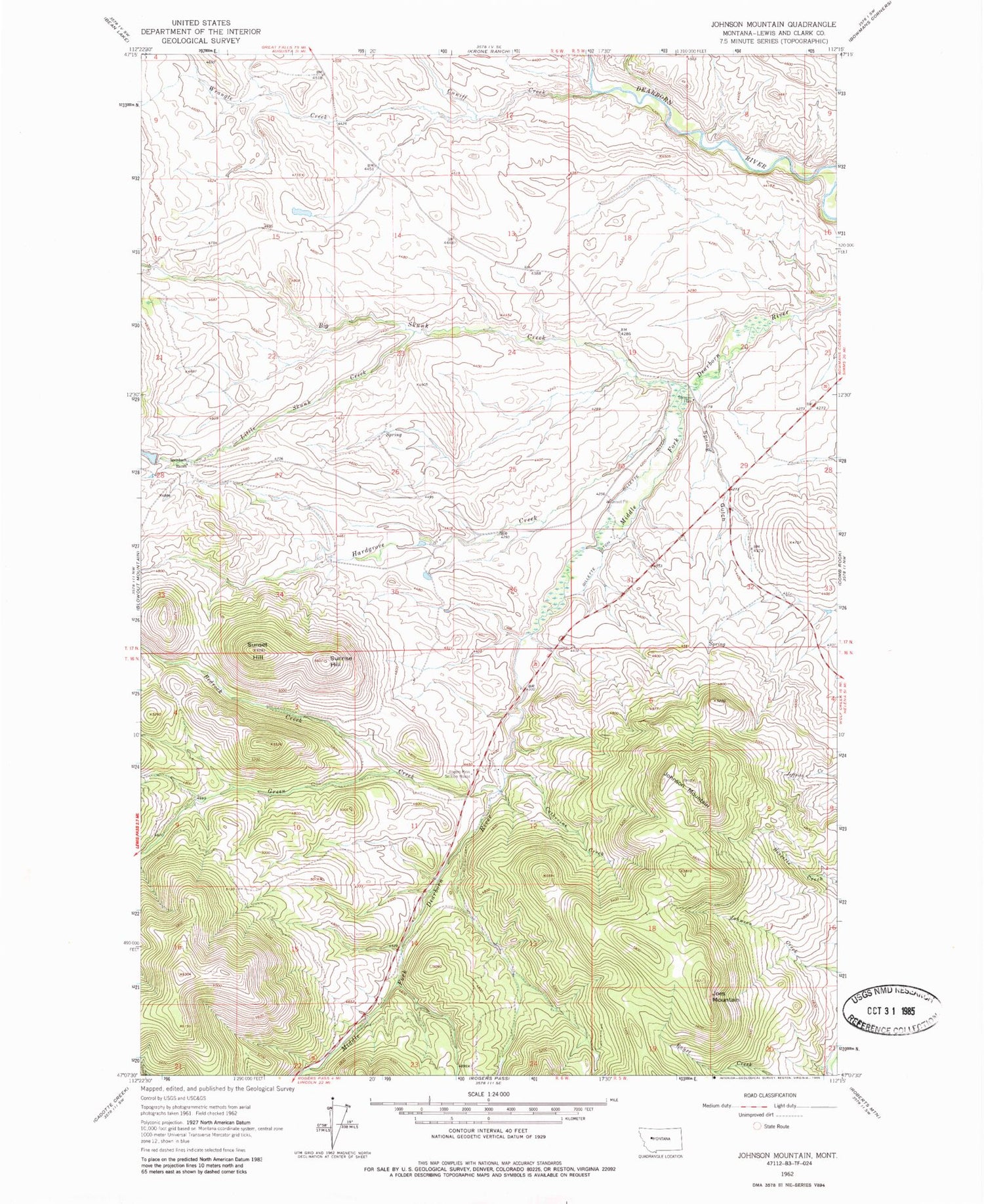
Classic USGS Johnson Mountain Montana 7.5'x7.5' Topo Map
Couldn't load pickup availability
Historical USGS topographic quad map of Johnson Mountain in the state of Montana. Map scale may vary for some years, but is generally around 1:24,000. Print size is approximately 24" x 27"
This quadrangle is in the following counties: Lewis and Clark.
The map contains contour lines, roads, rivers, towns, and lakes. Printed on high-quality waterproof paper with UV fade-resistant inks, and shipped rolled.
Contains the following named places: Bedrock Creek, Big Skunk Creek, Catherine Creek, Cuniff Creek, Gillette Ditch, Green Creek, Hardgrove Creek, Joes Mountain, Johnson Mountain, Little Skunk Creek, Roberts Creek, Rogers Pass Section House, Spring Gulch, Stearns Hall, Stearns Post Office, Steinbach Ranch, Sunrise Hill, Sunset Hill, Wrangle Creek