MyTopo
Classic USGS Johnson Park New Mexico 7.5'x7.5' Topo Map
Regular price
$16.95
Regular price
Sale price
$16.95
Unit price
per
Couldn't load pickup availability
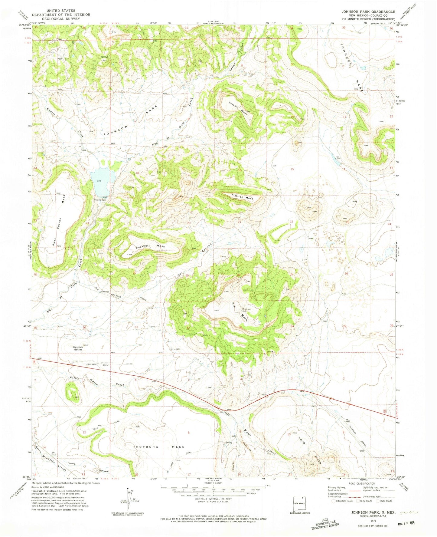
Historical USGS topographic quad map of Johnson Park in the state of New Mexico. Map scale may vary for some years, but is generally around 1:24,000. Print size is approximately 24" x 27"
This quadrangle is in the following counties: Colfax.
The map contains contour lines, roads, rivers, towns, and lakes. Printed on high-quality waterproof paper with UV fade-resistant inks, and shipped rolled.
Contains the following named places: B T U, Buckhorn Mesa, Burke, Cedar Canyon, Dry Canyon, Dry Mesa, Flatiron Mesa, Haycock Buttes, Hunter Creek, Johnson Park, Loco Mesa, Meloche Mesa, Popejoy, Taylor Canyon, Throttle Dam, Throttle Reservoir, Wilson Mesa