
MyTopo
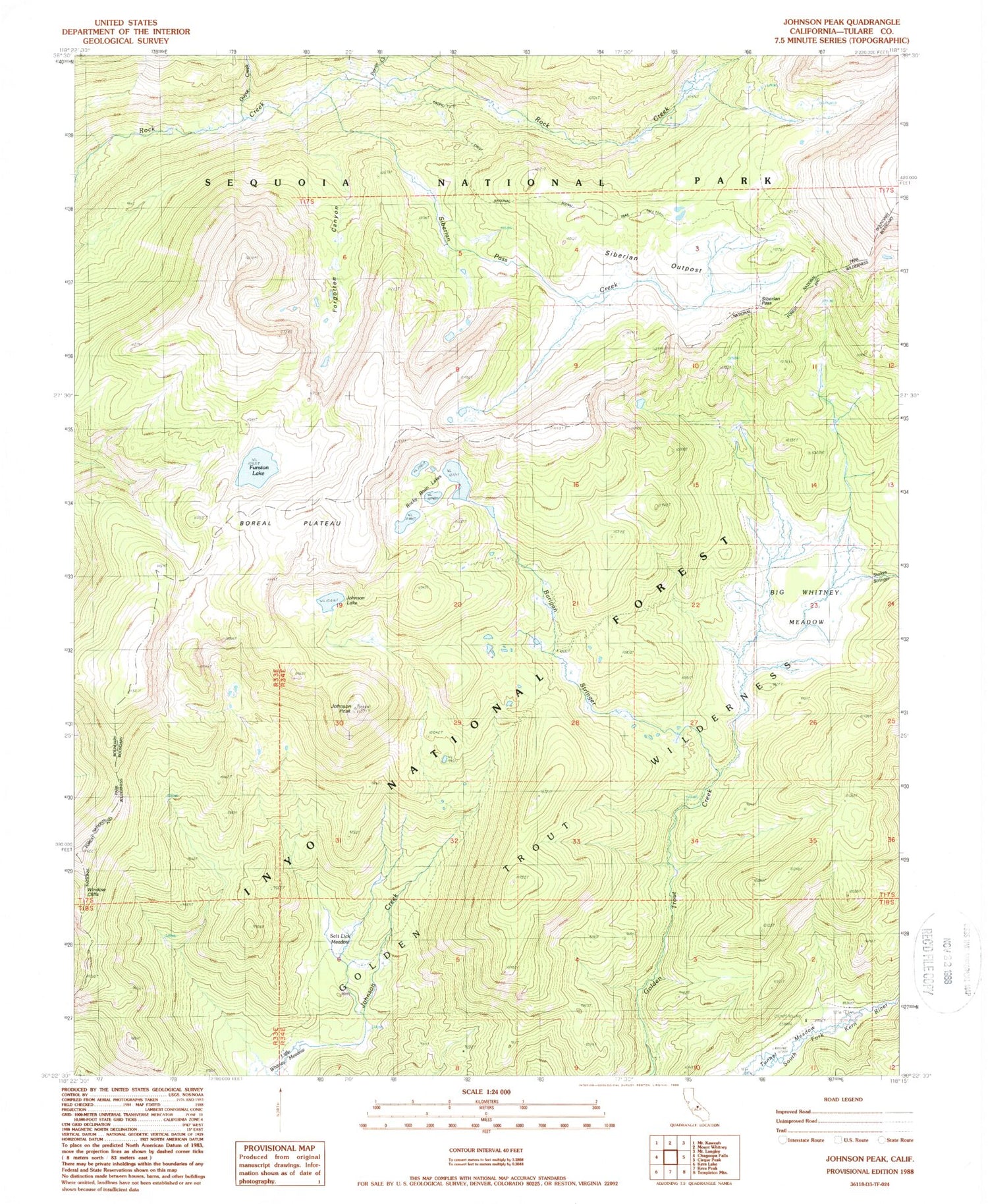
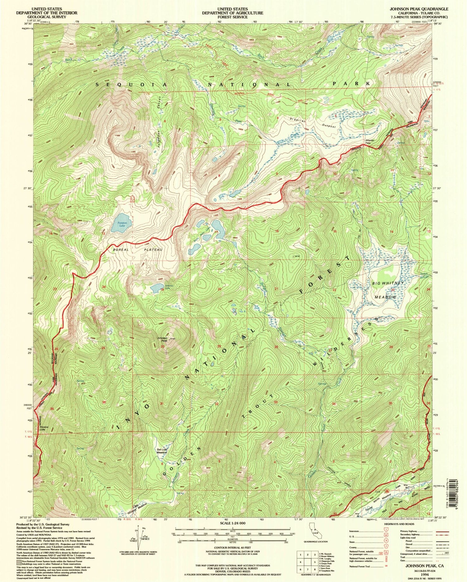
USGS Classic Johnson Peak California 7.5'x7.5' Topo Map
Couldn't load pickup availability
Historical USGS topographic quad map of Johnson Peak in the state of California. Scale: 1:24000. Print size: 24" x 27"
This quadrangle is in the following counties: Inyo, Tulare.
The map contains contour lines, roads, rivers, towns, lakes, and grids including latitude / longitude and UTM / MGRS. Printed on high-quality waterproof paper with UV fade-resistant inks.
Contains the following named places: Barigan Stringer, Whitney Meadow, Boreal Plateau, Forgotten Canyon, Funston Lake, Guyot Creek, Johnson Lake, Johnson Peak, Perrin Creek, Rock Creek Patrol Cabin, Rocky Basin Lakes, Salt Lick Meadow, Siberian Outpost, Siberian Pass, Siberian Pass Creek, Stokes Stringer, Tunnel Air Camp, Tunnel Meadow, Mount Anna Mills, Little Whitney Cow Camp


