MyTopo
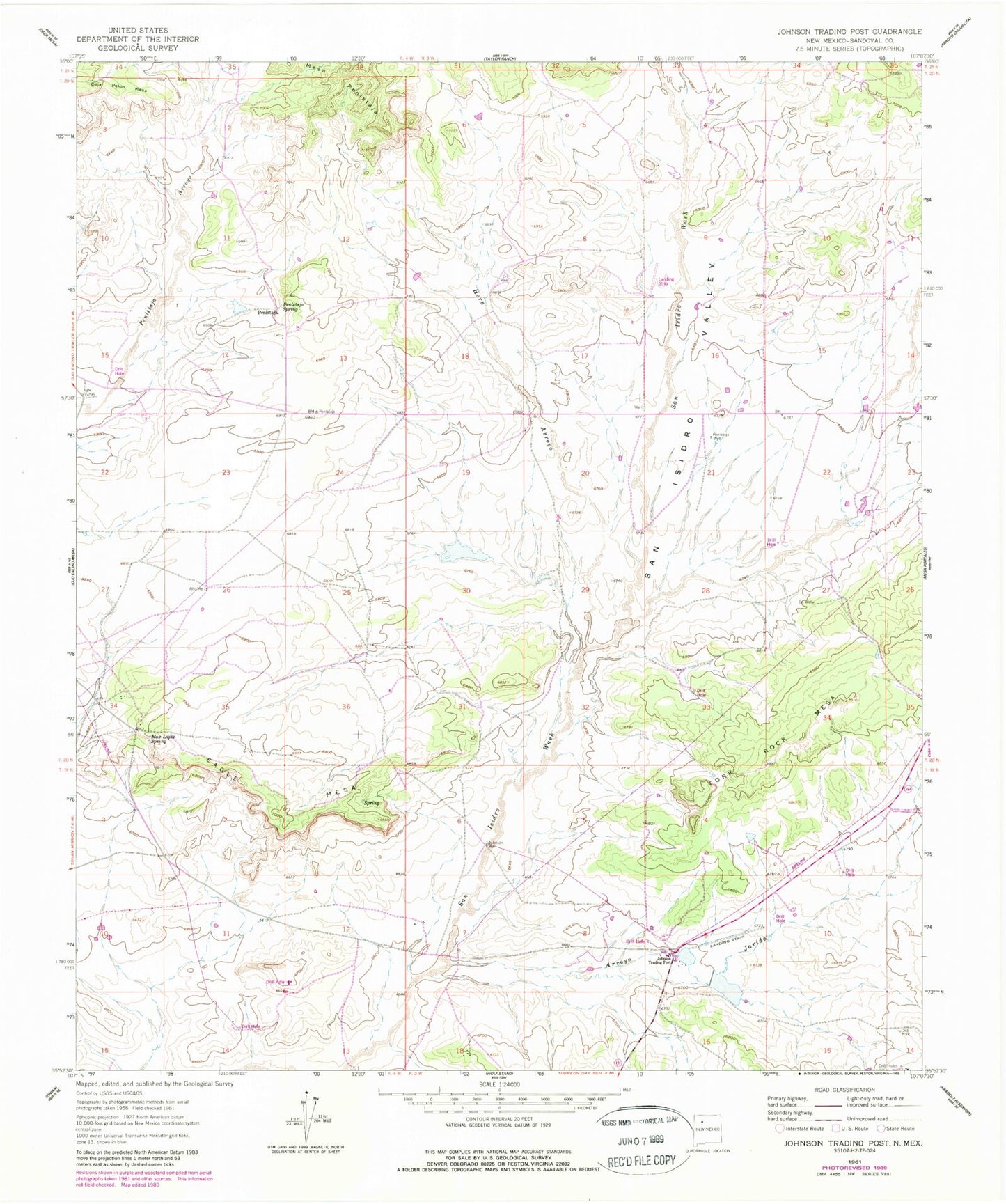
Classic USGS Johnson Ranch New Mexico 7.5'x7.5' Topo Map
Couldn't load pickup availability
Historical USGS topographic quad map of Johnson Ranch in the state of New Mexico. Map scale may vary for some years, but is generally around 1:24,000. Print size is approximately 24" x 27"
This quadrangle is in the following counties: Lea.
The map contains contour lines, roads, rivers, towns, and lakes. Printed on high-quality waterproof paper with UV fade-resistant inks, and shipped rolled.
Contains the following named places: 05001 Water Well, 05017 Water Well, 05018 Water Well, 12598 Water Well, 12599 Water Well, 12600 Water Well, 12607 Water Well, 12608 Water Well, 12866 Water Well, 13385 Water Well, 13388 Water Well, Double Windmill, Drill Hole Sand Windmill, East Lake, Jog Windmill, Johnson Ranch, Lucky Windmill, North Lake, North Windmill, Number One Windmill, Number Three Windmill, Number Two Windmill, South Windmill, X Four Windmill