MyTopo
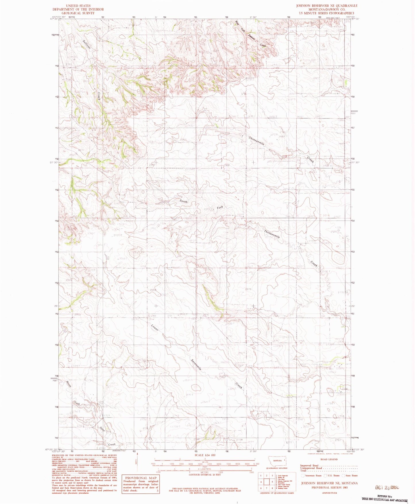
Classic USGS Johnson Reservoir NE Montana 7.5'x7.5' Topo Map
Regular price
$16.95
Regular price
Sale price
$16.95
Unit price
per
Couldn't load pickup availability
Historical USGS topographic quad map of Johnson Reservoir NE in the state of Montana. Map scale may vary for some years, but is generally around 1:24,000. Print size is approximately 24" x 27"
This quadrangle is in the following counties: Dawson.
The map contains contour lines, roads, rivers, towns, and lakes. Printed on high-quality waterproof paper with UV fade-resistant inks, and shipped rolled.
Contains the following named places: 19N52E02AAAB01 Well, 19N52E16CCDD01 Well, 19N52E26AAD_01 Well, 19N52E29AAD_01 Well, 19N53E05BCBC01 Well, 20N53E20CCCC01 Well, 20N53E31BCB_01 Spring, Buck Dam, Egeness School, Kolberg School, Richey Division, Seven Mile School, Steffen Dam