MyTopo
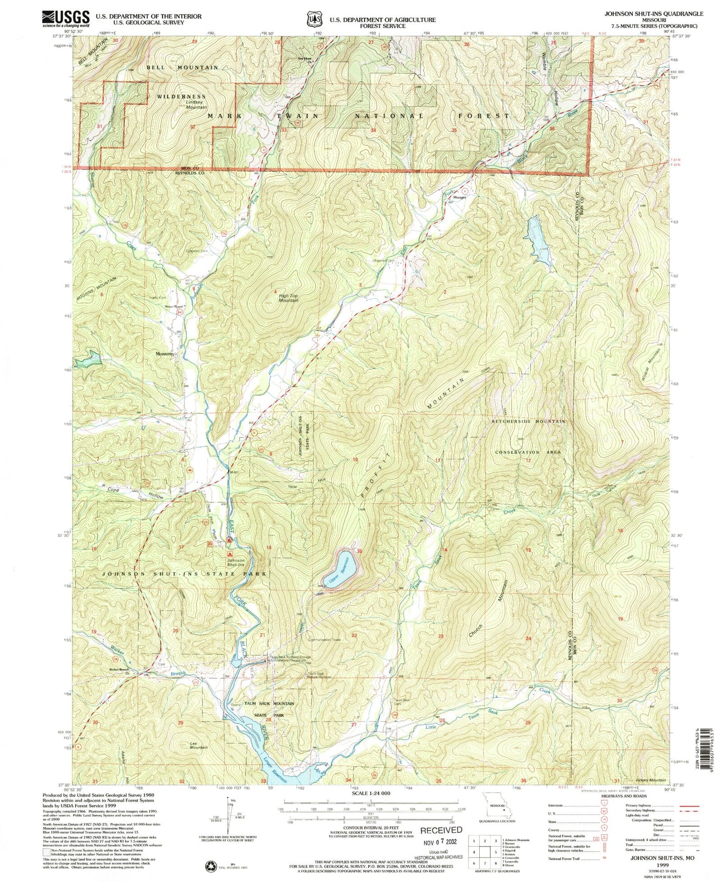
USGS Classic Johnson Shut-Ins Missouri 7.5'x7.5' Topo Map
Couldn't load pickup availability
Historical USGS topographic quad map of Johnson Shut-Ins in the state of Missouri. Scale: 1:24000. Print size: 24" x 27"
This quadrangle is in the following counties: Iron, Reynolds.
The map contains contour lines, roads, rivers, towns, lakes, and grids including latitude / longitude and UTM / MGRS. Printed on high-quality waterproof paper with UV fade-resistant inks.
Contains the following named places: Lee Mountain, High Top Mountain, Pinkley (historical), Upper Imboden School (historical), Lower Imboden School, Walker Branch School (historical), Sawyer School, Munger School (historical), Pinkleys School (historical), Chapman Cemetery, Church Mountain, Cope Hollow, Fitzgerald Cemetery, Hasty Cemetery, Imboden Fork, Johnson Shut-Ins, Johnson's Shut-Ins State Park, Lindsey Mountain, Little Taum Sauk Creek, Marys Chapel, Monterey, Munger, New Hope Church, Proffit Mountain, Shut-in Creek, Taum Sauk Cemetery, Taum Sauk Creek, Walker Branch, Walker Branch Church, Wildcat Mountain, Womble Hollow, Taum Sauk Nature Museum, Taum Sauk Pumped-Storage Hydroelectric Powerplant, Taum Sauk Upper Dam, Upper Reservoir, Lower Reservoir, Middlebrook Development Lake Dam, Number 49 Lake, Perdido Dam