MyTopo
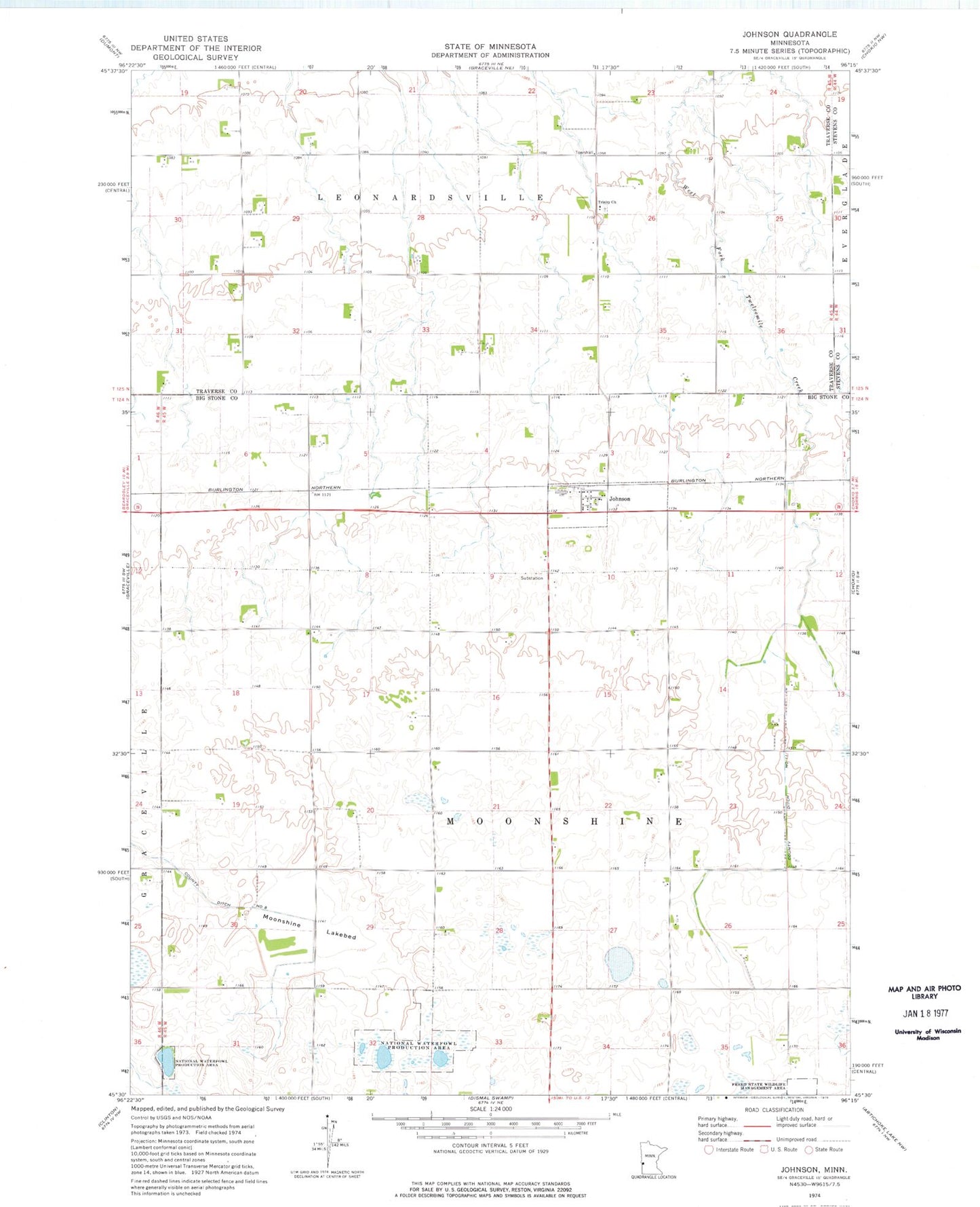
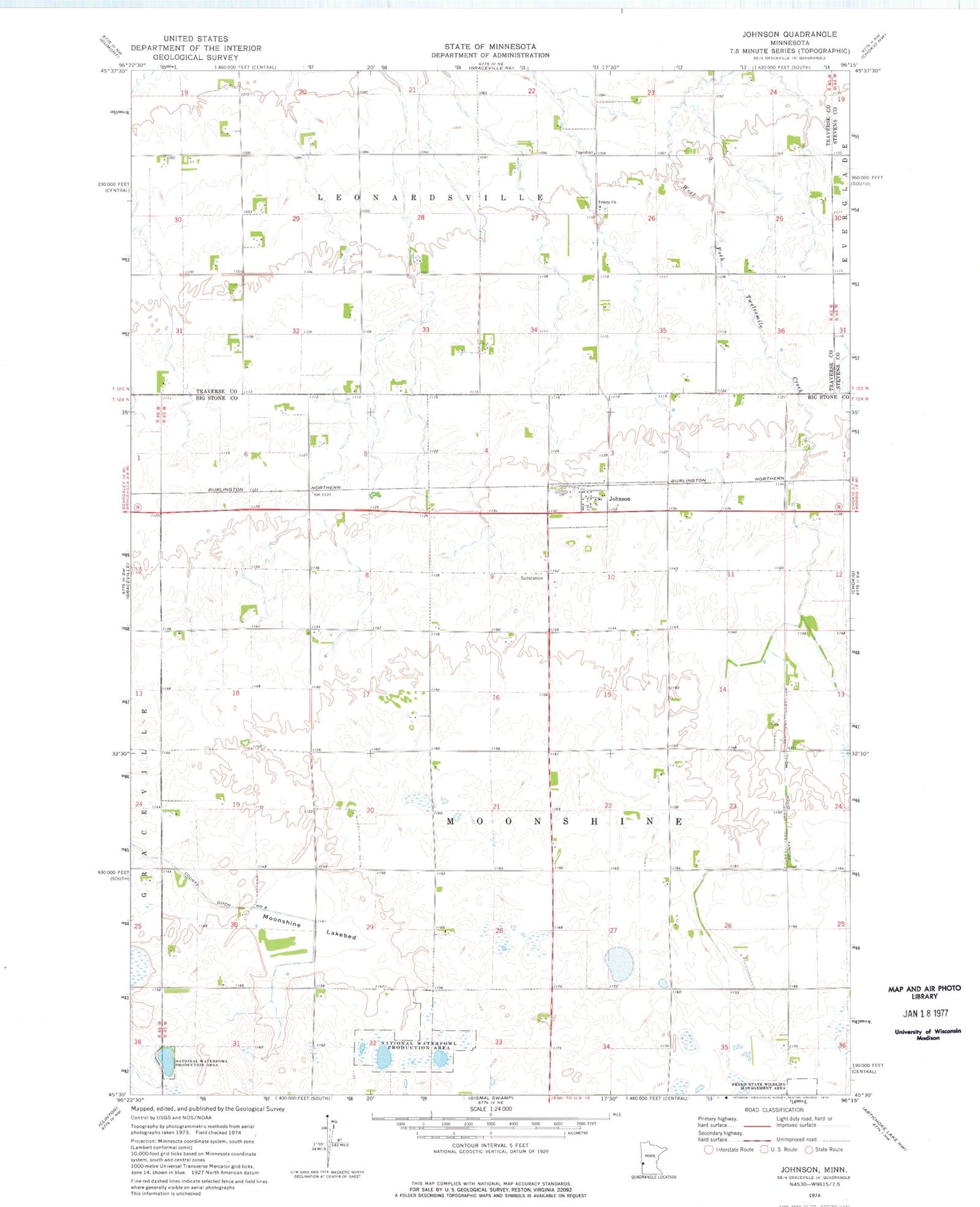
Classic USGS Johnson Minnesota 7.5'x7.5' Topo Map
Couldn't load pickup availability
Historical USGS topographic quad map of Johnson in the state of Minnesota. Map scale may vary for some years, but is generally around 1:24,000. Print size is approximately 24" x 27"
This quadrangle is in the following counties: Big Stone, Stevens, Traverse.
The map contains contour lines, roads, rivers, towns, and lakes. Printed on high-quality waterproof paper with UV fade-resistant inks, and shipped rolled.
Contains the following named places: City of Johnson, County Ditch Number Eleven, Four Corner School, Freed State Wildlife Management Area, Johnson, Johnson Post Office, Moonshine Lakebed, School Number 35, School Number 50, School Number 58, School Number 61, Township of Moonshine, Trinity Cemetery, Trinity Church, Trinity Lutheran School, Trinity School