MyTopo
Classic USGS Johnsonburg New York 7.5'x7.5' Topo Map
Couldn't load pickup availability
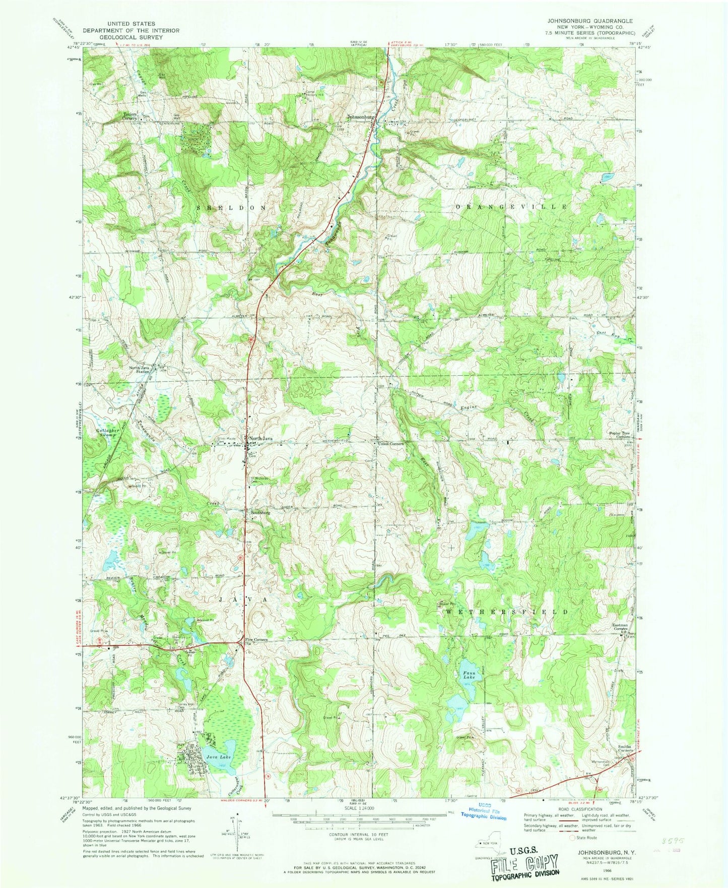
Historical USGS topographic quad map of Johnsonburg in the state of New York. Map scale may vary for some years, but is generally around 1:24,000. Print size is approximately 24" x 27"
This quadrangle is in the following counties: Wyoming.
The map contains contour lines, roads, rivers, towns, and lakes. Printed on high-quality waterproof paper with UV fade-resistant inks, and shipped rolled.
Contains the following named places: Camp Hickory Hill, East Fork Tonawanda Creek, Eastman Corners, Engine Creek, Faun Lake, Five Corners, Gallagher Swamp, Humphrey's Hollows Cemetery, Java Lake, Johnsonburg, Johnsonburg Cemetery, North Java, North Java Fire Department Station 1, North Java Pioneer Cemetery, North Java Post Office, North Java Station, Poplar Tree Corners, Roberts Roost Airport, Saint Nicholas Cemetery, Silver Maple Cemetery, Smiths Corner, Southburg, Torrey Hill Cemetery, Toziers Corner, Union Corners, Union Corners Cemetery, Wethersfield Cemetery, ZIP Codes: 14113, 14167