MyTopo
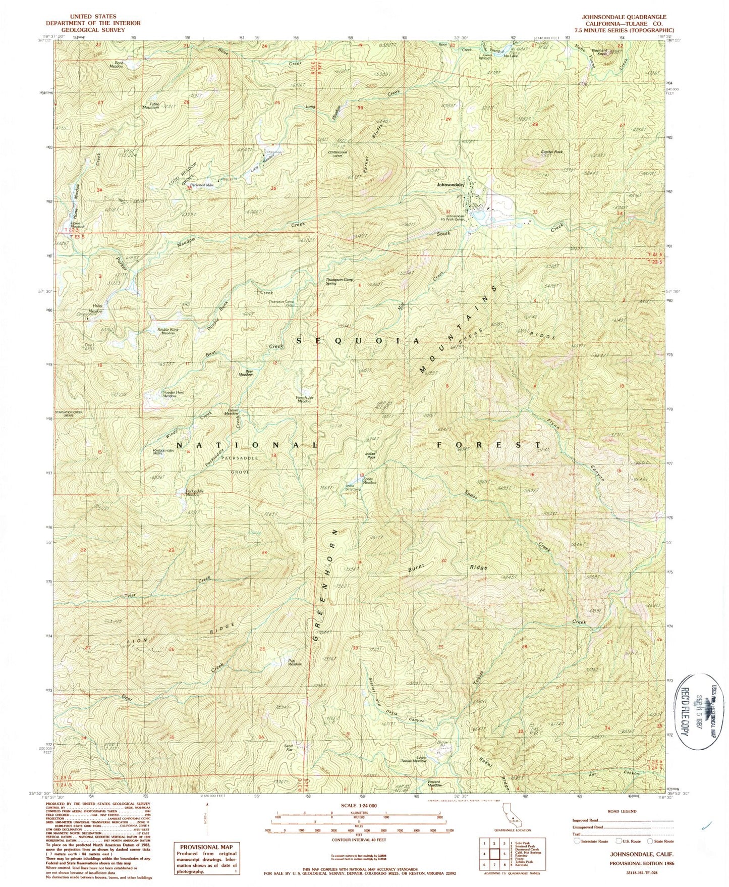
Classic USGS Johnsondale California 7.5'x7.5' Topo Map
Couldn't load pickup availability
Historical USGS topographic quad map of Johnsondale in the state of California. Typical map scale is 1:24,000, but may vary for certain years, if available. Print size: 24" x 27"
This quadrangle is in the following counties: Tulare.
The map contains contour lines, roads, rivers, towns, and lakes. Printed on high-quality waterproof paper with UV fade-resistant inks, and shipped rolled.
Contains the following named places: Bone Creek, Sand Flat, Bear Creek, Bear Meadow, Bone Meadow, Burnt Ridge, Capitol Rock, Clover Meadow, Cunningham Grove, Double Bunk Creek, Double Bunk Meadow, Elephant Knob, French Joe Meadow, Holey Meadow, Horse Meadow, Ida Lake, Lion Ridge, Long Meadow, Long Meadow Creek, Long Meadow Grove, Lower Tobias Meadow, Meadow Creek, Mill Creek, Packsaddle Creek, Packsaddle Grove, Packsaddle Meadow, Parker Bluffs, Powder Horn Meadow, Powderhorn Grove, Pup Meadow, Redwood Meadow, Scarlet and Davis Canyon, Speas Creek, Speas Dirty Camp, Speas Meadow, Speas Ridge, Starvation Creek Grove, Thompson Camp Spring, Tobias Creek Trail, Vincent Meadow, Windy Creek, Johnsondale Forest Service Work Center, Lion Spring, Deer Creek Mill, Holey Meadow Campground, Redwood Meadow Campground, Long Meadow Campground, Parker Meadow Creek, Johnsondale, Table Mountain, Thompson Camp (historical), Dome Rock