MyTopo
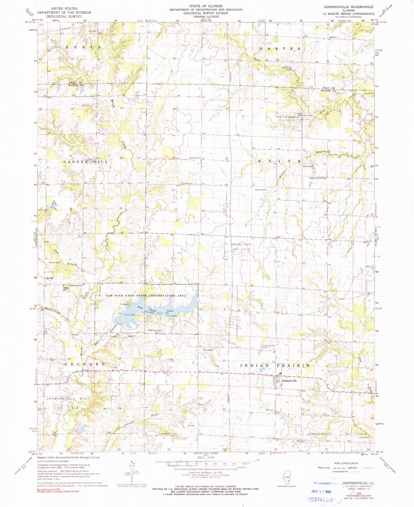
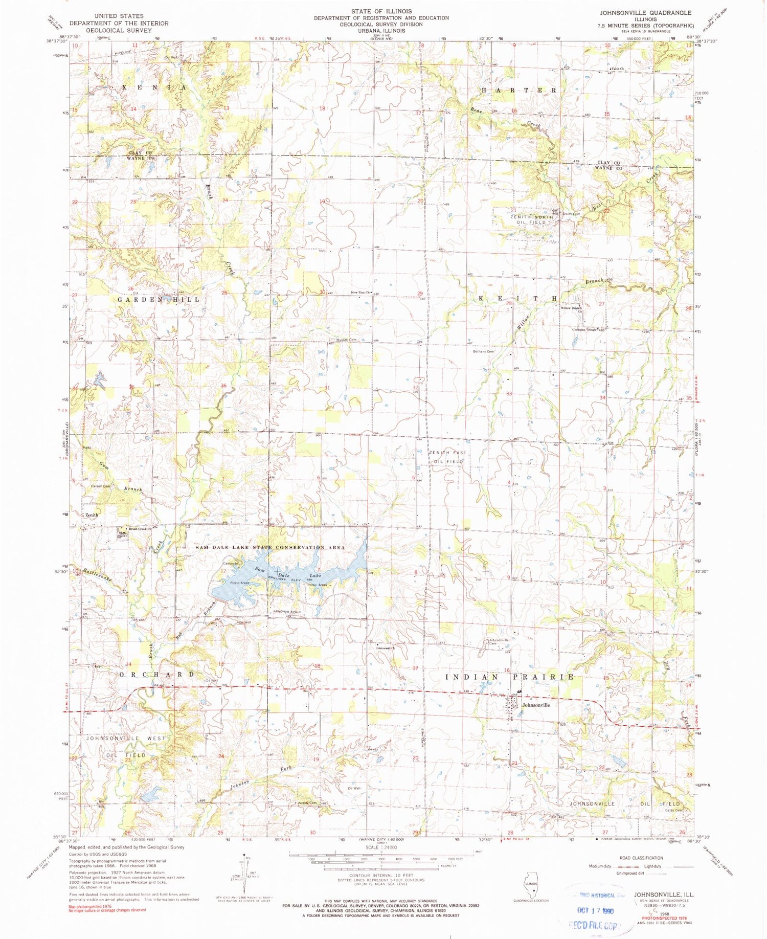
Classic USGS Johnsonville Illinois 7.5'x7.5' Topo Map
Couldn't load pickup availability
Historical USGS topographic quad map of Johnsonville in the state of Illinois. Map scale may vary for some years, but is generally around 1:24,000. Print size is approximately 24" x 27"
This quadrangle is in the following counties: Clay, Wayne.
The map contains contour lines, roads, rivers, towns, and lakes. Printed on high-quality waterproof paper with UV fade-resistant inks, and shipped rolled.
Contains the following named places: Allen Pond, Allen Pond Dam, Baity School, Bethany Cemetery, Bethany Church, Bob Branch, Brush Creek Church, Cates Cemetery, Christian Temple, Cook School, Fairview School, Faith Church, Garfield School, Glenwood Church, Gum Branch, Hargrave School, Harrell Cemetery, Hazel Dale School, Johnsonville, Johnsonville Cemetery, Johnsonville Elementary School, Johnsonville Post Office, Johnsonville West Oil Field, Lone Star School, Maple Grove Picnic Area, New Hope School, New Zion Church, North Taylor School, Rattlesnake Creek, Russell Cemetery, Sam Dale Lake, Sam Dale Lake Dam, Sam Dale Lake State Conservation Area, Sassafras Camping and Picnic Area, Smith Cemetery, Smyer Old Cemetery, Tennessee School, Township of Indian Prairie, Trout Pond, Village of Johnsonville, Wesley Chapel, Wesley Chapel Cemetery, Willow Branch, Willow Branch Cemetery, Willow Branch Church, Willow Branch School, Zenith, Zenith East Oil Field, Zenith North Oil Field, ZIP Code: 62878