MyTopo
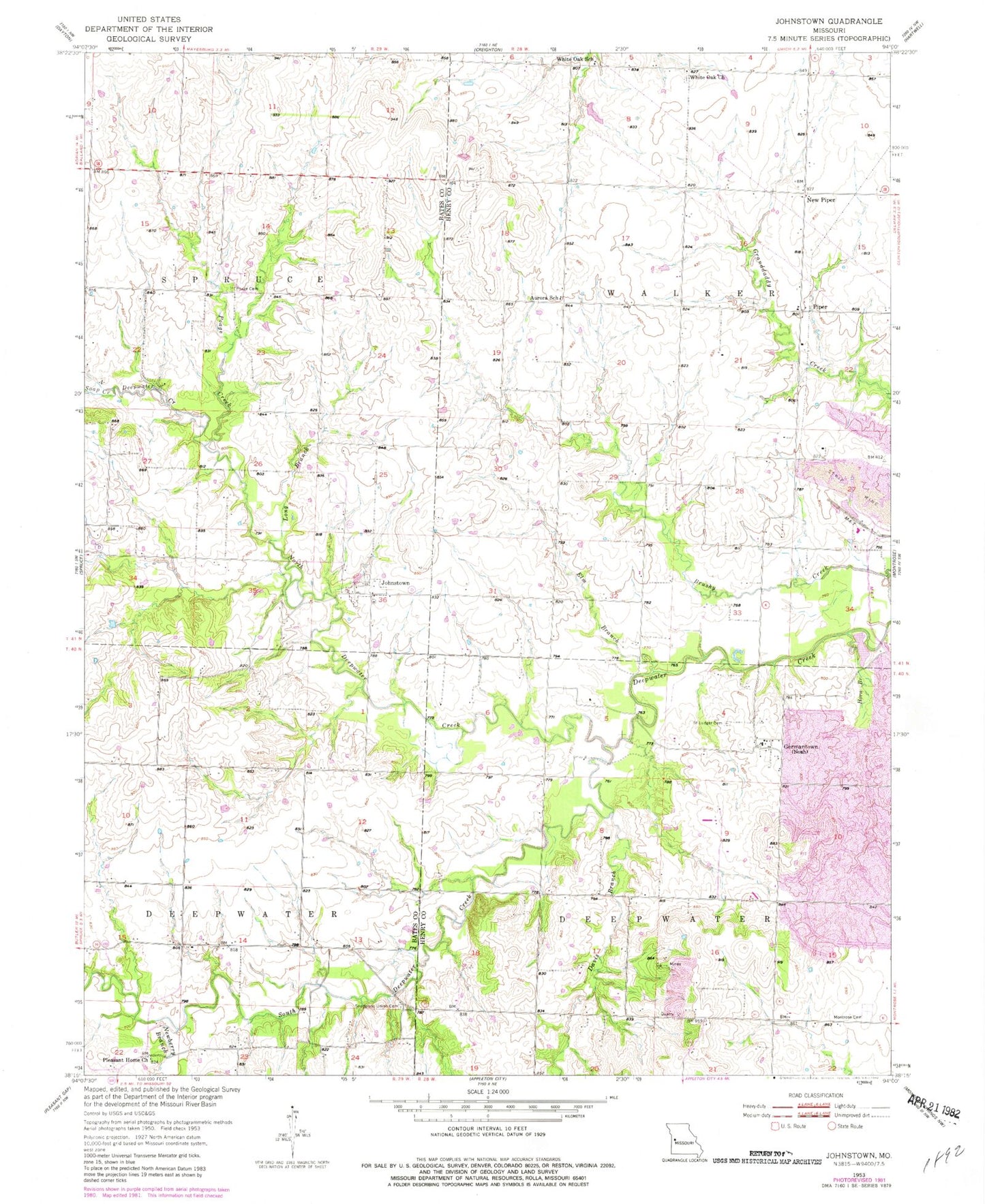
Classic USGS Johnstown Missouri 7.5'x7.5' Topo Map
Couldn't load pickup availability
Historical USGS topographic quad map of Johnstown in the state of Missouri. Map scale may vary for some years, but is generally around 1:24,000. Print size is approximately 24" x 27"
This quadrangle is in the following counties: Bates, Henry.
The map contains contour lines, roads, rivers, towns, and lakes. Printed on high-quality waterproof paper with UV fade-resistant inks, and shipped rolled.
Contains the following named places: American School, Antioch Creek, Aurora School, Brownsberger Airport, Davis Branch, Elm Branch, Enterprise School, Germantown, Grange Hall School, Horn Branch, Johnstown, Johnstown School, Long Branch, Maple Grove School, Montrose Cemetery, New Piper, Newberry Branch, North Deepwater Creek, Piper, Pleasant Home Church, Poage Cemetery, Poage Creek, Saint Ludger Cemetery, Saint Ludger Church, Snodgrass Union Cemetery, Soap Creek, South Deepwater Creek, Township of Deepwater, Township of Walker, White Oak Church, White Oak School, Willow Tree School