MyTopo
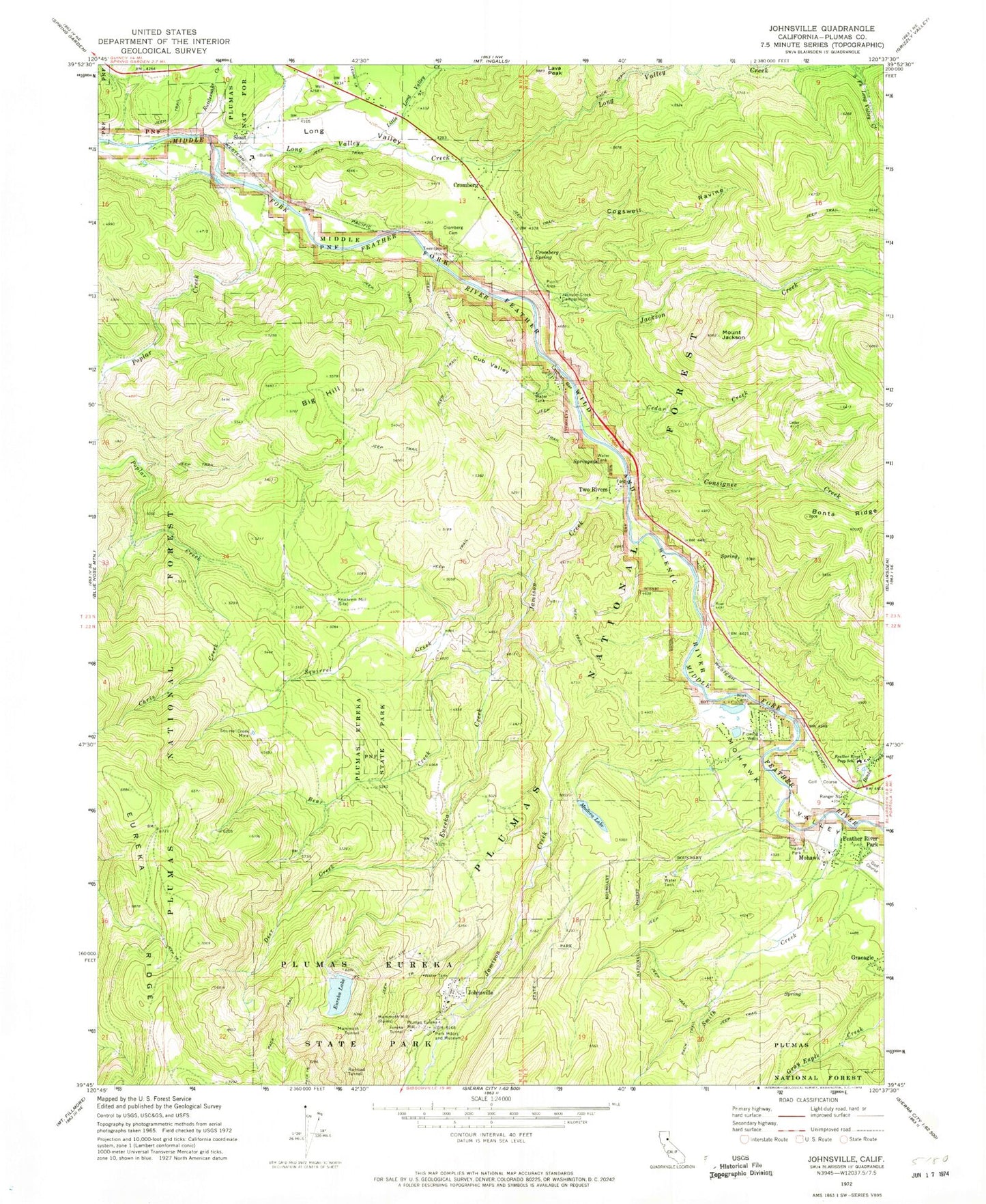
Classic USGS Johnsville California 7.5'x7.5' Topo Map
Couldn't load pickup availability
Historical USGS topographic quad map of Johnsville in the state of California. Map scale may vary for some years, but is generally around 1:24,000. Print size is approximately 24" x 27"
This quadrangle is in the following counties: Plumas.
The map contains contour lines, roads, rivers, towns, and lakes. Printed on high-quality waterproof paper with UV fade-resistant inks, and shipped rolled.
Contains the following named places: Bear Creek, Big Hill, Bonta Creek, Cedar Creek, Chris Creek, Claim Creek, Cogswell Creek, Cogswell Ravine, Consignee Creek, Cromberg, Cromberg Cemetery, Cromberg Census Designated Place, Cromberg Spring, Cub Valley, Deer Creek, Eureka Creek, Eureka Lake, Eureka Lake 1-042 Dam, Eureka Peak Loop Trail, Eureka Tunnel, Feather River Inn, Feather River Inn Golf Course, Feather River Park, Feather River Prep School, Graeagle Census Designated Place, Graeagle Division, Jackson Creek, Jackson Creek Campground, Jackson Creek United States Forest Service Cabin, Jamison, Jamison Creek, Johnsville, Johnsville Cemetery, Johnsville Census Designated Place, Lava Peak, Layman Bar, Layman Camp, Little Long Valley Creek, Long Valley, Long Valley Creek, Long Valley Volunteer Fire Department, Madora Lake, Madora Lake Loop Trail, Mammoth Mill, Mammoth Tunnel, Mohawk, Mohawk Boys Camp, Mohawk Cemetery, Mohawk Ranger Station, Mohawk Valley, Mount Jackson, Plumas Eureka, Plumas Eureka Census Designated Place, Plumas Eureka Fire and Rescue, Plumas Eureka Mill, Plumas Pines Golf Course, Plumas-Eureka State Park, Poplar Valley, Rattlesnake Creek, Sierra Lodge, Sloat, Smith Creek, Squirrel Creek, Squirrel Creek Mine, Twentymile House, Two Rivers, ZIP Code: 96103