MyTopo
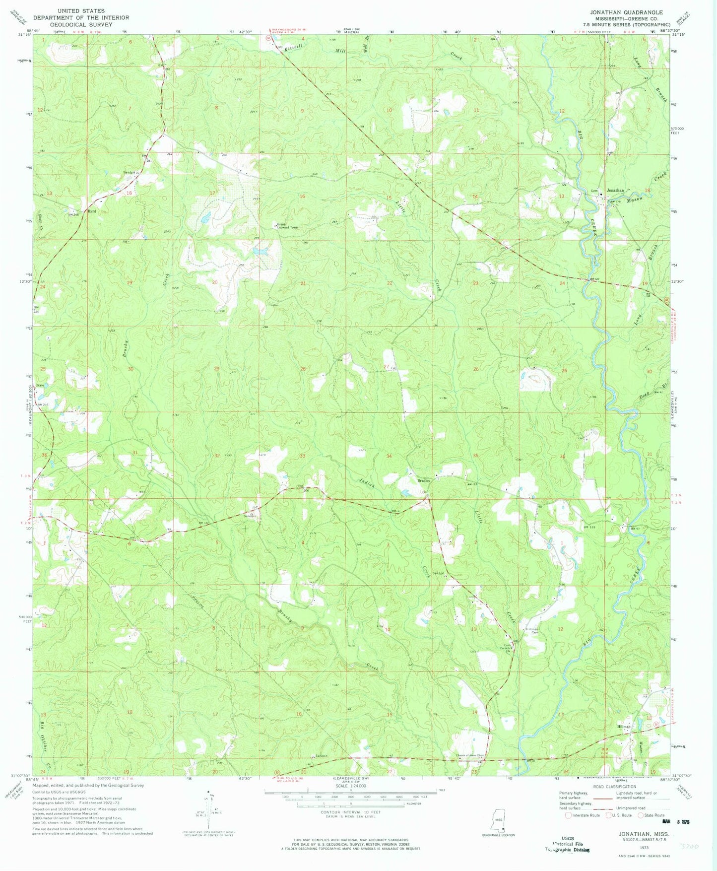
Classic USGS Jonathan Mississippi 7.5'x7.5' Topo Map
Couldn't load pickup availability
Historical USGS topographic quad map of Jonathan in the state of Mississippi. Map scale may vary for some years, but is generally around 1:24,000. Print size is approximately 24" x 27"
This quadrangle is in the following counties: Greene.
The map contains contour lines, roads, rivers, towns, and lakes. Printed on high-quality waterproof paper with UV fade-resistant inks, and shipped rolled.
Contains the following named places: Bradley, Bradley Cemetery, Byrd, Cedar Grove Baptist Church, Church of Jesus Christ, Corinth Church, Deep Branch, Green Lookout Tower, Greene County, Hillman, Hillman Cemetery, Indian Creek, Jonathan, Jonathan Volunteer Fire Department, Kittrell Mill Creek, Little Creek, Long Branch, Mason Creek, Neely Volunteer Fire Department, Supervisor District 5, Wilson, Wolf Branch, ZIP Code: 39461