MyTopo
Classic USGS Jones Creek Texas 7.5'x7.5' Topo Map
Couldn't load pickup availability
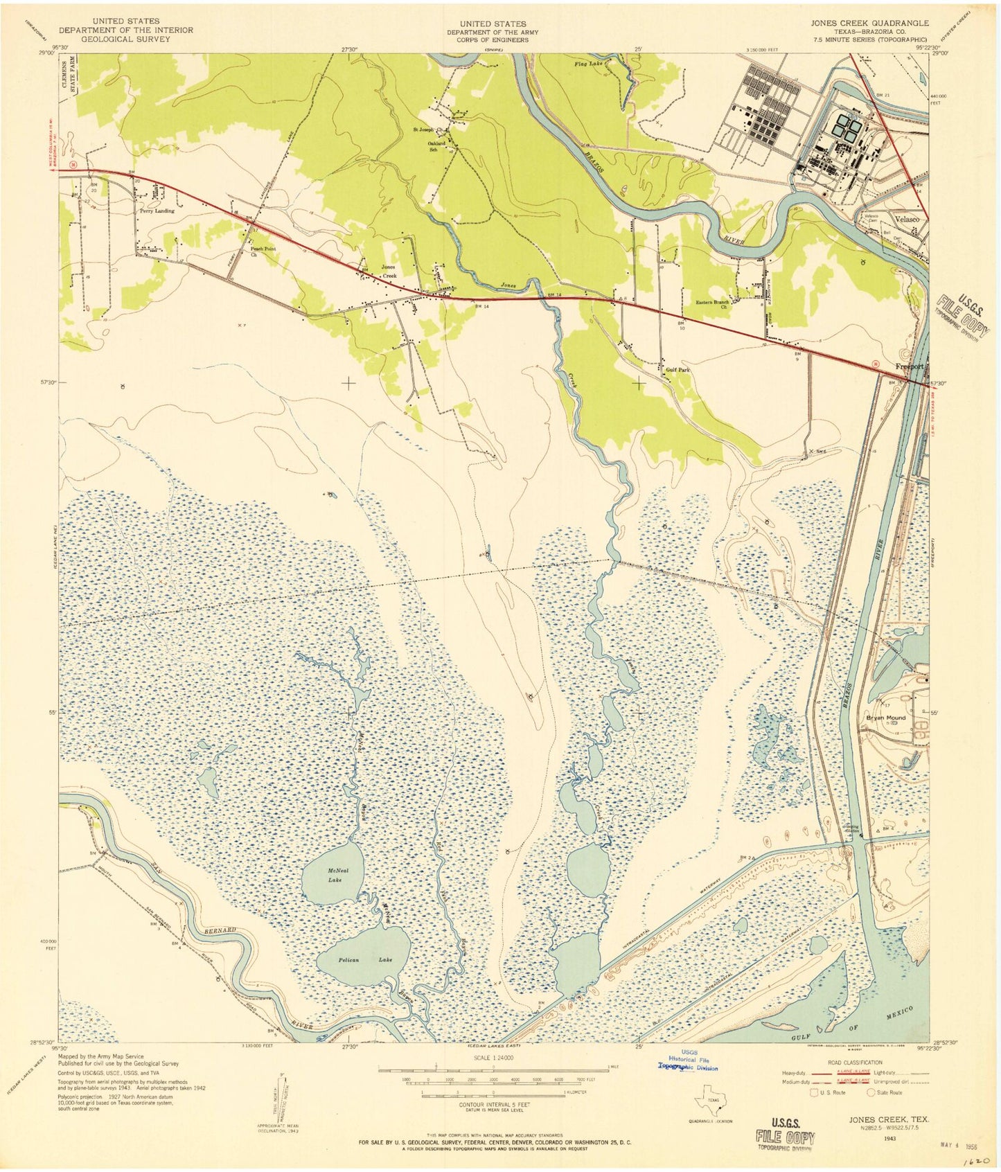
Historical USGS topographic quad map of Jones Creek in the state of Texas. Map scale may vary for some years, but is generally around 1:24,000. Print size is approximately 24" x 27"
This quadrangle is in the following counties: Brazoria.
The map contains contour lines, roads, rivers, towns, and lakes. Printed on high-quality waterproof paper with UV fade-resistant inks, and shipped rolled.
Contains the following named places: Austin School, Brazos River, Bryan Beach, Bryan Mound, Calvary Church, Durazno Plantation, Eastern Branch Church, Flag Lake Drainage Canal, Gulf Park, Gulf Prairie Church, Jones Creek, Jones Creek Marshal's Office, Jones Creek Volunteer Fire Department, Jones Lake, McNeal Bayou, McNeal Lake, Oakland, Old Intracoastal Waterway, Pelican Lake, Perry Landing, Redfish Bayou, Saint Joseph Church, Stephen F Austin Elementary School, Velasco Cemetery, Village of Jones Creek