MyTopo
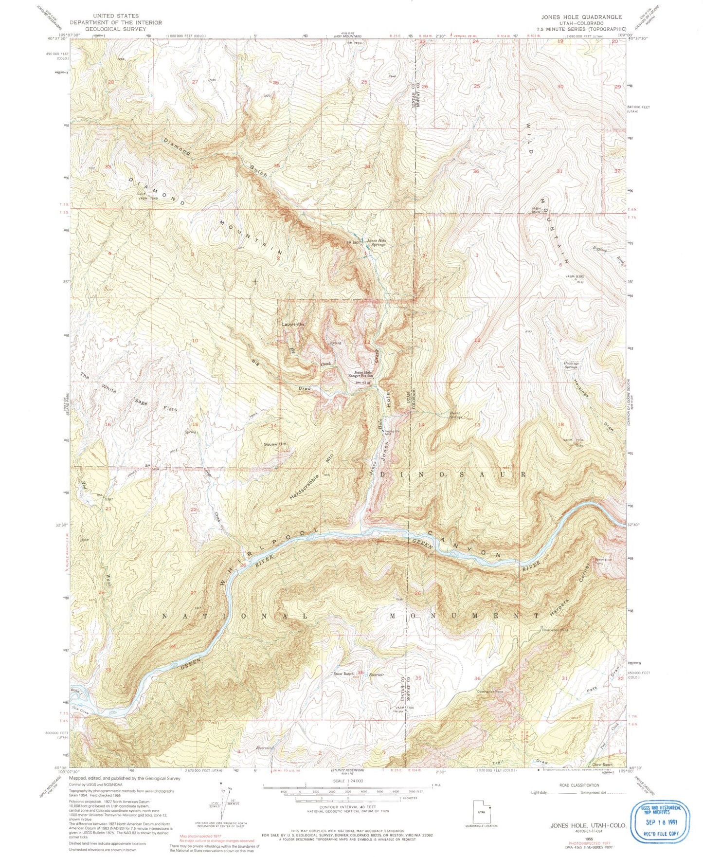
Classic USGS Jones Hole Utah 7.5'x7.5' Topo Map
Couldn't load pickup availability
Historical USGS topographic quad map of Jones Hole in the states of Utah, Colorado. Typical map scale is 1:24,000, but may vary for certain years, if available. Print size: 24" x 27"
This quadrangle is in the following counties: Moffat, Uintah.
The map contains contour lines, roads, rivers, towns, and lakes. Printed on high-quality waterproof paper with UV fade-resistant inks, and shipped rolled.
Contains the following named places: Whirlpool Canyon, Big Draw, Ely Creek, Hardscrabble Mountain, Jones Hole, Jones Hole Creek, Jones Hole Ranger Station, Jones Hole Springs, Jones Hole Trail, Labyrinths, Martha Ridge, Red Wash, Sage Creek, Snow Ranch, Squaw Hill, The Cove, The White Sage Flats, Jones Hole National Fish Hatchery, Diamond Gulch, Chew Ranch, Harpers Corner, Hackings Draw, Hackings Springs, Burnt Springs, Trail Draw