MyTopo
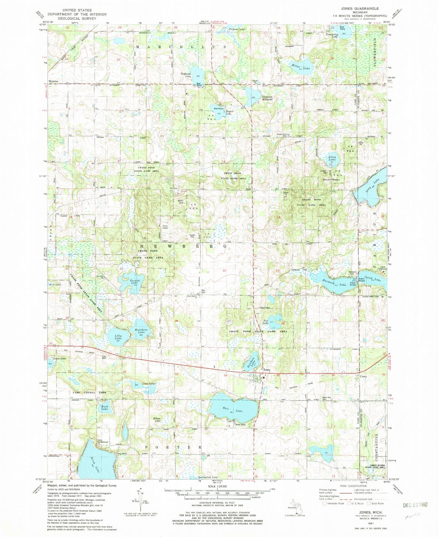
Classic USGS Jones Michigan 7.5'x7.5' Topo Map
Couldn't load pickup availability
Historical USGS topographic quad map of Jones in the state of Michigan. Map scale may vary for some years, but is generally around 1:24,000. Print size is approximately 24" x 27"
This quadrangle is in the following counties: Cass, St. Joseph.
The map contains contour lines, roads, rivers, towns, and lakes. Printed on high-quality waterproof paper with UV fade-resistant inks, and shipped rolled.
Contains the following named places: Allen Lake, Bair Lake, Bald Hill, Bald Hill School, Birch Lake, Bogart Lake, Bucher School, Buck Lake, Camelot Camp Grounds, Camp Eberhardt, Camp Kil Lo Qua, Camp Tannadoonah, Cass County Park, Chapman School, Corey, Corey Church of the Nazarene, Corey Lake School, Corey Post Office, Corey's Station, Cranberry Lake, Crane Pond State Game Area, Driskels Lake, Elbow Lake, Faith Bible Church, First Baptist Church, Forked Lake, Fox Lake, Harwood Lake, Hutchens Lake, Jones, Jones Post Office, Jones Station, Keenum Airport, Lakeside Campground, Laneville School, Lilly Lake, Lilly Lake Cemetery, Lime Lakes, Long Lake, M40 Speedway, Mill Lake, Mount Misery, Newberg Norton Bible Church, Newberg Township Fire and Emergency Medical Services, North Porter School, Norton School, Pemberton School, Poe Cemetery, Poe School, Poe's Corners Historical Marker, Sand Hill Cemetery, Shady Point Campgrounds, Skyhawk Lake, Star School, Streaters Mill Pond, Swiss Valley Ski Area, Township of Newberg