MyTopo
Classic USGS Jones Tennessee 7.5'x7.5' Topo Map
Couldn't load pickup availability
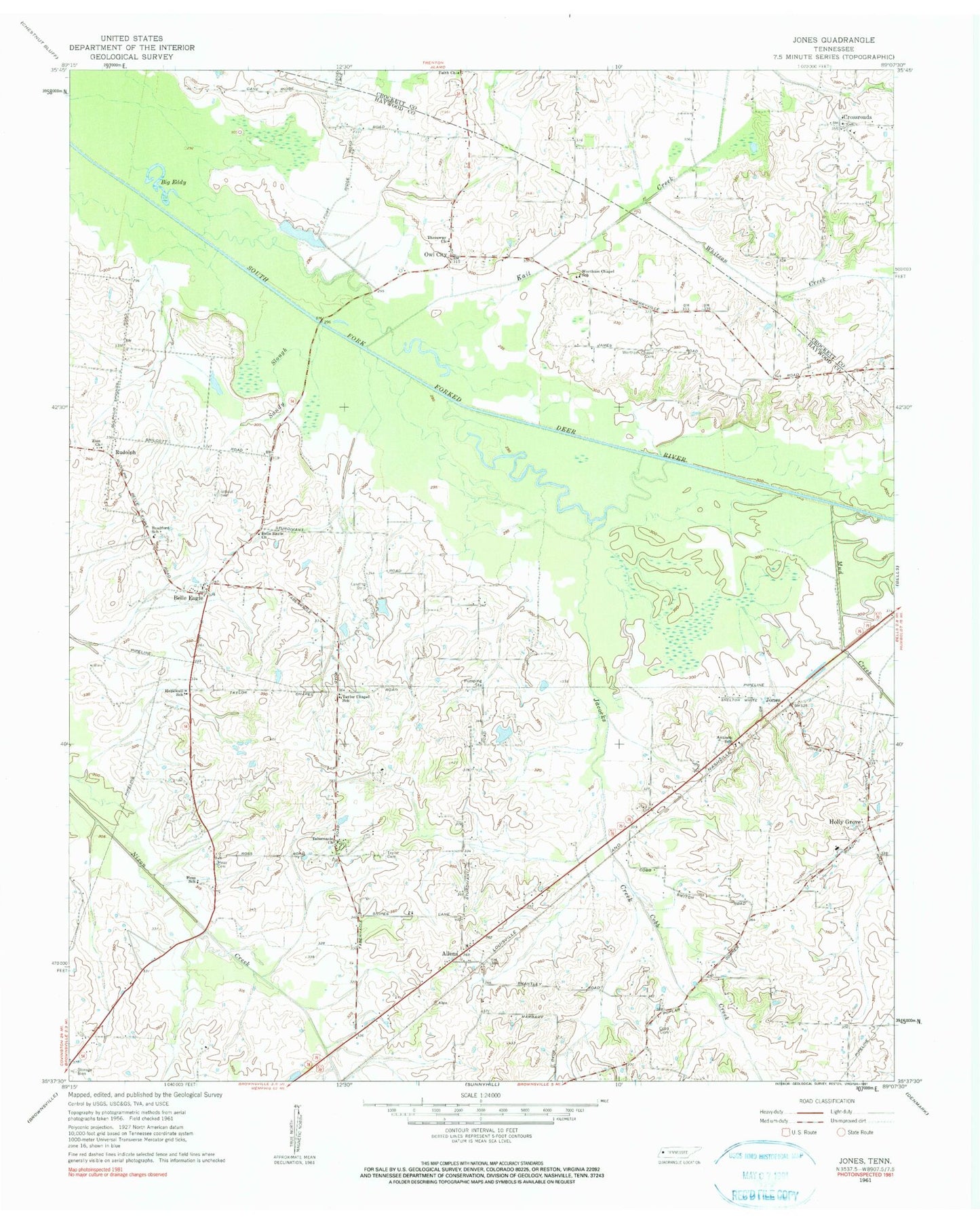
Historical USGS topographic quad map of Jones in the state of Tennessee. Map scale may vary for some years, but is generally around 1:24,000. Print size is approximately 24" x 27"
This quadrangle is in the following counties: Crockett, Haywood.
The map contains contour lines, roads, rivers, towns, and lakes. Printed on high-quality waterproof paper with UV fade-resistant inks, and shipped rolled.
Contains the following named places: Allen Baptist Church, Allens, Antioch Baptist Church, Antioch School, Belle Eagle, Belle Eagle Church, Big Eddy, Bradford, Bradford School, Brownsville - Haywood County Fire Department District 7, Brownsville - Haywood County Fire Department District 8, Centerville School, Clark School, Cobb Cemetery, Cobb Creek, Commissioner District 2, Commissioner District 6, Cross Roads Baptist Church, Crossroads, Faith Church, Fort Ridge, Hess Cemetery, Hess School, Holly Grove, Holly Grove Baptist Church, Holly Grove School, Holly Grove-Belle Eagle Division, Hopewell School, Indian Head, Island Number Eleven, Island Number Ten, Island Number Twelve, Jacocks Creek, Jones, Kail Creek, Mud Creek, Owl City, Sanctified Church, Sandy Slough, Snipes Grove Church, Snipes Grove School, Tabernacle Cemetery, Tabernacle Church, Taylor Cemetery, Taylor Chapel, Taylor Chapel School, Thornton Airport, Threeway Church, Whitson Creek, William A Jameson Lake, William A Jameson Lake Dam, Wortham Chapel, Wortham Chapel Cemetery, Wortham Chapel School, Zion Cemetery, Zion Church