MyTopo
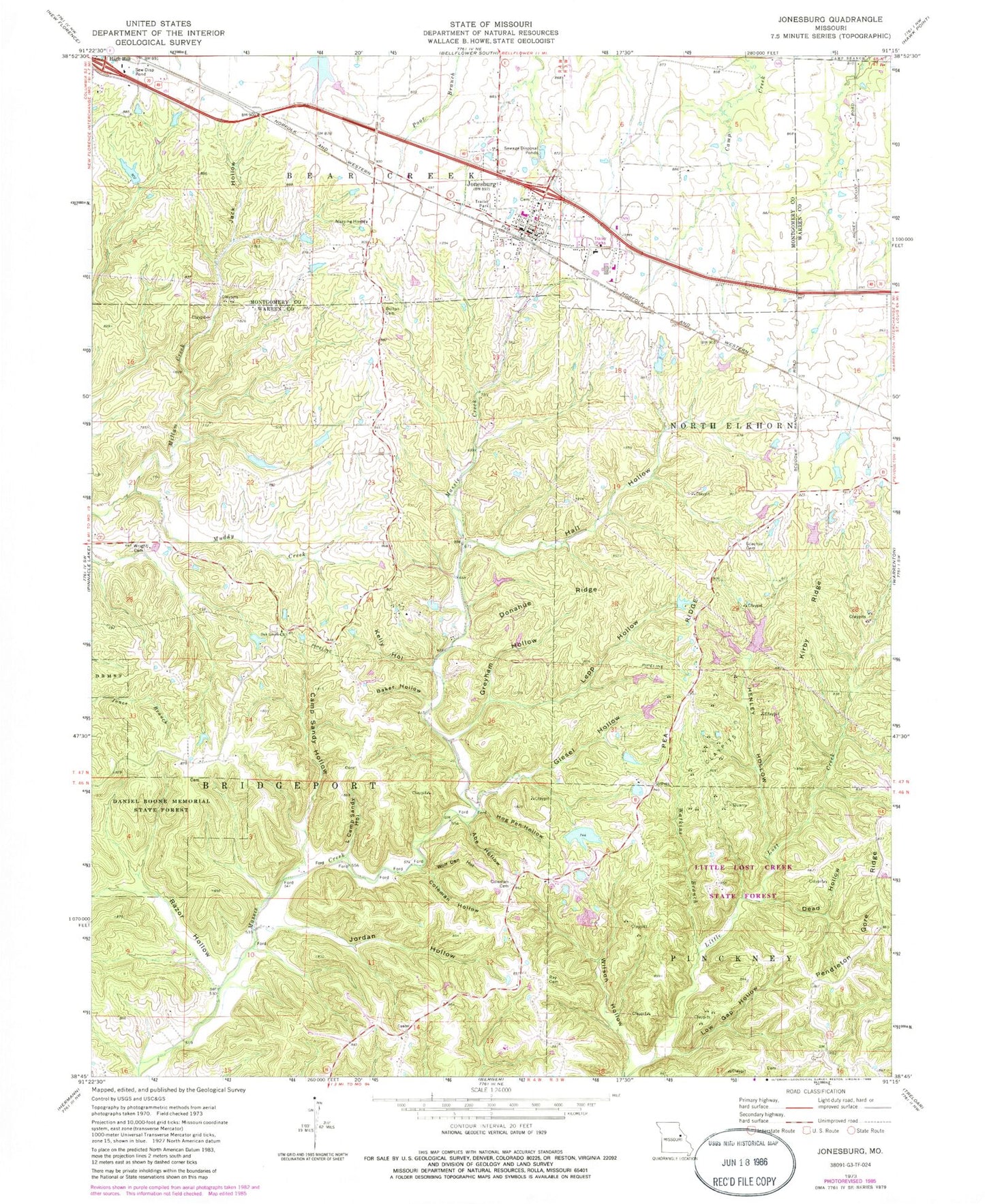
Classic USGS Jonesburg Missouri 7.5'x7.5' Topo Map
Couldn't load pickup availability
Historical USGS topographic quad map of Jonesburg in the state of Missouri. Map scale may vary for some years, but is generally around 1:24,000. Print size is approximately 24" x 27"
This quadrangle is in the following counties: Montgomery, Warren.
The map contains contour lines, roads, rivers, towns, and lakes. Printed on high-quality waterproof paper with UV fade-resistant inks, and shipped rolled.
Contains the following named places: Abe Hollow, Adventures Aloft Airport, Baker Hollow, Ball School, Big Four School, Bullar Lake Dam, Camp Sandy Creek, Camp Sandy Hollow, Casper Lake Dam, Central School, City of Jonesburg, Coleman Cemetery, Coleman Hollow, Cool Valley Lake, Crancers Lake, Crancers Lake Dam, Crancers Lake Section 7 South Dam, Dead Hollow, Donahue Ridge, Giesel Hollow, Greyham Hollow, Hall Hollow, Hambauch Lake Dam, Henley Hollow, Hicks Lake Section 20 North Dam, Hicks Lake Section 20 South Dam, Hog Pen Hollow, Jack Hollow, John Scofield Lake, Jonesburg, Jonesburg - High Hill Fire Protection District, Jonesburg Elementary School, Jonesburg Post Office, Jordan Hollow, Kelly Hollow, Kelly Lake Dam, Kirby Ridge, Lepp Hollow, Little Camp Sandy Hollow, Little Lost Creek State Forest, Longstreet Lake Dam, Low Gap Hollow, Martin School, Muddy Creek, Oak Grove Church, Oak Grove School, Pea Ridge, Progressive School, Ray Cemetery, Razor Hollow, Robertson Lake, Scachse Cemetery, Scofield Lake Number 3 Dam, Tightsqueeze Field, Township of Bridgeport, Twin Echoes Lake, Watkins Branch, Wilson Hollow, Wolf Den Hollow, Wright Cemetery, ZIP Code: 63351