MyTopo
Classic USGS Jonestown Mississippi 7.5'x7.5' Topo Map
Couldn't load pickup availability
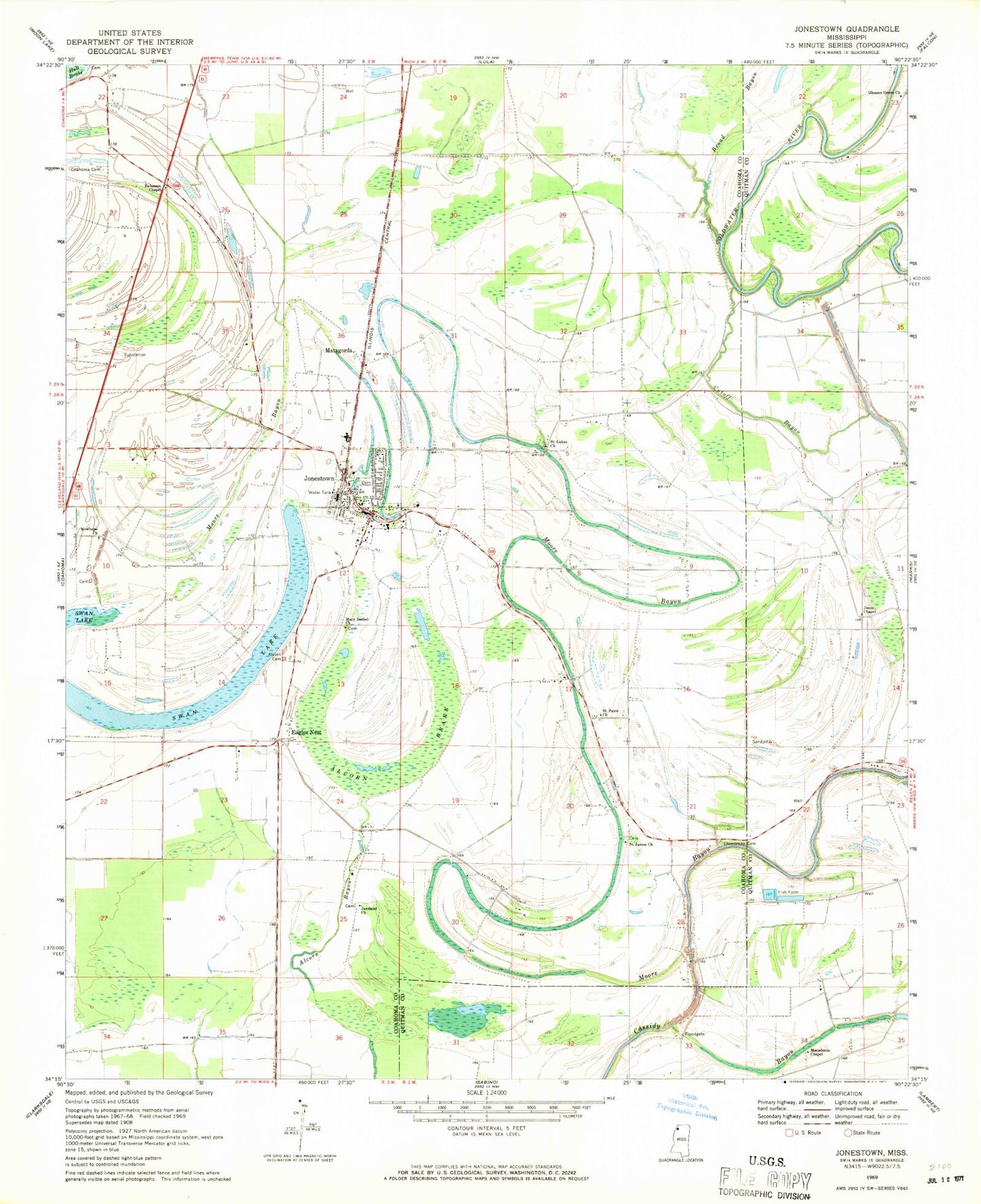
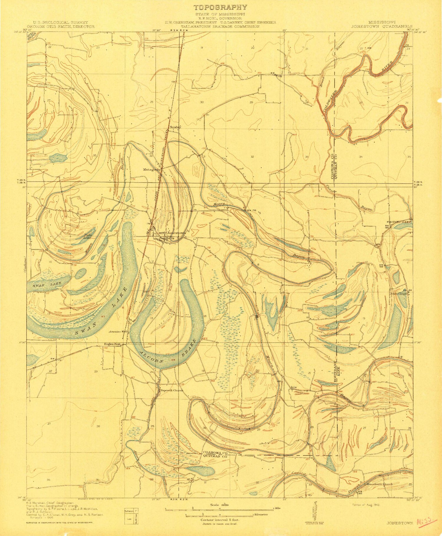
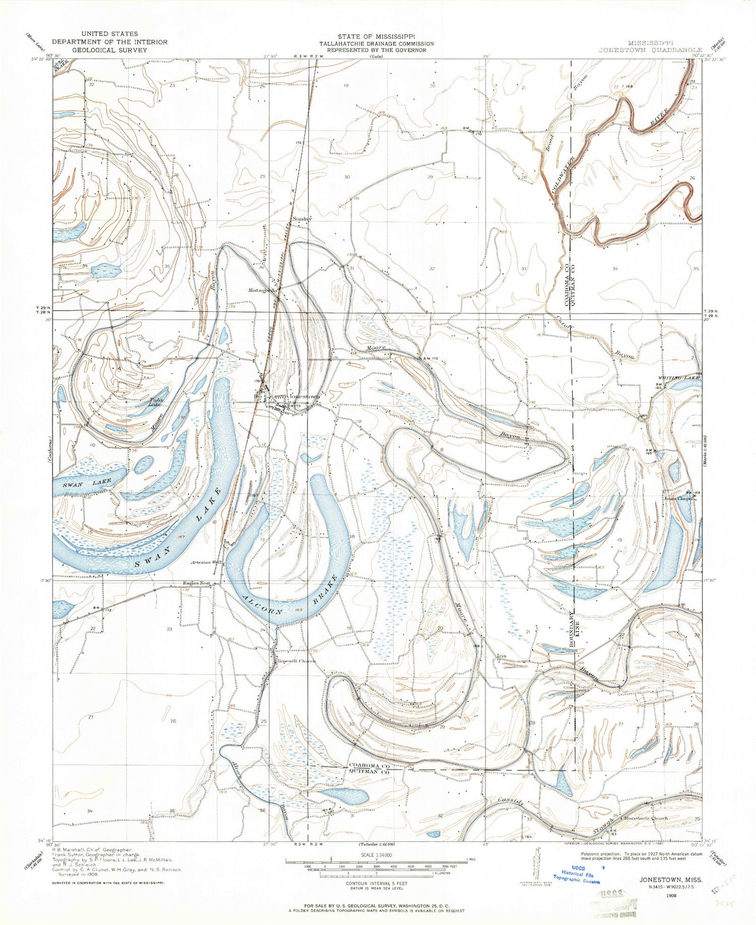
Historical USGS topographic quad map of Jonestown in the state of Mississippi. Map scale may vary for some years, but is generally around 1:24,000. Print size is approximately 24" x 27"
This quadrangle is in the following counties: Coahoma, Quitman.
The map contains contour lines, roads, rivers, towns, and lakes. Printed on high-quality waterproof paper with UV fade-resistant inks, and shipped rolled.
Contains the following named places: Alcorn Brake, Alcorn Cemetery, Broad Bayou, Chrestman Cemetery, Church of Christ, Cleary, Coahoma Cemetery, Coahoma County Volunteer Fire Department Jonestown, Cutoff Bayou, Eagles Nest, Gleason Grove Church, Gleason School, Hopewell Church, Iris, Jazzland Church, Jones Chapel, Jonestown, Jonestown Middle School, Jonestown Police Department, Jonestown Post Office, Macedonia Chapel, Mackin Chapel, Mary Bethel Church, Matagorda, Newhope Church, Nittch Church, Robinson Chapel, Saint James Church, Saint Lukes Church, Saint Pauls Church, Sunday, Sunrise Church, Swan Lake, Swan Lake College, Town of Jonestown, Tula Lake, ZIP Code: 38639