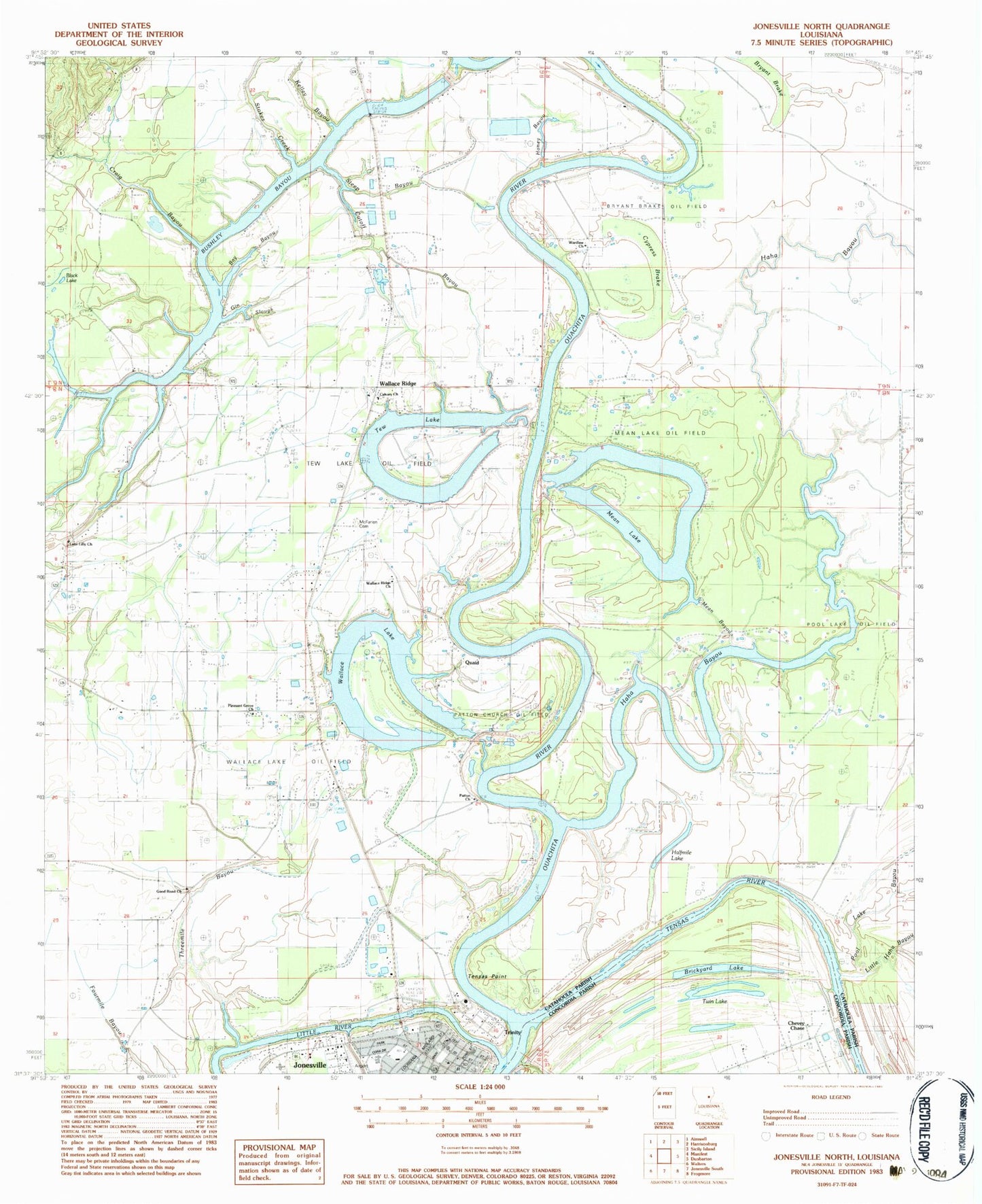
MyTopo
Classic USGS Jonesville North Louisiana 7.5'x7.5' Topo Map
Couldn't load pickup availability
Historical USGS topographic quad map of Jonesville North in the state of Louisiana. Map scale may vary for some years, but is generally around 1:24,000. Print size is approximately 24" x 27"
This quadrangle is in the following counties: Catahoula, Concordia.
The map contains contour lines, roads, rivers, towns, and lakes. Printed on high-quality waterproof paper with UV fade-resistant inks, and shipped rolled.
Contains the following named places: Bay Bayou, Black Lake, Black River, Block High School, Brickyard Lake, Brickyard Lake Oil Field, Bryant Brake, Bryant Brake Oil Field, Bushley Bayou, Calvary Church, Catahoula Parish, Catahoula Ward 9 Fire District 2, Chevey Chase, Chevey Chase Census Designated Place, Craig Bayou, Cutoff Bayou, Cypress Brake, First Baptist Church, First Pentecostal Church, First United Methodist Church, Gin Slough, Good Road Church, Haha Bayou, Halfmile Lake, Honey Bayou, Jonesville, Jonesville Elementary School, Jonesville Police Department, Jonesville Post Office, Jonesville Volunteer Fire Department, Kelley Bayou, Lake Lilly Baptist Church, Little River, McFarlen Cemetery, Mean Bayou, Mean Lake, Mean Lake Oil Field, Meyers Bend Church, Ouachita River, Parish Governing Authority District 5, Patton Church, Patton Church Oil Field, Pleasant Grove Baptist Church, Pool Lake Oil Field, Poole Bend Church, Quaid, Saint Gerards Catholic Church, Steep Bayou, Stokes Creek, Tensas Point, Tensas River, Tew Lake, Tew Lake Oil Field, Threemile Bayou, Trinity, Trinity Cemetery, Trinity Community Cemetery, Trinity Presbyterian Church, Twin Lake, Wallace Lake, Wallace Lake Oil Field, Wallace Ridge, Wallace Ridge Census Designated Place, Wallace Ridge Church, Ward Eight, Ward Five, Wardlaw Church