MyTopo
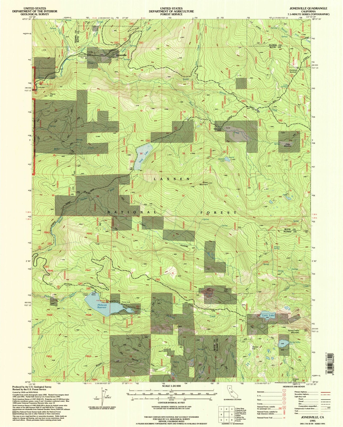
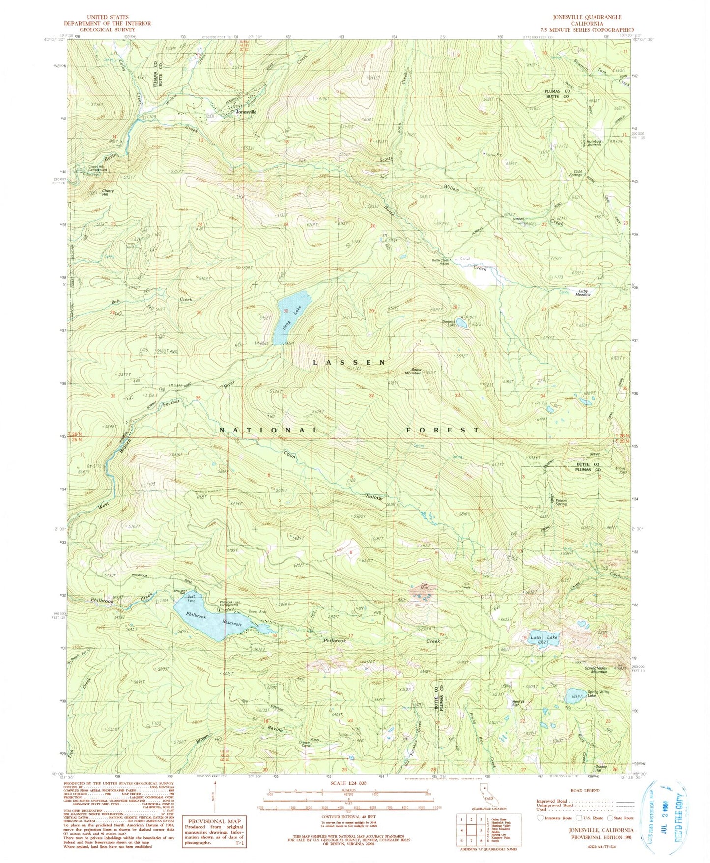
Classic USGS Jonesville California 7.5'x7.5' Topo Map
Couldn't load pickup availability
Historical USGS topographic quad map of Jonesville in the state of California. Typical map scale is 1:24,000, but may vary for certain years, if available. Print size: 24" x 27"
This quadrangle is in the following counties: Butte, Plumas, Tehama.
The map contains contour lines, roads, rivers, towns, and lakes. Printed on high-quality waterproof paper with UV fade-resistant inks, and shipped rolled.
Contains the following named places: Carr Mine, Butte Creek House, Cherry Hill, Cirby Meadow, Colby Creek, Cold Springs, Coon Hollow, Dresser Camp, Grassy Flat, Henrys Flat, Humbug Summit, Jones Creek, Jonesville, Lotts Lake, Philbrook Reservoir, Poison Spring, Sky High Mine (historical), Snag Lake, Snow Mountain, Spring Valley Lake, Spring Valley Mountain, Summit Lake, Willow Creek, Willow Creek, Philbrook Lake Boat Ramp, Scotts John Creek, Cherry Hill Campground, Philbrook Lake Campground, Philbrook 97-008 Dam, Round Valley 97-009 Dam, Spring Valley Lake 1-073 Dam