
MyTopo
Classic USGS Jordan East Minnesota 7.5'x7.5' Topo Map
Couldn't load pickup availability
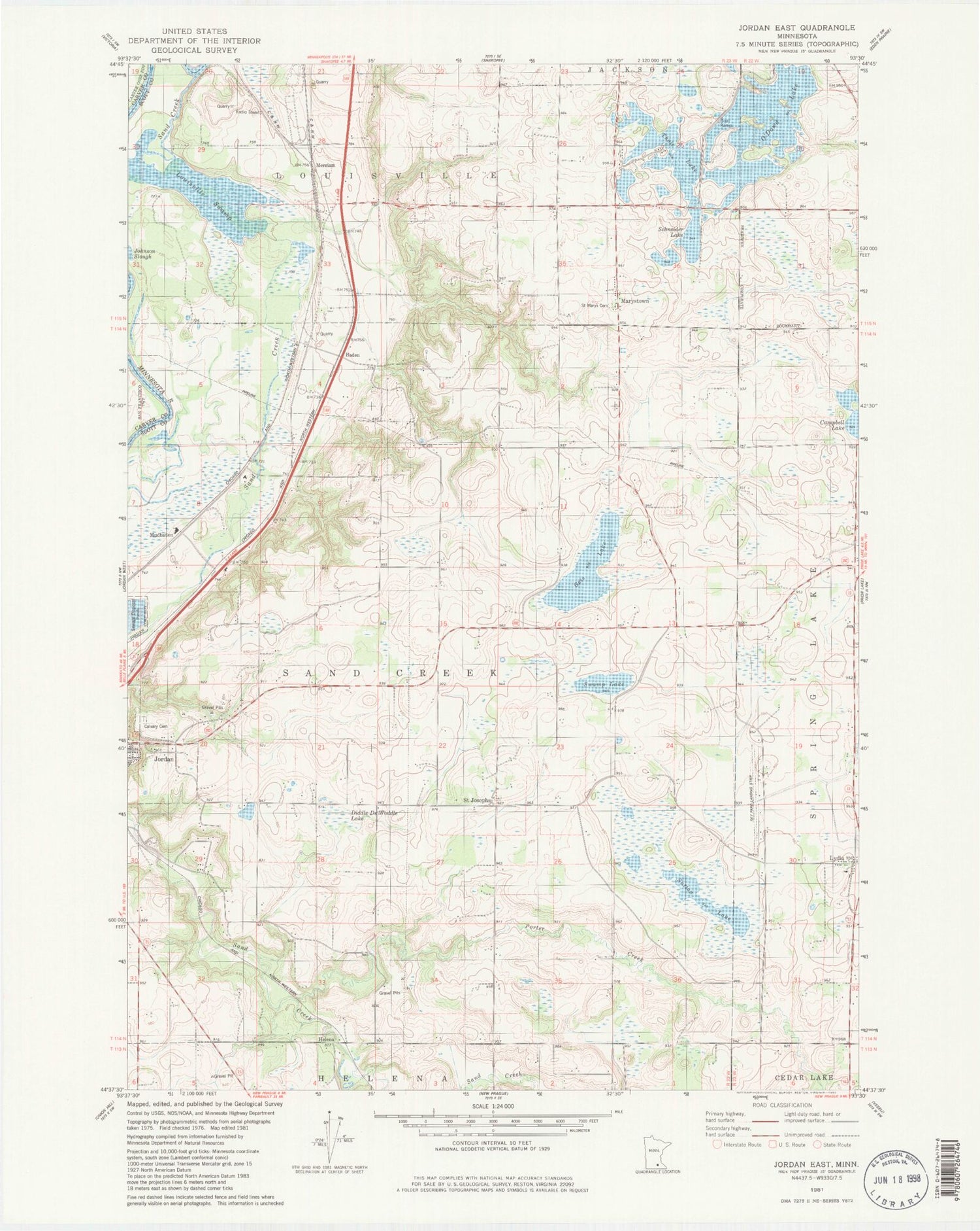
Historical USGS topographic quad map of Jordan East in the state of Minnesota. Map scale may vary for some years, but is generally around 1:24,000. Print size is approximately 24" x 27"
This quadrangle is in the following counties: Carver, Scott.
The map contains contour lines, roads, rivers, towns, and lakes. Printed on high-quality waterproof paper with UV fade-resistant inks, and shipped rolled.
Contains the following named places: Baden, Bendzick Pond, Calvary Cemetery, Diddle De Woddle Lake, Geis Lake, Helena, Helena Post Office, Jim's Apple Farm, Louisville Swamp, Lydia, Lydia Post Office, Marystown, Marystown Post Office, Merriam, Merriam Post Office, Minneapolis Southwest KOA Kampground, Minnesota Valley National Wildlife Refuge, Mudbaden, Mudbaden Post Office, O'Dowd Lake, Picha Creek, Porter Creek, Ridges of Sand Creek, Saint Josephs, Saint Josephs School, Saint Mary's Cemetery, Sand Creek, Schneider Lake, Scott County, Sky Park Airport, Sutton Lake, Swamp Lake, Theis-Bendzick Pond Dam, Thole Lake, Township of Louisville, Township of Sand Creek, ZIP Code: 55352


