MyTopo
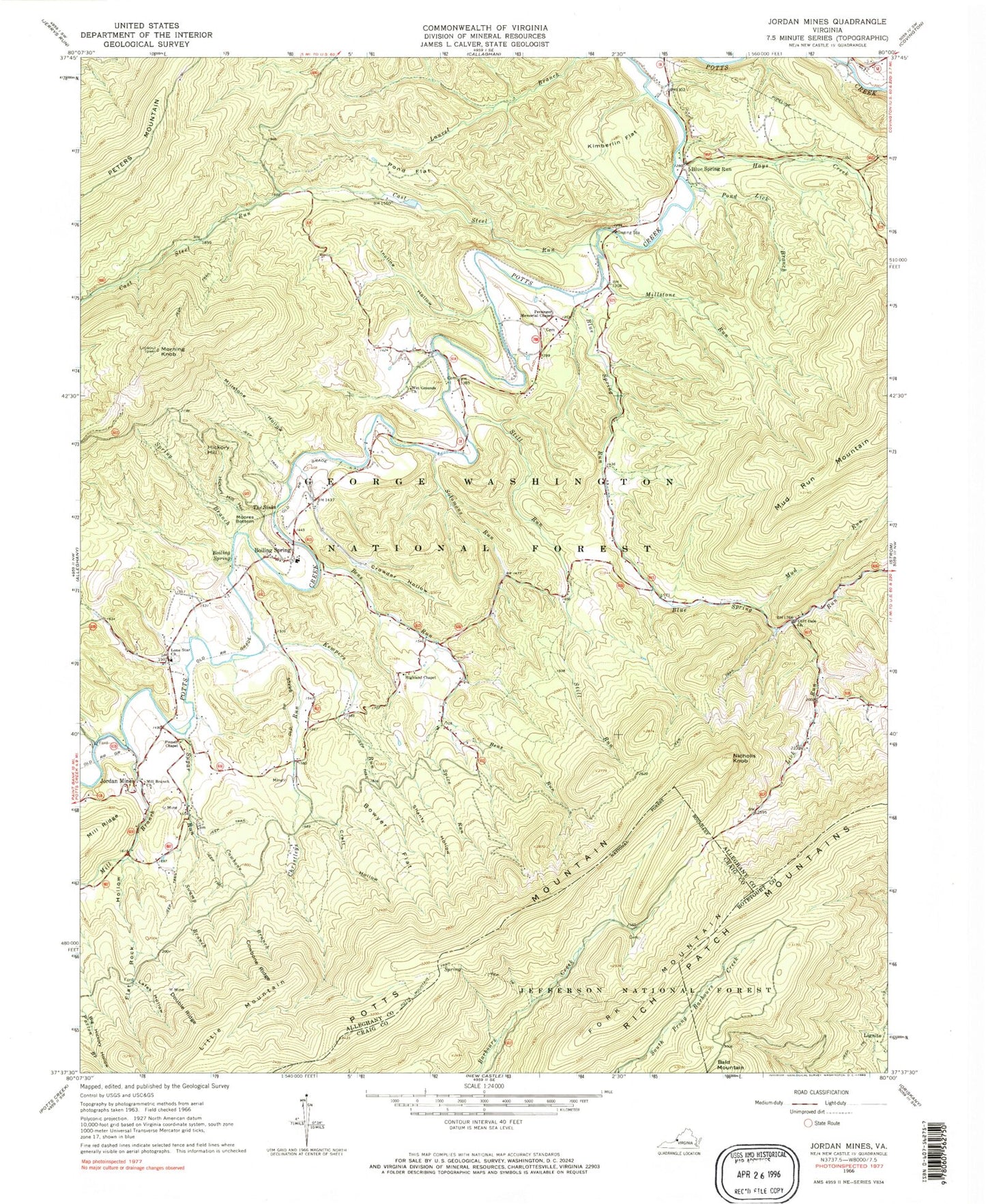
Classic USGS Jordan Mines Virginia 7.5'x7.5' Topo Map
Couldn't load pickup availability
Historical USGS topographic quad map of Jordan Mines in the state of Virginia. Map scale may vary for some years, but is generally around 1:24,000. Print size is approximately 24" x 27"
This quadrangle is in the following counties: Alleghany, Botetourt, Craig.
The map contains contour lines, roads, rivers, towns, and lakes. Printed on high-quality waterproof paper with UV fade-resistant inks, and shipped rolled.
Contains the following named places: Bens Run, Blue Spring Run, Boiling Spring, Boiling Spring Elementary School, Boiling Springs Volunteer Fire Department and Rescue Squad Station 1, Bowyer Flat, Cast Steel Run, Christleys Run, Clifdale, Cliff Dale Church, Cowbone Branch, Cowbone Ridge, Craft Hollow, Crowder Hollow, Double Ridge, Flat Rock Hollow, Fork Mountain, Hays Creek, Hickory Hill, Hickory Hill Hollow, Highland Chapel, Incline Hollow, Jordan Mines, Kempers Run, Kimberlin Flat, Lafes Hollow, Lick Run, Little Mountain, Lone Star Church, Mill Branch, Mill Branch Church, Millstone Hollow, Millstone Run, Moores Bottom, Morning Knob, Morning Knob Fire Lookout Tower, Mud Run, National Childrens Forest, Nicholls Knob, Persinger Memorial Chapel, Pinnell Chapel, Pond Flat, Pond Lick Branch, Pond Lick Branch Dam, Pond Lick Branch Reservoir, Shanty Hollow, Solomons Run, Spice Run, Spring Branch, Still Run, Sugar Run, Swamp Branch, The Sinks, Wet Grounds Church