MyTopo
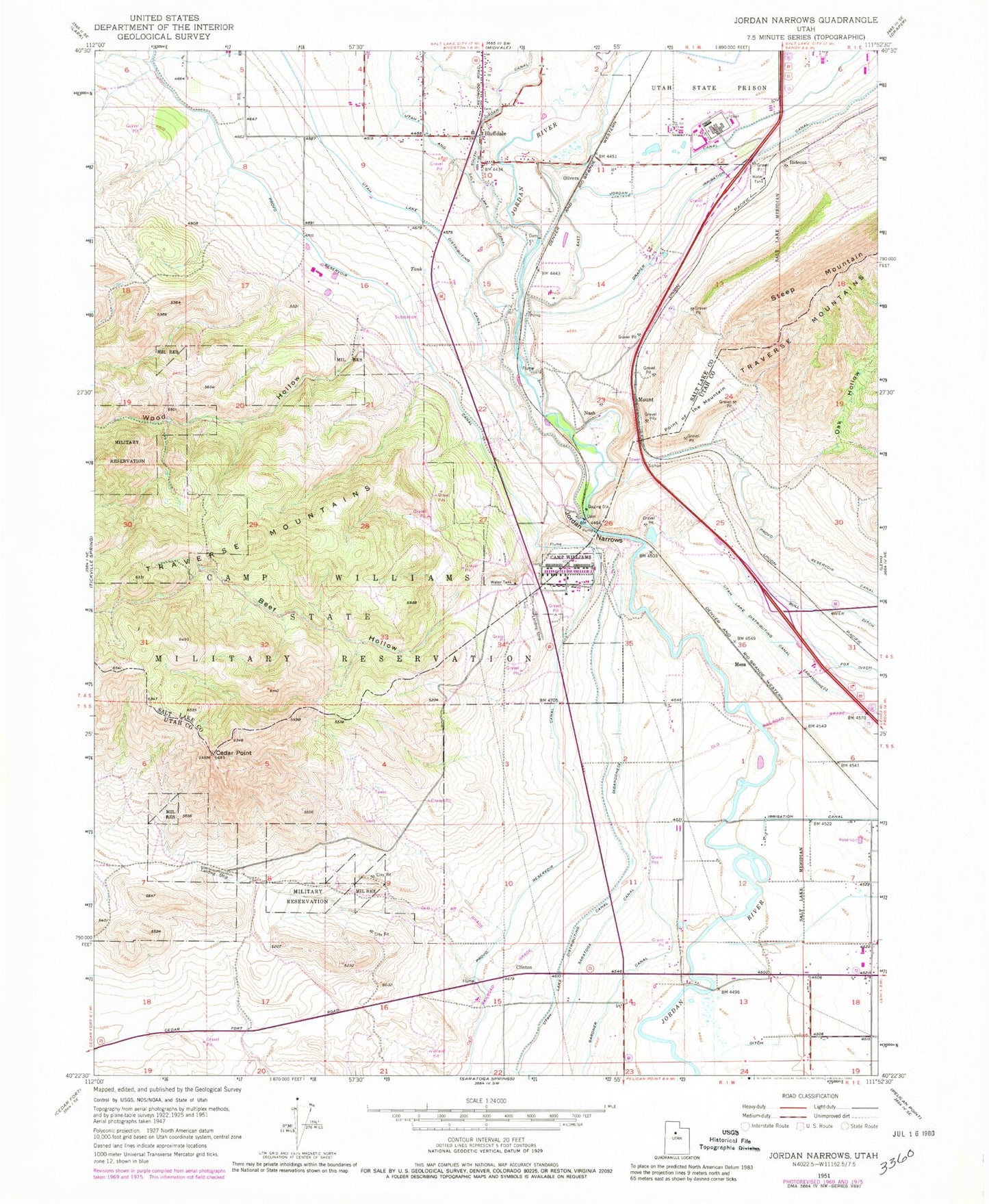
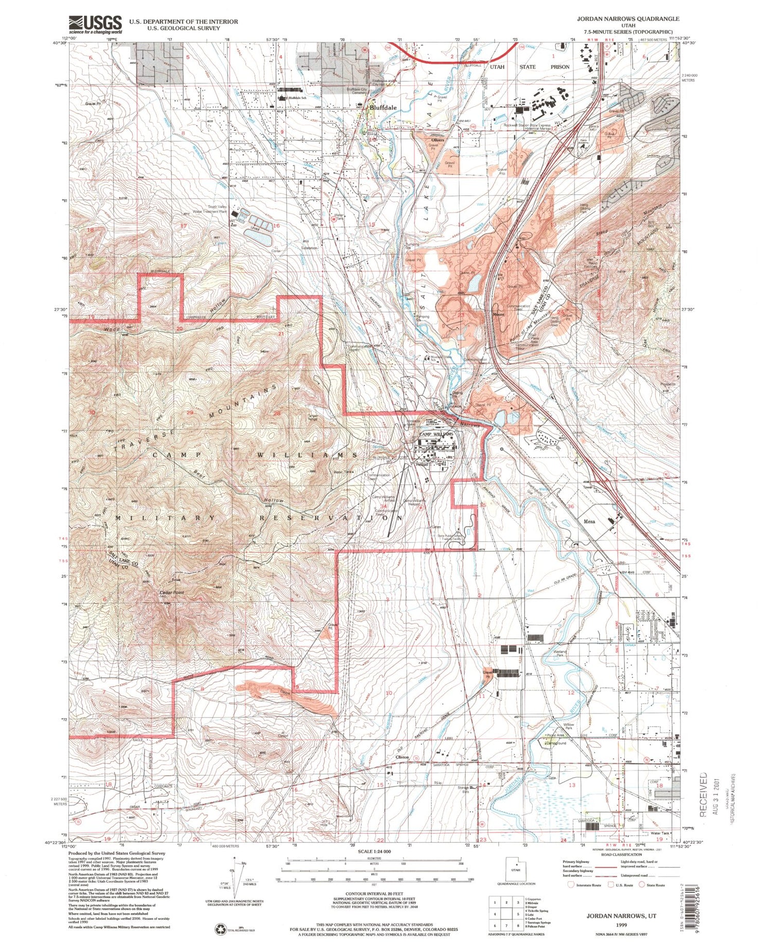
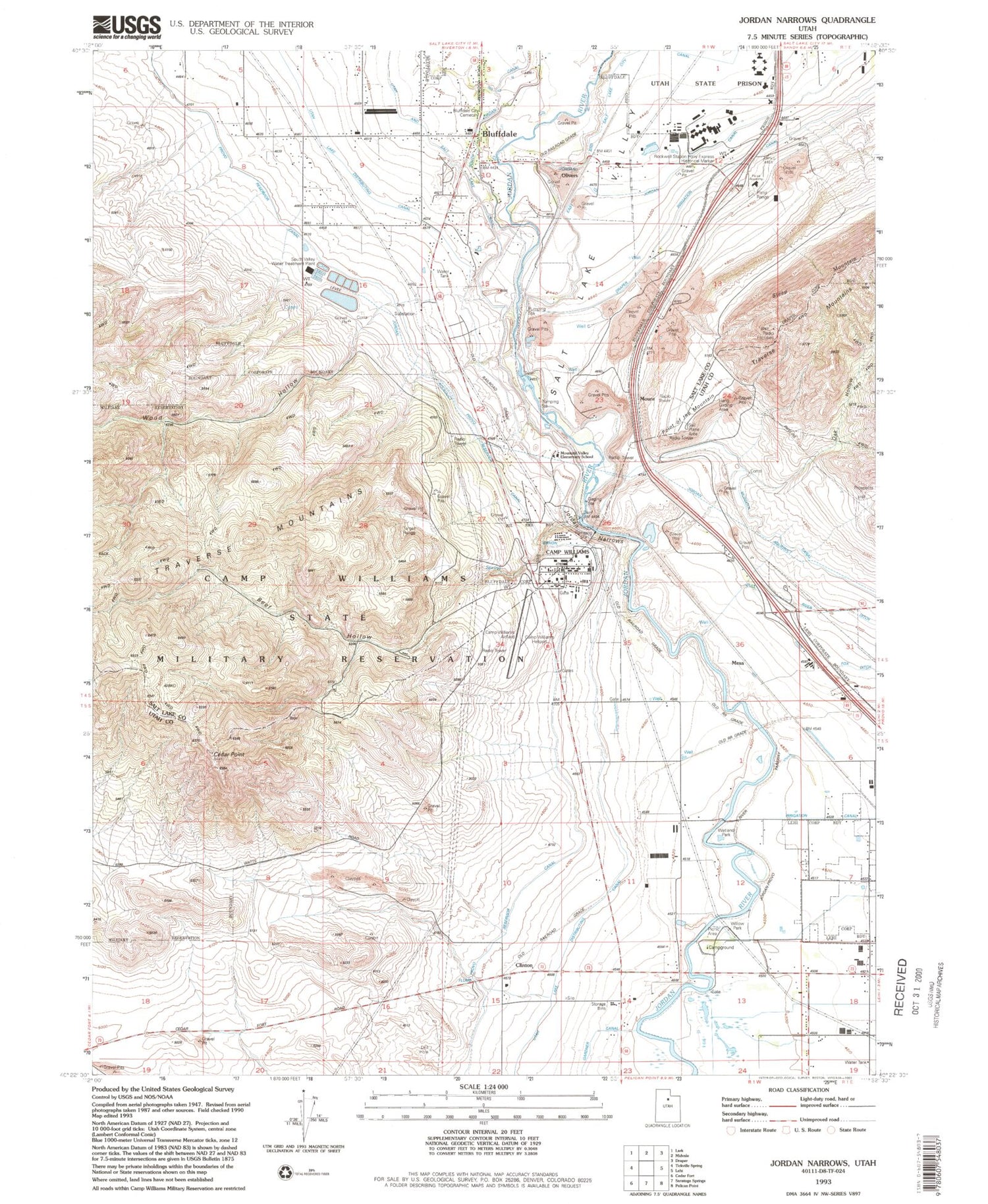
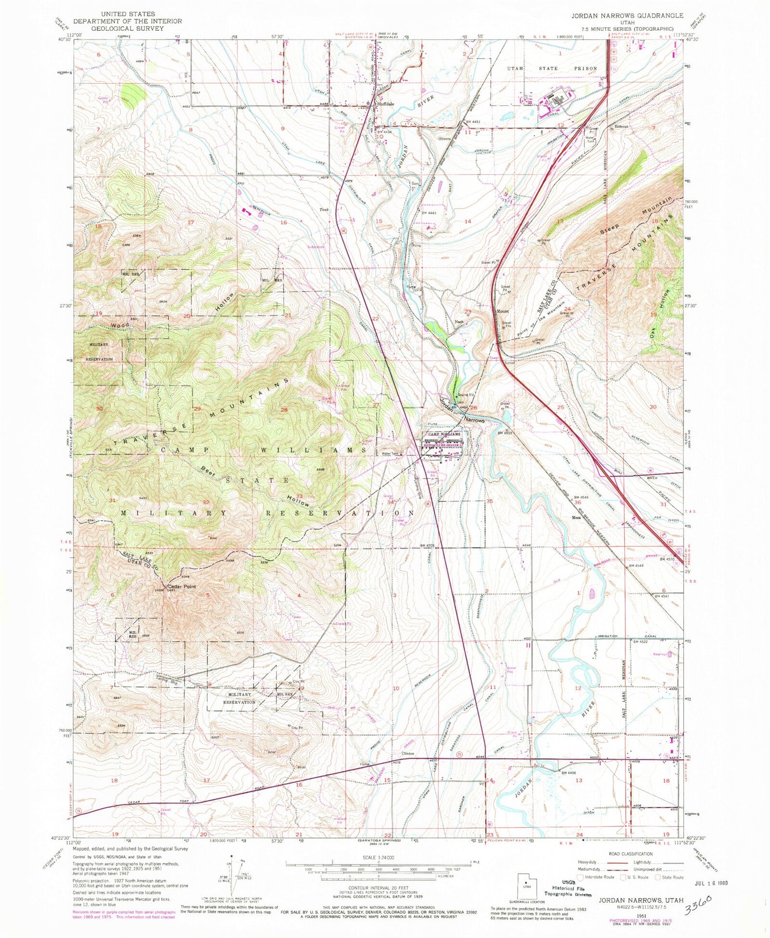
Classic USGS Jordan Narrows Utah 7.5'x7.5' Topo Map
Couldn't load pickup availability
Historical USGS topographic quad map of Jordan Narrows in the state of Utah. Map scale may vary for some years, but is generally around 1:24,000. Print size is approximately 24" x 27"
This quadrangle is in the following counties: Salt Lake, Utah.
The map contains contour lines, roads, rivers, towns, and lakes. Printed on high-quality waterproof paper with UV fade-resistant inks, and shipped rolled.
Contains the following named places: Avalon Estates, Beef Hollow, Bluffdale, Bluffdale City Cemetery, Bluffdale Elementary School, Bluffdale Fire Department, Camp Williams Airfield, Camp Williams Heliport, Camp Williams Utah Army National Guard, Cedar Point, City of Bluffdale, Clinton, Country Living, Draper Canal, Gardiner Estates, Genesis Youth Center, Johnson Anderson, Jordan, Jordan Narrows, Jordan Valley Water Purification Dam, Jordan Valley Water Purification Reservoir, Lewis Estates, Mesa, Mount, Moyal Anderson, Nash, Oak Hollow, Olivers, Point of the Mountain, Rideout, Saratoga Canal, Saratoga Springs Unified Fire Department and Emergency Medical Services, South Bluff Estates, State of Utah Lone Peak Fire Center, Steep Mountain, The Church of Jesus Christ of Latter Day Saints, Traverse Mountains, Unified Fire Authority Fire Station 114, Utah Lake Distributing Canal, Utah State Prison, Utah State Prison Heliport, Utah Veterans Cemetery and Memorial Park, Wood Hollow, ZIP Codes: 84043, 84065