MyTopo
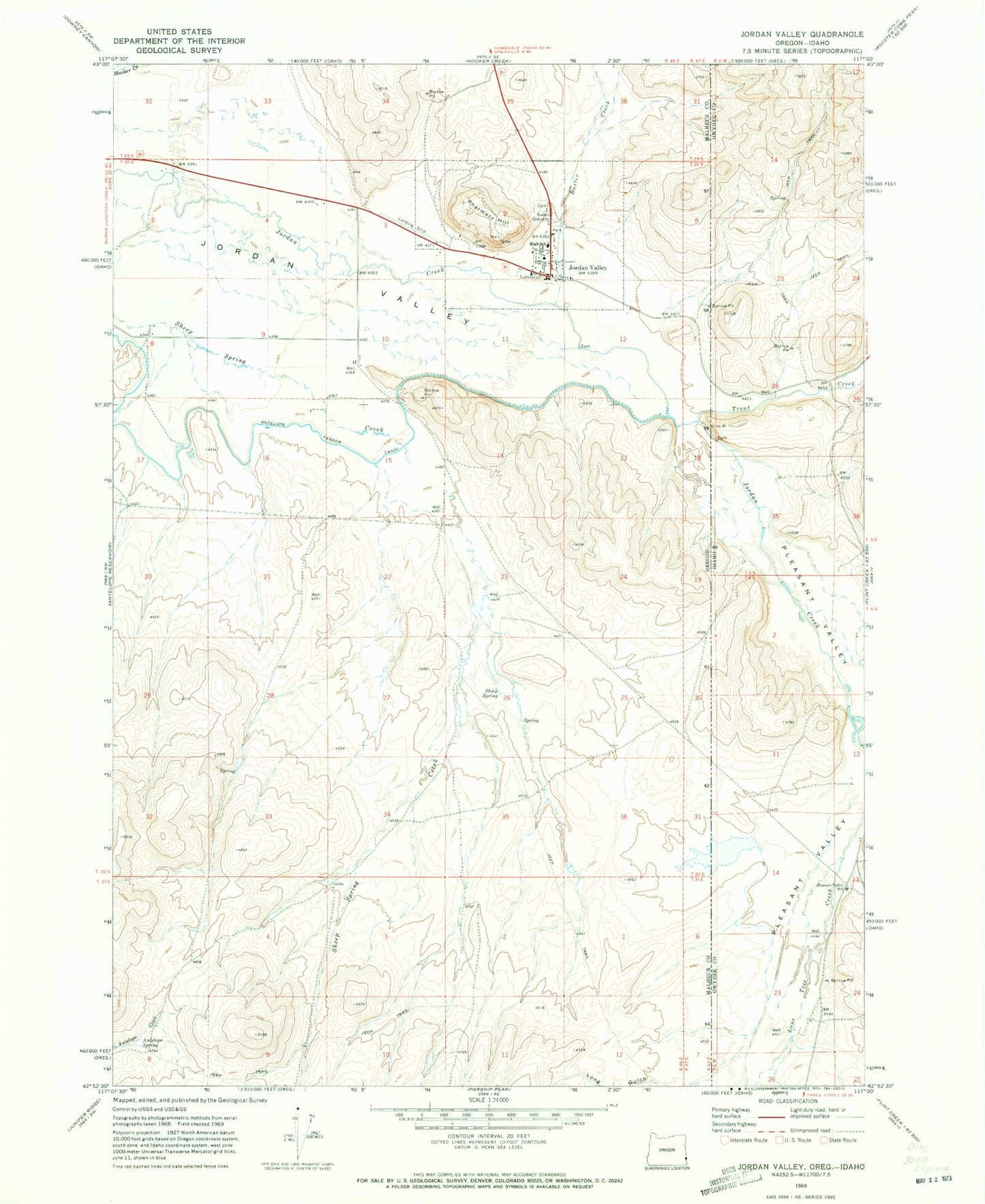
Classic USGS Jordan Valley Oregon 7.5'x7.5' Topo Map
Couldn't load pickup availability
Historical USGS topographic quad map of Jordan Valley in the states of Oregon, Idaho. Map scale may vary for some years, but is generally around 1:24,000. Print size is approximately 24" x 27"
This quadrangle is in the following counties: Malheur, Owyhee.
The map contains contour lines, roads, rivers, towns, and lakes. Printed on high-quality waterproof paper with UV fade-resistant inks, and shipped rolled.
Contains the following named places: Antelope Spring, Baxter Creek, Big Loop Rodeo Grounds, City of Jordan Valley, Jordan Creek, Jordan Valley, Jordan Valley Airstrip, Jordan Valley and Owyhee ION Heritage Museum, Jordan Valley Cemetery, Jordan Valley City Hall, Jordan Valley Elementary School, Jordan Valley High School, Jordan Valley Post Office, Jordan Valley Public Works Department, Jordan Valley Volunteer Fire Department, Jordan Valley Wastewater Treatment Plant, Lone Tree Dam, Long Gulch, Pharmacy Hill, Pleasant Valley, Pleasant Valley Elementary - Junior High School, Sheep Spring, Trout Creek, Wroten Reservoir 1