MyTopo
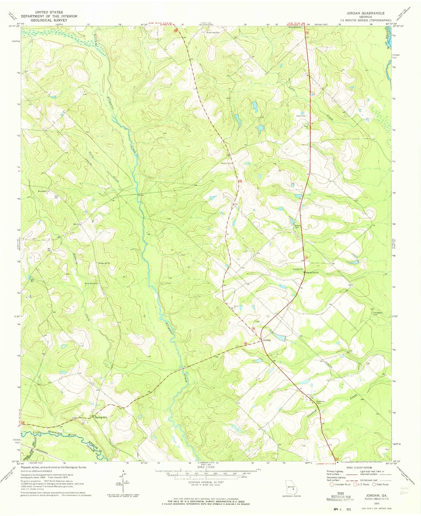
Classic USGS Jordan Georgia 7.5'x7.5' Topo Map
Couldn't load pickup availability
Historical USGS topographic quad map of Jordan in the state of Georgia. Map scale may vary for some years, but is generally around 1:24,000. Print size is approximately 24" x 27"
This quadrangle is in the following counties: Montgomery, Telfair, Wheeler.
The map contains contour lines, roads, rivers, towns, and lakes. Printed on high-quality waterproof paper with UV fade-resistant inks, and shipped rolled.
Contains the following named places: Adams Cemetery, Benton Cemetery, Browning Cemetery, Browning Church, Camp Creek, Clark Cemetery, Eddards Creek, Free Run Church, Glenwood Division, Hope Church, Horne Mission Church, Jordan, Little Creek, Livingston Cemetery, Lotts Creek, Pleasant Hill Church, Sardis Church, Shiloh Church, Smith Pond, Smith Pond Dam, Spencer and Baker Cemetery, Spring Hill, Spring Hill Baptist Church, Spring Hill Methodist Church, Springhill Volunteer Fire Department, Starlight Cemetery, Stewart Pond, Stewart Pond Dam, Wheeler County