MyTopo
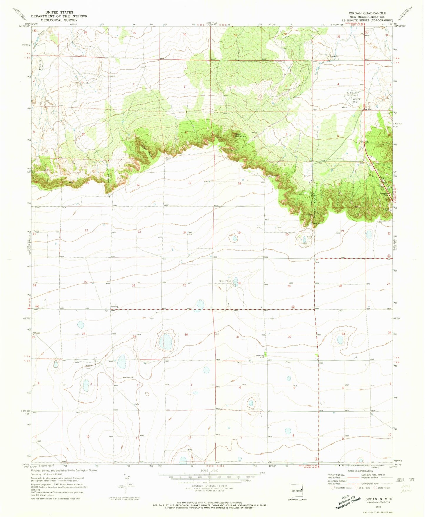
Classic USGS Jordan New Mexico 7.5'x7.5' Topo Map
Couldn't load pickup availability
Historical USGS topographic quad map of Jordan in the state of New Mexico. Map scale may vary for some years, but is generally around 1:24,000. Print size is approximately 24" x 27"
This quadrangle is in the following counties: Quay.
The map contains contour lines, roads, rivers, towns, and lakes. Printed on high-quality waterproof paper with UV fade-resistant inks, and shipped rolled.
Contains the following named places: 10395 Water Well, 10551 Water Well, 10557 Water Well, 10559 Water Well, 10563 Water Well, 10564 Water Well, 10565 Water Well, 10569 Water Well, 10570 Water Well, 10573 Water Well, 10650 Water Well, 10727 Water Well, 88427, Akin and Akin Airport, Bar B Ranch, Browning Cemetery, Bucks, Honey Canyon, Ish Canyon, Jordan, Jordan Fire District Main Station, Jordan Post Office, Lawson, Pinon Point, Rincon Canyon, Sand Mountain