MyTopo
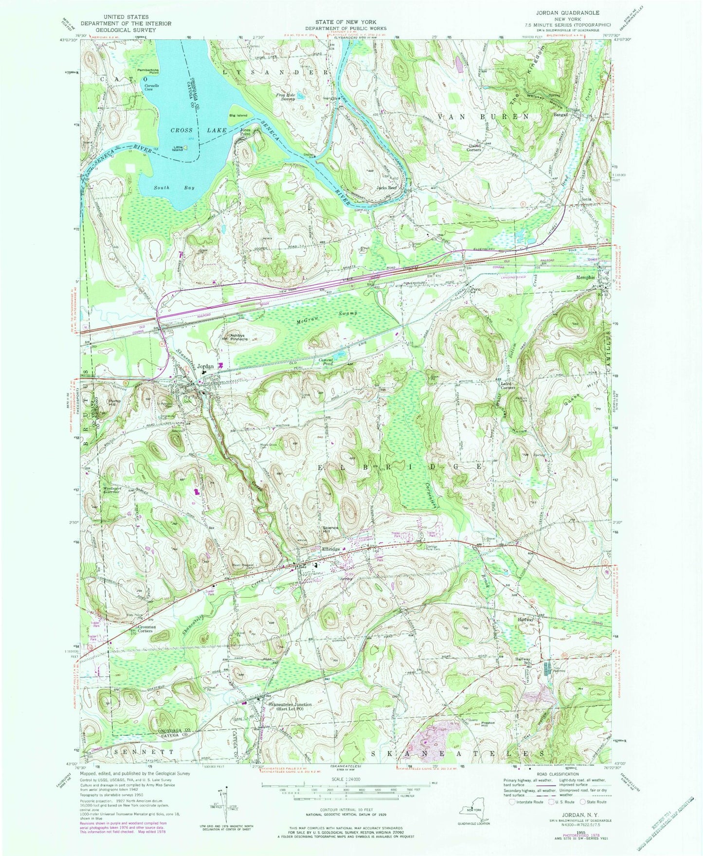
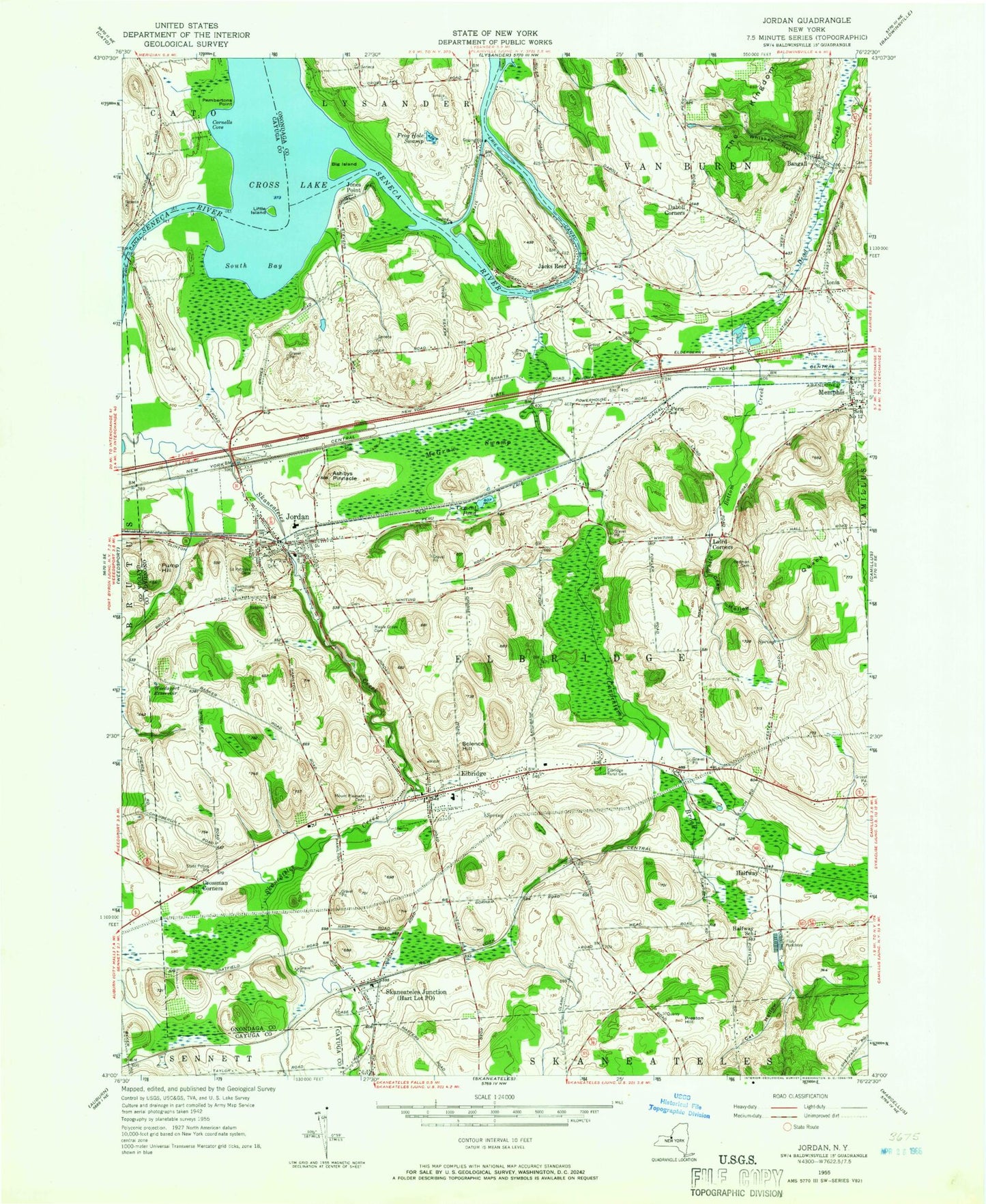
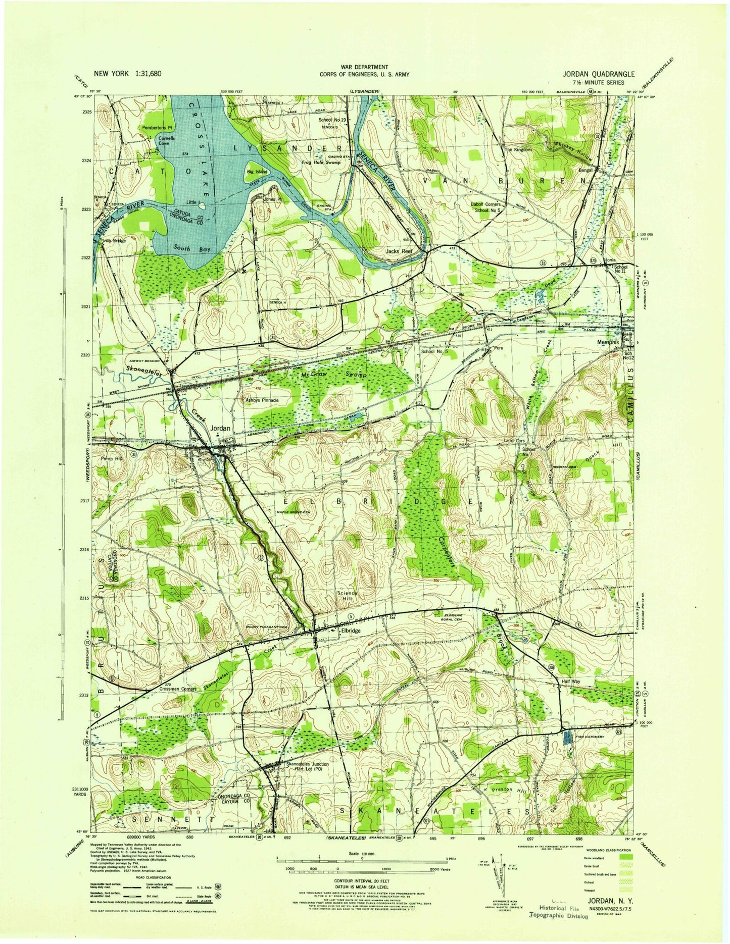
Classic USGS Jordan New York 7.5'x7.5' Topo Map
Couldn't load pickup availability
Historical USGS topographic quad map of Jordan in the state of New York. Typical map scale is 1:24,000, but may vary for certain years, if available. Print size: 24" x 27"
This quadrangle is in the following counties: Cayuga, Onondaga.
The map contains contour lines, roads, rivers, towns, and lakes. Printed on high-quality waterproof paper with UV fade-resistant inks, and shipped rolled.
Contains the following named places: Ashbys Pinnacle, Bangall, Big Island, Carpenters Brook, Cat Hollow, Cement Pond, Cornells Cove, Crab Hollow, Cross Lake, Crossman Corners, Daboll Corners, Elbridge, Elbridge Rural Cemetery, Frog Hole Swamp, Halfway, Halfway School, Ionia, Jacks Reef, Jones Point, Jordan, Laird Corners, Little Island, Maple Grove Cemetery, McGraw Swamp, Memphis, Mount Pleasant Cemetery, Pembertons Point, Peru, Preston Hill, Pump Hill, Redman Cemetery, Saint Patricks Cemetery, Science Hill, Skaneateles Junction, South Bay, The Kingdom, Weedsport Reservoir, Quack Hill, Whiskey Hollow, White Bottom Creek, Erie Canal, Quimbys Marina, School Number 12 (historical), Walls Airport, Anthonson Airport, Town of Elbridge, Hart Lot Post Office, The Kingdom (historical), School Number 5 (historical), School Number 5 (historical), School Number 7 (historical), School Number 11 (historical), School Number 19 (historical), Village of Jordan, Village of Elbridge, Champion Mobile Home Park, Winter Mobile Home Park, Rolling Hills Mobile Home Court, Plainville Farms, Leubner Apple Farm, Wake Robin Farm, Elbridge Rural Cemetery, Whiting Road Cemetery, Ionia Cemetery, Skaneateles Quarry, Hillside Mobile Home Park, Shady Brook Mobile Home Park, Millstone Golf Course, Jordan Bramley Library, Elbridge Post Office, Memphis Post Office, Elbridge Elementary School, Ramsdell Elementary School, Jordan - Elbridge Middle School, Jordan - Elbridge High School, Memphis Fire Department, Plainville Fire District Company 2, Jordan Fire Department, Elbridge Volunteer Fire Department, Jordan Post Office, Ashbys Pinnacle, Bangall, Big Island, Carpenters Brook, Cat Hollow, Cement Pond, Cornells Cove, Crab Hollow, Cross Lake, Crossman Corners, Daboll Corners, Elbridge, Elbridge Rural Cemetery, Frog Hole Swamp, Halfway, Halfway School, Ionia, Jacks Reef, Jones Point, Jordan, Laird Corners, Little Island, Maple Grove Cemetery, McGraw Swamp, Memphis, Mount Pleasant Cemetery, Pembertons Point, Peru, Preston Hill, Pump Hill, Redman Cemetery, Saint Patricks Cemetery, Science Hill, Skaneateles Junction, South Bay, The Kingdom, Weedsport Reservoir, Quack Hill, Whiskey Hollow, White Bottom Creek, Erie Canal, Quimbys Marina, School Number 12 (historical), Walls Airport, Anthonson Airport, Town of Elbridge, Hart Lot Post Office, The Kingdom (historical), School Number 5 (historical), School Number 5 (historical), School Number 7 (historical), School Number 11 (historical), School Number 19 (historical), Village of Jordan, Village of Elbridge, Champion Mobile Home Park, Winter Mobile Home Park, Rolling Hills Mobile Home Court, Plainville Farms, Leubner Apple Farm, Wake Robin Farm, Elbridge Rural Cemetery, Whiting Road Cemetery, Ionia Cemetery, Skaneateles Quarry, Hillside Mobile Home Park, Shady Brook Mobile Home Park, Millstone Golf Course, Jordan Bramley Library, Elbridge Post Office, Memphis Post Office, Elbridge Elementary School, Ramsdell Elementary School, Jordan - Elbridge Middle School, Jordan - Elbridge High School, Memphis Fire Department, Plainville Fire District Company 2, Jordan Fire Department, Elbridge Volunteer Fire Department, Jordan Post Office