
MyTopo
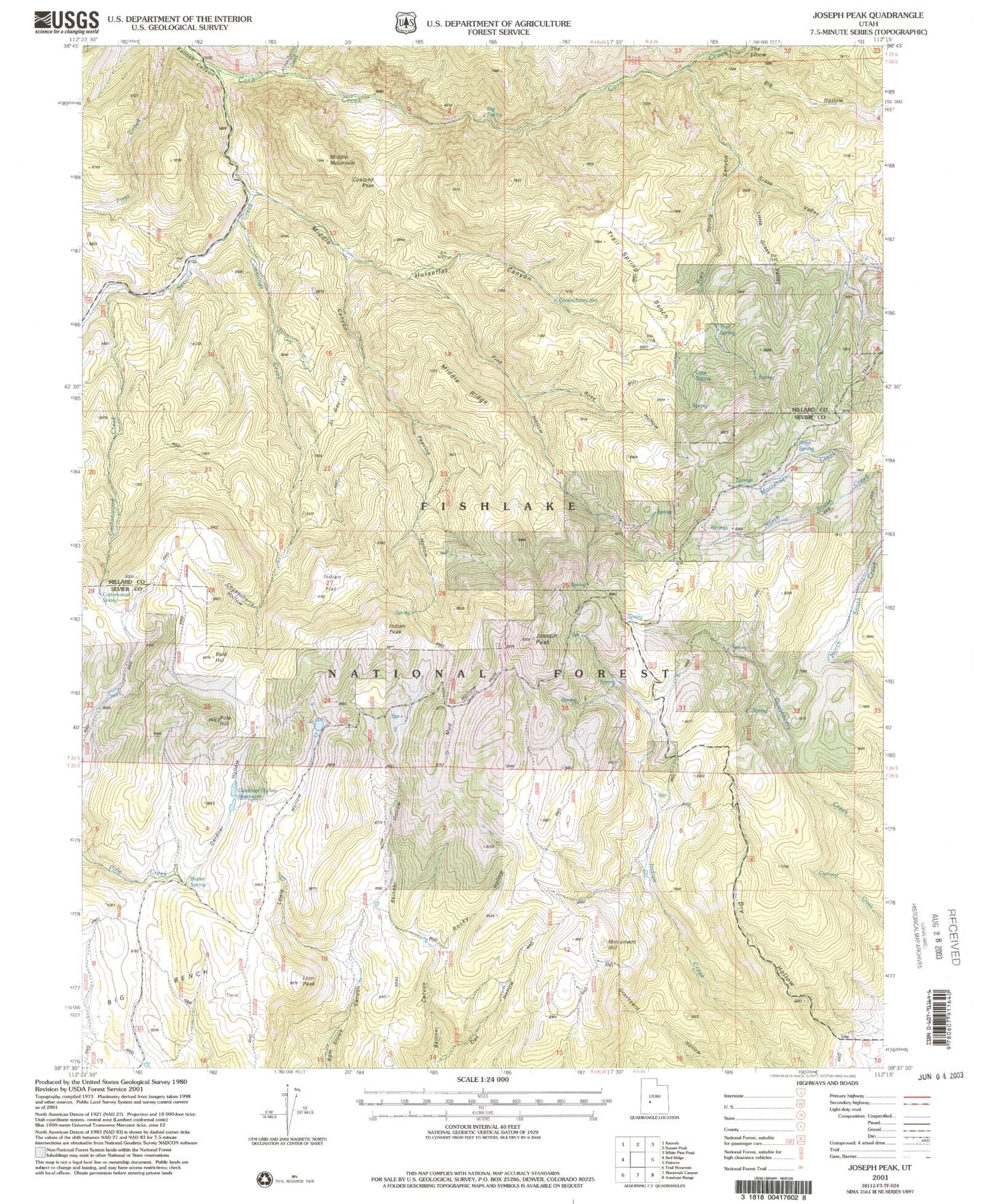
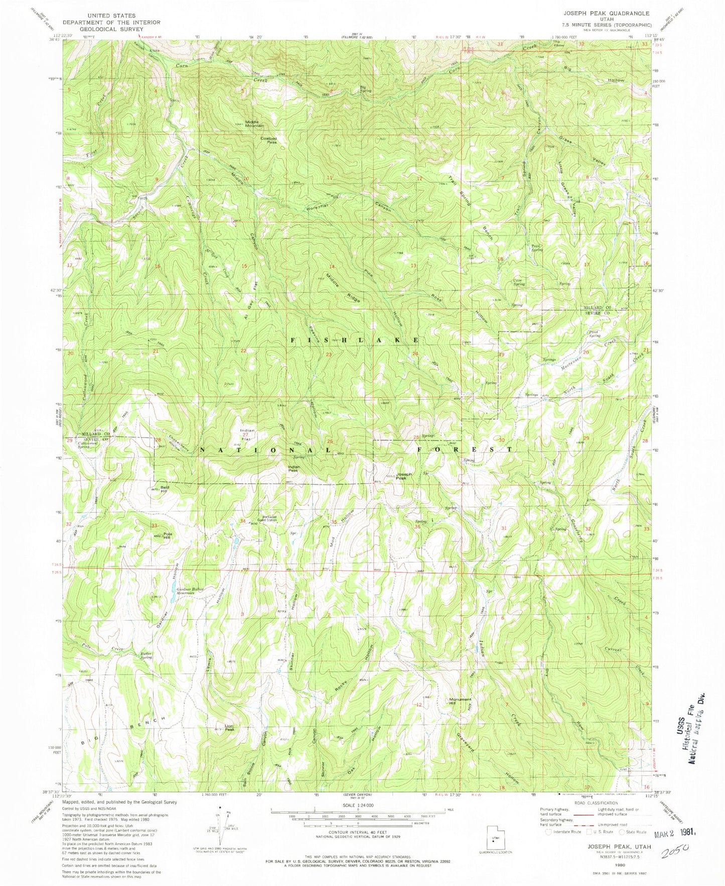
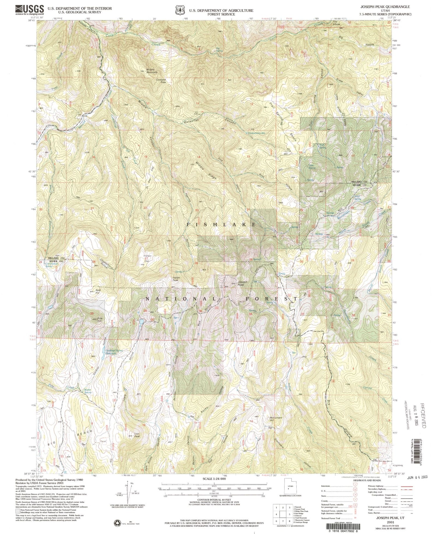
Classic USGS Joseph Peak Utah 7.5'x7.5' Topo Map
Couldn't load pickup availability
Historical USGS topographic quad map of Joseph Peak in the state of Utah. Map scale may vary for some years, but is generally around 1:24,000. Print size is approximately 24" x 27"
This quadrangle is in the following counties: Millard, Sevier.
The map contains contour lines, roads, rivers, towns, and lakes. Printed on high-quality waterproof paper with UV fade-resistant inks, and shipped rolled.
Contains the following named places: Al Gay Creek, Al Gay Flat, Bald Hill, Big Hollow, Big Spring, Butler Spring, Cave Spring, Chokecherry Hollow, Chokecherry Reservoir, Coalbed Pass, Cottonwood Creek, Cottonwood Spring, Cummings Creek, Gardner Hollow, Gardner Hollow Reservoirs, Grass Valley, Horseflat Canyon, Indian Flat, Indian Peak, Joseph Peak, Lewis Hollow, Lion Peak, Little Grass Valley, Middle Canyon, Middle Mountain, Middle Ridge, Monk Spring Creek, Monument Hill, Mud Hollow, Oak Hollow, Parker Ranch, Peavine Hollow, Pine Hollow, Pole Hill, Pond Spring, Rockwood Ranger Station, Rocky Hollow, Rose Hollow, Second Creek, Skinner Hollow, The Elbow, Trail Spring, Trail Spring Bench, Trail Spring Canyon