MyTopo
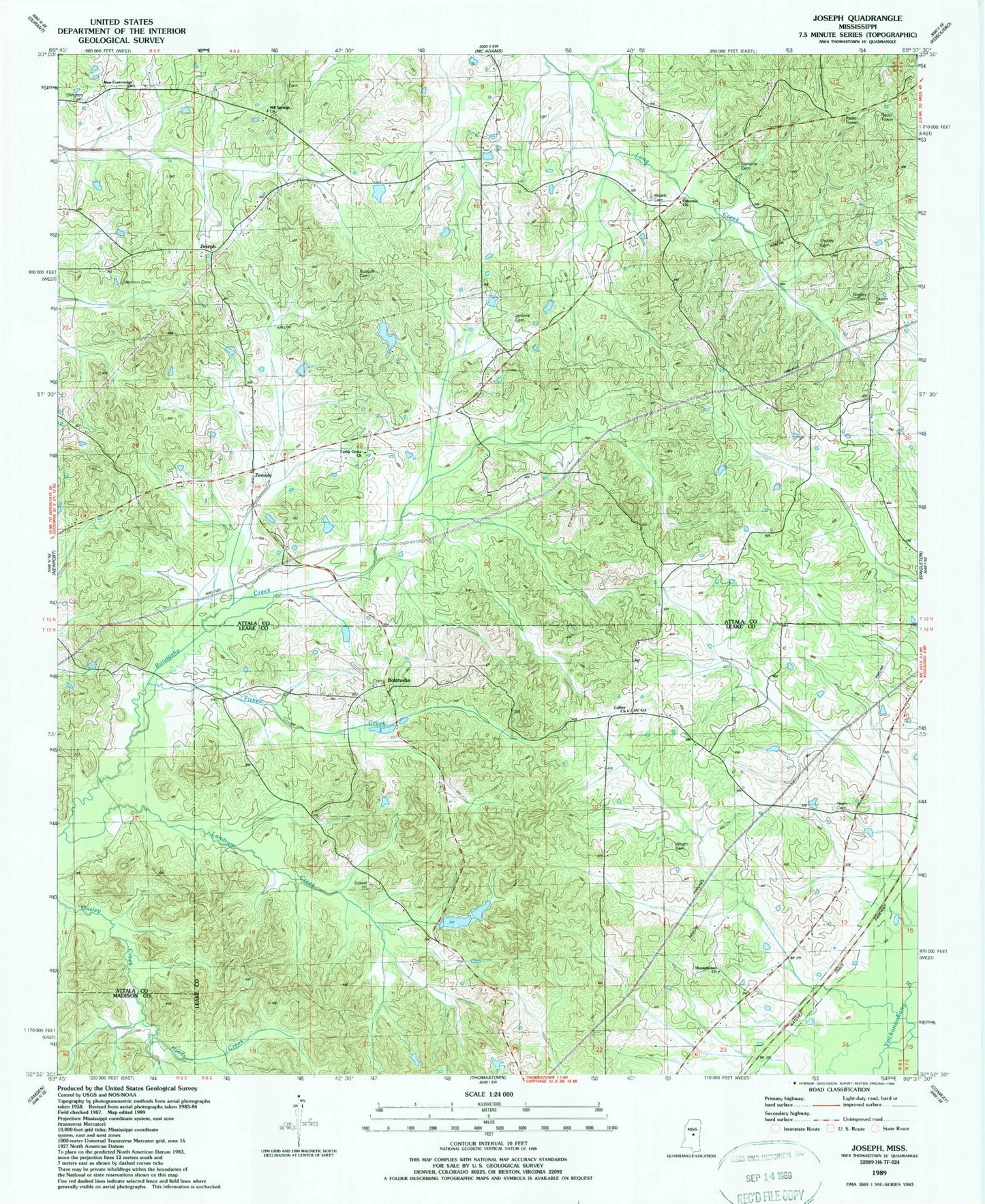
Classic USGS Joseph Mississippi 7.5'x7.5' Topo Map
Couldn't load pickup availability
Historical USGS topographic quad map of Joseph in the state of Mississippi. Map scale may vary for some years, but is generally around 1:24,000. Print size is approximately 24" x 27"
This quadrangle is in the following counties: Attala, Leake, Madison.
The map contains contour lines, roads, rivers, towns, and lakes. Printed on high-quality waterproof paper with UV fade-resistant inks, and shipped rolled.
Contains the following named places: Bolatusha, Cedar Grove Baptist Church, Cow Barn School, Ellington Cemetery, Fisher Creek, Galilee Church, Hallbrook Lake Dam, Harmon Cemetery, Hill Springs Cemetery, Hill Springs Church, Hinds Creek, Jenkins Cemetery, Jones Lake Dam, Joseph, Joseph School, Landrum Creek, Malett Cemetery, Malett School, Merchant Creek, Morgan School, Nash Cemetery, Palestine Church, Russell Cemetery, Rutherford, Samarra Cemetery, Shelley Cemetery, Skeen Cemetery, Thomastown Church, Tom Bell Pond Dam, Wright Cemetery, Zemuly, Zemuly Church, Zemuly School