MyTopo
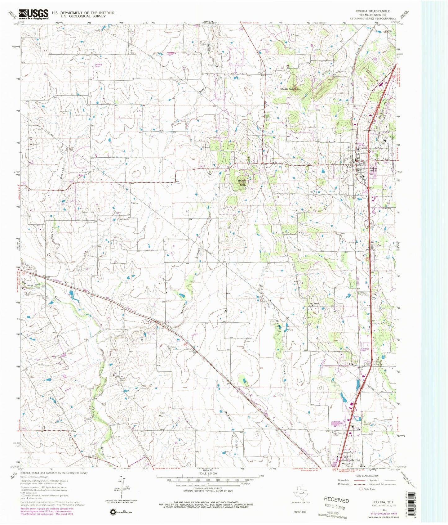
Classic USGS Joshua Texas 7.5'x7.5' Topo Map
Couldn't load pickup availability
Historical USGS topographic quad map of Joshua in the state of Texas. Map scale may vary for some years, but is generally around 1:24,000. Print size is approximately 24" x 27"
This quadrangle is in the following counties: Johnson.
The map contains contour lines, roads, rivers, towns, and lakes. Printed on high-quality waterproof paper with UV fade-resistant inks, and shipped rolled.
Contains the following named places: A G Elder Elementary School, Accelerated Learning Center, Benjamin Franklin Airport, Blackwood Airpark, Brushy Knob, Buchanan, Buchanan Cemetery, Buffalo Chips Airpark, Burleson-Joshua Division, Caddo Cemetery, Caddo Peak, Calvary Chapel Church, City of Joshua, Green Acres Memorial Park, H D Staples Elementary School, Joshua, Joshua Baptist Church, Joshua City Hall, Joshua Fire Department, Joshua High School, Joshua Police Department, Joshua Post Office, Joshua Primary School, KCLE-AM (Cleburne), Lightfoot Cemetery, Martin Branch, Mount Carmel, Old Bethany Cemetery, Old Lane Prairie Cemetery, Owl Stadium, R C Loflin Middle School, Taylor's Air Park, Wallace Branch, West Nolan Creek, ZIP Code: 76058