MyTopo
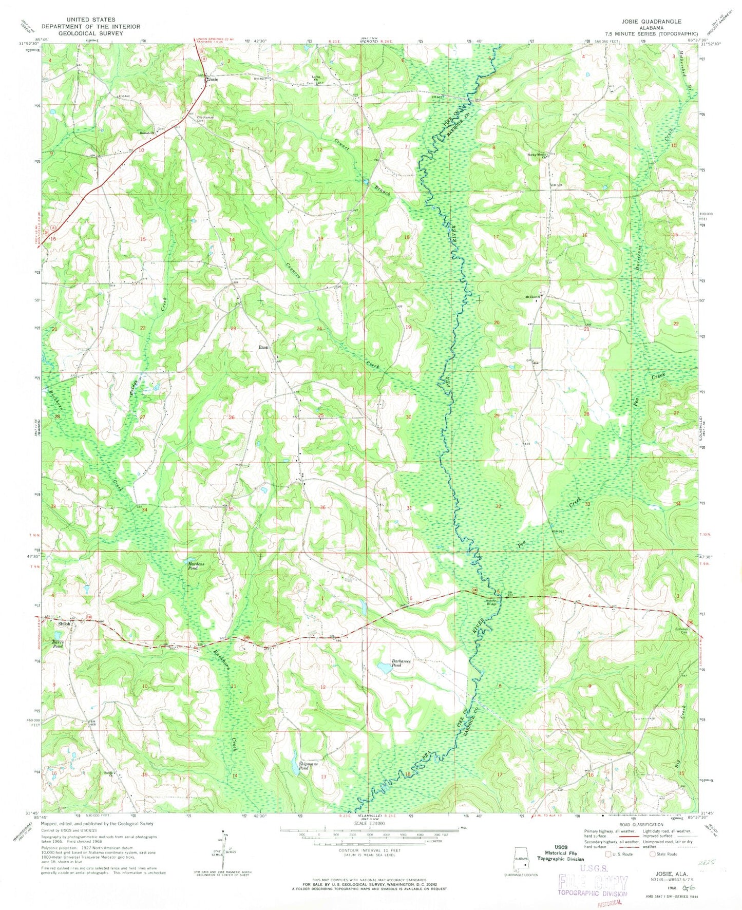
Classic USGS Josie Alabama 7.5'x7.5' Topo Map
Couldn't load pickup availability
Historical USGS topographic quad map of Josie in the state of Alabama. Map scale may vary for some years, but is generally around 1:24,000. Print size is approximately 24" x 27"
This quadrangle is in the following counties: Barbour, Pike.
The map contains contour lines, roads, rivers, towns, and lakes. Printed on high-quality waterproof paper with UV fade-resistant inks, and shipped rolled.
Contains the following named places: Barbarees Pond, Barkers Store, Barrs Pond, Bridge Creek, Conner Cemetery, Connors Creek, Cowart Branch, Enon, Enon Cemetery, Enon Church, Ephesus Cemetery, Full Gospel Church, Hardens Pond, Hobdys Bridge, Hurricane Creek, Josie, Lawsons Bridge, Loflin Church, Louisville AHP Airport, Meyers Store, Mothershed Branch, Mount Zion Baptist Church, Mount Zion Church, Old Ramah Cemetery, Pea Creek, Pea River Battleground, Ramah Cemetery, Ramah Primitive Baptist Church, Rocky Mount Church, Sand Creek, Sardis Cemetery, Sardis Church, Scroggins Store, Shiloh, Shiloh Church, Shipmans Pond