MyTopo
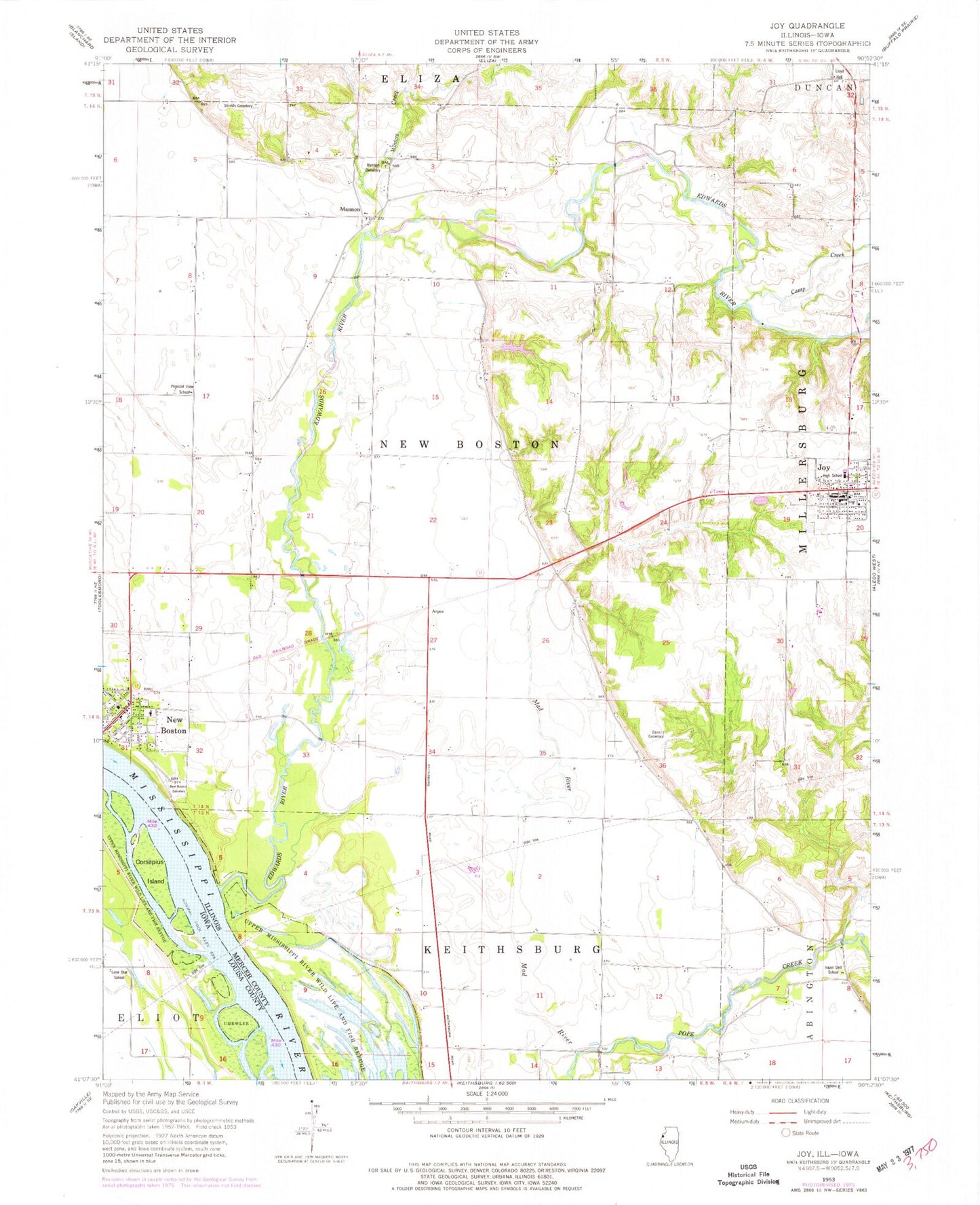
Classic USGS Joy Illinois 7.5'x7.5' Topo Map
Couldn't load pickup availability
Historical USGS topographic quad map of Joy in the states of Illinois, Iowa. Map scale may vary for some years, but is generally around 1:24,000. Print size is approximately 24" x 27"
This quadrangle is in the following counties: Louisa, Mercer.
The map contains contour lines, roads, rivers, towns, and lakes. Printed on high-quality waterproof paper with UV fade-resistant inks, and shipped rolled.
Contains the following named places: Arpee, Big Chief Run, Camp Creek, City of New Boston, Corsepius Island, Davis Cemetery, Edwards River, Hazel Dell School, Joy, Joy Community Fire Protection District, Joy Post Office, Lewis School, Lloyd Hall, Lone Star School, M and J Air Incorporated Airport, Mad River, Mannon, Mannon Cemetery, Morrison Lake, Morrison Lake Dam, New Boston, New Boston - Eliza Fire Protection District Station 1, New Boston Cemetery, New Boston Police Department, New Boston Volunteer Ambulance Service, Pleasant View School, Prouty School, Shields Cemetery, Township of New Boston, Village of Joy, Westmer Elementary School, Westmer High School, Westmer School, Winters Creek, ZIP Code: 61260