MyTopo
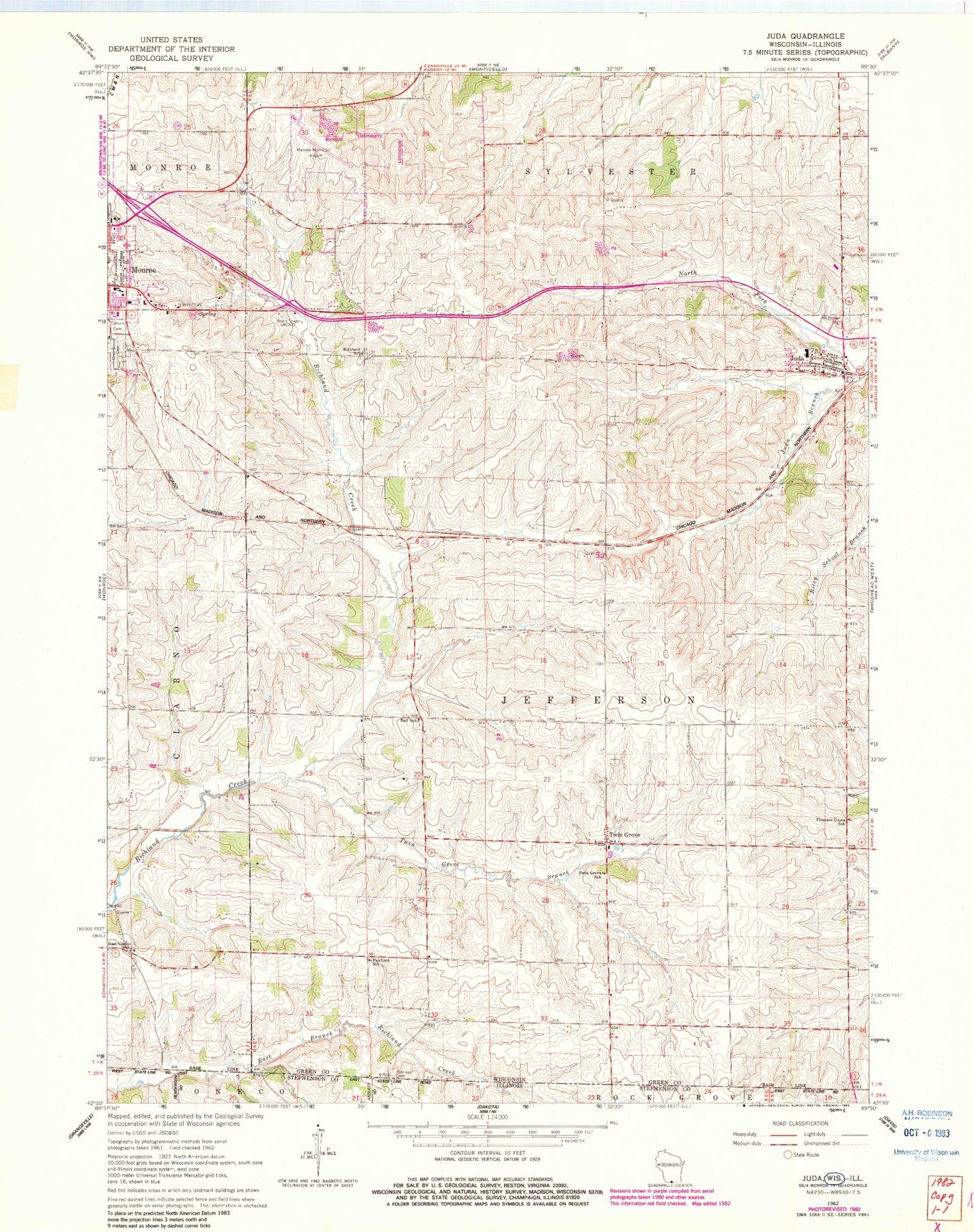
Classic USGS Juda Wisconsin 7.5'x7.5' Topo Map
Couldn't load pickup availability
Historical USGS topographic quad map of Juda in the state of Wisconsin. Map scale may vary for some years, but is generally around 1:24,000. Print size is approximately 24" x 27"
This quadrangle is in the following counties: Green, Stephenson.
The map contains contour lines, roads, rivers, towns, and lakes. Printed on high-quality waterproof paper with UV fade-resistant inks, and shipped rolled.
Contains the following named places: Ackerman Farm, Ball School, Barker Farms, Baumann Farms, Calvary Cemetery, Dein Acres, Devoe Farm, Eakins Farm, East Clarno School, Fairfield School, Green County Sheriff's Office, Johnson Cemetery, Jordan Acres, Juda, Juda Census Designated Place, Juda Community Fire Department Station 1, Juda Community Fire Station 2, Juda Elementary School, Juda High School, Juda Post Office, Mansfield Farm, Meier Farm, Monroe Emergency Response Inter - Agency Training Center, Monroe Independent Virtual Charter School, Monroe Municipal Airport, Monroe Virtual Charter Middle School, Mount Vernon Cemetery, North Fork Juda Branch, Northside Elementary School, Pleasant Grove School, Reed Farm, Richland School, Sacker Dairy Farm, Schmidt Farms, Speedbowl Quarry, Stuckey Dairy, Town of Jefferson, Twin Grove, Twin Grove Branch Richland Creek, Twin Grove School, WEKZ-AM (Monroe), Wyss Homestead Farm