MyTopo
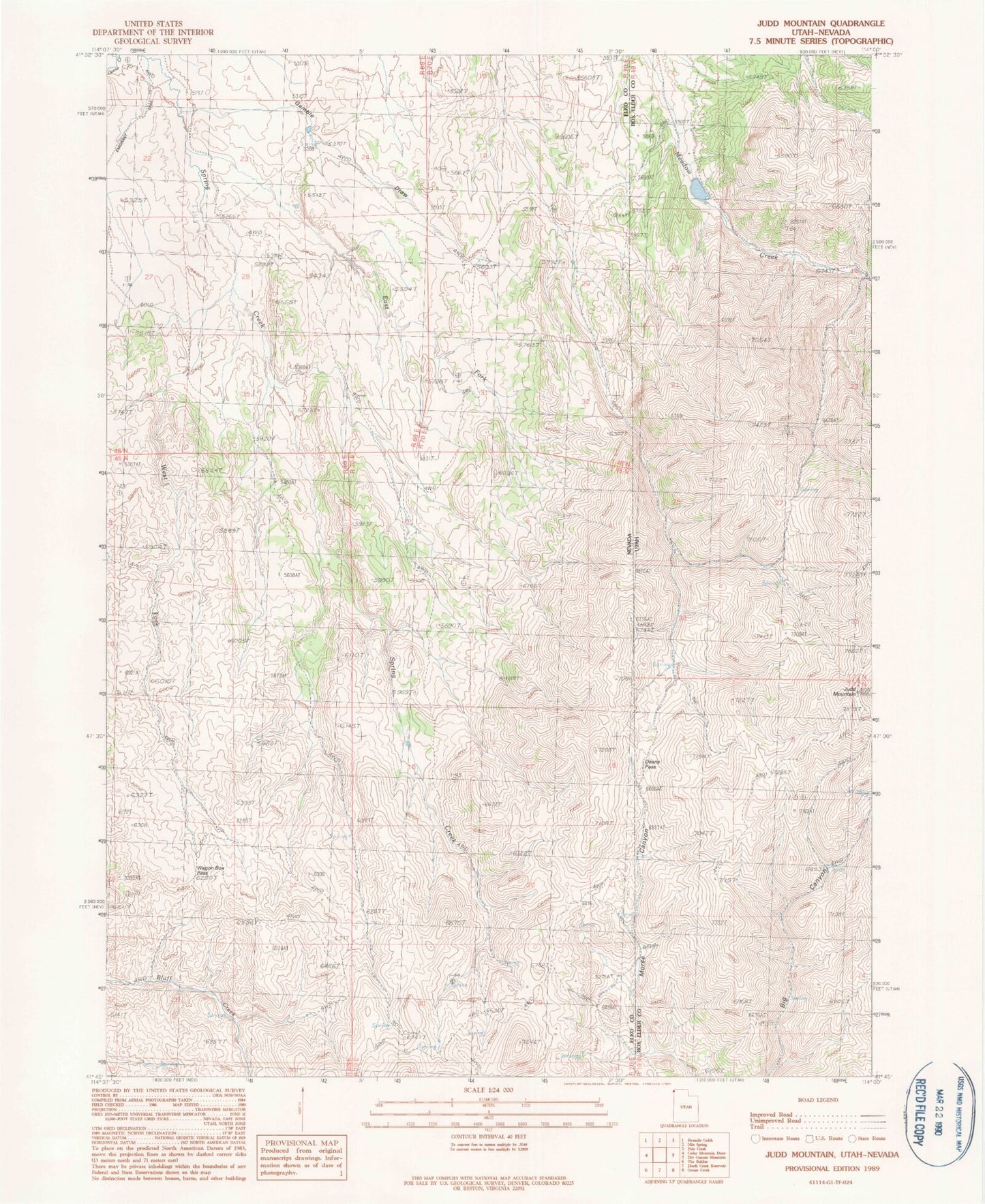
Classic USGS Judd Mountain Utah 7.5'x7.5' Topo Map
Regular price
$16.95
Regular price
Sale price
$16.95
Unit price
per
Couldn't load pickup availability
Historical USGS topographic quad map of Judd Mountain in the states of Utah, Nevada. Map scale may vary for some years, but is generally around 1:24,000. Print size is approximately 24" x 27"
This quadrangle is in the following counties: Box Elder, Elko.
The map contains contour lines, roads, rivers, towns, and lakes. Printed on high-quality waterproof paper with UV fade-resistant inks, and shipped rolled.
Contains the following named places: Annaville Post Office, Burnt Reservoir, Cold Spring, Deans Pass, Deans Pass Reservoir, East Fork Spring Creek, Gamble Draw, Judd Mountain, Rock Spring, South Fork Reservoir, Triple Group Springs, Wagon Box Pass, West Fork Spring Creek