MyTopo
Classic USGS Julesburg Colorado 7.5'x7.5' Topo Map
Couldn't load pickup availability
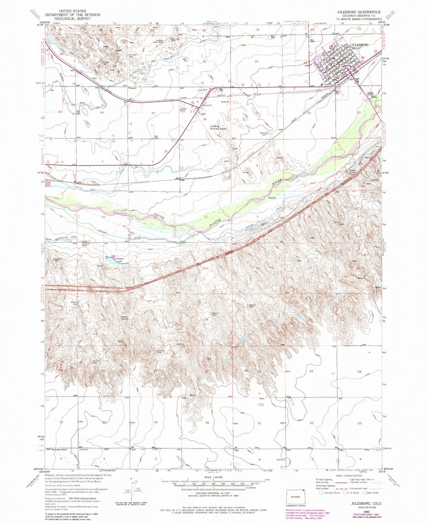
Historical USGS topographic quad map of Julesburg in the state of Colorado. Map scale may vary for some years, but is generally around 1:24,000. Print size is approximately 24" x 27"
This quadrangle is in the following counties: Sedgwick.
The map contains contour lines, roads, rivers, towns, and lakes. Printed on high-quality waterproof paper with UV fade-resistant inks, and shipped rolled.
Contains the following named places: Carlson Ditch, Fort Julesburg, Italian Caves, Johnson Lake, Johnson Spring, Julesburg, Julesburg Municipal Airport, Julesburg Post Office, Julesburg Volunteer Fire Department, Julesburg Water Works, Liddle Ditch, Ovid Cemetery, Riverside School, Sedgwick County, Sedgwick County Ambulance Service, Sedgwick County Health Center, Sedgwick County Sheriff's Office, Town of Julesburg, Weir